Givardon
Givardon is a commune in the Cher department in the Centre-Val de Loire region of France.
Givardon | |
|---|---|
Location of Givardon 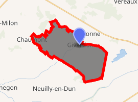
| |
 Givardon  Givardon | |
| Coordinates: 46°50′27″N 2°49′04″E | |
| Country | France |
| Region | Centre-Val de Loire |
| Department | Cher |
| Arrondissement | Saint-Amand-Montrond |
| Canton | Dun-sur-Auron |
| Intercommunality | CC Les Trois Provinces |
| Government | |
| • Mayor (2008–2014) | Daniel Apied |
| Area 1 | 21.9 km2 (8.5 sq mi) |
| Population (2017-01-01)[1] | 298 |
| • Density | 14/km2 (35/sq mi) |
| Time zone | UTC+01:00 (CET) |
| • Summer (DST) | UTC+02:00 (CEST) |
| INSEE/Postal code | 18102 /18600 |
| Elevation | 184–268 m (604–879 ft) (avg. 200 m or 660 ft) |
| 1 French Land Register data, which excludes lakes, ponds, glaciers > 1 km2 (0.386 sq mi or 247 acres) and river estuaries. | |
Geography
A farming area comprising the village and several hamlets situated by the banks of the small Sagonin river some 22 miles (35 km) southeast of Bourges at the junction of the D76 and the D34 roads.
Population
| Year | Pop. | ±% |
|---|---|---|
| 1962 | 393 | — |
| 1968 | 434 | +10.4% |
| 1975 | 364 | −16.1% |
| 1982 | 342 | −6.0% |
| 1990 | 316 | −7.6% |
| 1999 | 291 | −7.9% |
| 2008 | 330 | +13.4% |
Sights
- The church of St. Pierre.
- The chateau of Alarde, dating from the fifteenth century.
gollark: Indeed.
gollark: There's no other liquid. No idea about slots.
gollark: I tried a filtered servo on a fluiduct. It refuses to work.
gollark: How do I get only oxygen out of an electrolyser?
gollark: If yes, which sides will work?
See also
References
- "Populations légales 2017". INSEE. Retrieved 6 January 2020.
| Wikimedia Commons has media related to Givardon. |
| Authority control |
|
|---|
This article is issued from Wikipedia. The text is licensed under Creative Commons - Attribution - Sharealike. Additional terms may apply for the media files.