Aubinges
Aubinges is a commune in the Cher department in the Centre-Val de Loire region of France.
Aubinges | |
|---|---|
Location of Aubinges 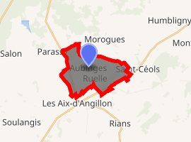
| |
 Aubinges  Aubinges | |
| Coordinates: 47°13′23″N 2°34′59″E | |
| Country | France |
| Region | Centre-Val de Loire |
| Department | Cher |
| Arrondissement | Bourges |
| Canton | Saint-Germain-du-Puy |
| Intercommunality | CC Terres Haut Berry |
| Government | |
| • Mayor (2014-2020) | Jean-Paul Roblet |
| Area 1 | 10.97 km2 (4.24 sq mi) |
| Population (2017-01-01)[1] | 394 |
| • Density | 36/km2 (93/sq mi) |
| Time zone | UTC+01:00 (CET) |
| • Summer (DST) | UTC+02:00 (CEST) |
| INSEE/Postal code | 18016 /18220 |
| Elevation | 184–262 m (604–860 ft) (avg. 200 m or 660 ft) |
| 1 French Land Register data, which excludes lakes, ponds, glaciers > 1 km2 (0.386 sq mi or 247 acres) and river estuaries. | |
Geography
A farming area comprising the village and three hamlets situated by the banks of the river Colin, some 14 miles (23 km) northeast of Bourges, near the junction of the D133 with the D12 and the D46 roads.
Population
| Year | Pop. | ±% |
|---|---|---|
| 1962 | 255 | — |
| 1968 | 281 | +10.2% |
| 1975 | 260 | −7.5% |
| 1982 | 226 | −13.1% |
| 1990 | 279 | +23.5% |
| 1999 | 333 | +19.4% |
| 2008 | 366 | +9.9% |
| 2015 | 356 | −2.7% |
Places of interest
- The church of St.Marcel, dating from the nineteenth century.
- Two chateaux, de Breton and de Lusson
- Communes of the Cher department
gollark: I ignore it because it is untestable and should probably not reasonably affect my behaviour.
gollark: It contains a bunch of integration code which is glued together into one process for convenience.
gollark: Perhaps ultimately. It's not exactly just one python script but that's the particularly accursed and custom bit.
gollark: I wonder if there's anything conveniently personal-scale I could apply this sort of thing to without having to release it anywhere but my accursed all-managing python script.
gollark: Sounds cool but probably suffers from the horrible network effects of new social/reviewy stuff.
References
- "Populations légales 2017". INSEE. Retrieved 6 January 2020.
| Wikimedia Commons has media related to Aubinges. |
| Authority control |
|
|---|
This article is issued from Wikipedia. The text is licensed under Creative Commons - Attribution - Sharealike. Additional terms may apply for the media files.