Gron, Cher
Gron is a commune in the Cher department in the Centre-Val de Loire region of France.
Gron | |
|---|---|
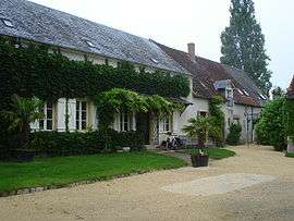 Farmhouse | |
Location of Gron 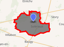
| |
 Gron  Gron | |
| Coordinates: 47°07′20″N 2°44′31″E | |
| Country | France |
| Region | Centre-Val de Loire |
| Department | Cher |
| Arrondissement | Bourges |
| Canton | Avord |
| Intercommunality | CC La Septaine |
| Government | |
| • Mayor (2008–2014) | Pascal Orlowski |
| Area 1 | 26.22 km2 (10.12 sq mi) |
| Population (2017-01-01)[1] | 469 |
| • Density | 18/km2 (46/sq mi) |
| Time zone | UTC+01:00 (CET) |
| • Summer (DST) | UTC+02:00 (CEST) |
| INSEE/Postal code | 18105 /18800 |
| Elevation | 167–263 m (548–863 ft) |
| 1 French Land Register data, which excludes lakes, ponds, glaciers > 1 km2 (0.386 sq mi or 247 acres) and river estuaries. | |
Geography
An area of forestry and farming, comprising the village and several hamlets situated by the banks of the Yèvre river, some 14 miles (23 km) east of Bourges, at the junction of the D10, D93 and the N151 roads. The commune lies on the pilgrimage route known as St. James' Way.
Population
| Year | Pop. | ±% |
|---|---|---|
| 1962 | 389 | — |
| 1968 | 483 | +24.2% |
| 1975 | 365 | −24.4% |
| 1982 | 302 | −17.3% |
| 1990 | 341 | +12.9% |
| 1999 | 426 | +24.9% |
| 2008 | 455 | +6.8% |
Sights
- The church of St. Etienne, dating from the twelfth century.
- The fifteenth-century chateau du Coupoy.
- A mill.
gollark: Yes, if you say wrong things you will IMMEDIATELY be subject to an orbital laser strike.
gollark: Very expensively.
gollark: The point is signalling that you have some base level of intelligence, ability to follow instructions and whatever.
gollark: The point is not actually the education.
gollark: As planned.
See also
References
- "Populations légales 2017". INSEE. Retrieved 6 January 2020.
| Wikimedia Commons has media related to Gron (Cher). |
| Authority control |
|
|---|
This article is issued from Wikipedia. The text is licensed under Creative Commons - Attribution - Sharealike. Additional terms may apply for the media files.