Saint-Céols
Saint-Céols is a commune in the Cher department in the Centre-Val de Loire region of France.
Saint-Céols | |
|---|---|
Location of Saint-Céols 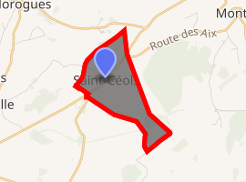
| |
 Saint-Céols  Saint-Céols | |
| Coordinates: 47°13′22″N 2°37′50″E | |
| Country | France |
| Region | Centre-Val de Loire |
| Department | Cher |
| Arrondissement | Bourges |
| Canton | Saint-Germain-du-Puy |
| Intercommunality | CC Terres du Haut Berry |
| Government | |
| • Mayor (2008–2014) | Vincent Fonsagrive |
| Area 1 | 3.34 km2 (1.29 sq mi) |
| Population (2017-01-01)[1] | 14 |
| • Density | 4.2/km2 (11/sq mi) |
| Time zone | UTC+01:00 (CET) |
| • Summer (DST) | UTC+02:00 (CEST) |
| INSEE/Postal code | 18202 /18220 |
| Elevation | 194–278 m (636–912 ft) (avg. 208 m or 682 ft) |
| 1 French Land Register data, which excludes lakes, ponds, glaciers > 1 km2 (0.386 sq mi or 247 acres) and river estuaries. | |
Geography
A tiny farming village situated some 14 miles (23 km) northeast of Bourges, near the junction of the D955 with the D154 and D59 roads.
Population
| Year | Pop. | ±% |
|---|---|---|
| 1962 | 38 | — |
| 1968 | 42 | +10.5% |
| 1975 | 27 | −35.7% |
| 1982 | 22 | −18.5% |
| 1990 | 25 | +13.6% |
| 1999 | 32 | +28.0% |
| 2008 | 18 | −43.8% |
Sights
- The church of St. Céols, dating from the thirteenth century.
- The sixteenth-century chateau, with two dovecotes.
gollark: You mean ++apioform?
gollark: Exactly, those have SIGNIFICANT effects on apioformic field gradients.
gollark: You're forgetting things like cryometaübergollariousmetairidichromatoformicization.
gollark: I'm sure you'd like to think so.
gollark: But what if apioformicative processes supersede this?
See also
References
- "Populations légales 2017". INSEE. Retrieved 6 January 2020.
External links
| Wikimedia Commons has media related to Saint-Céols. |
- Saint-Céols on the Quid website (in French)
| Authority control |
|
|---|
This article is issued from Wikipedia. The text is licensed under Creative Commons - Attribution - Sharealike. Additional terms may apply for the media files.