La Celette
La Celette is a commune in the Cher department in the Centre-Val de Loire region of France.
La Celette | |
|---|---|
Location of La Celette 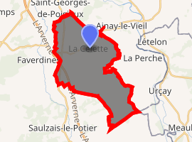
| |
 La Celette  La Celette | |
| Coordinates: 46°39′08″N 2°31′19″E | |
| Country | France |
| Region | Centre-Val de Loire |
| Department | Cher |
| Arrondissement | Saint-Amand-Montrond |
| Canton | Châteaumeillant |
| Government | |
| • Mayor (2008–2014) | Phililpe Chateau |
| Area 1 | 24.81 km2 (9.58 sq mi) |
| Population (2017-01-01)[1] | 181 |
| • Density | 7.3/km2 (19/sq mi) |
| Time zone | UTC+01:00 (CET) |
| • Summer (DST) | UTC+02:00 (CEST) |
| INSEE/Postal code | 18041 /18360 |
| Elevation | 165–231 m (541–758 ft) (avg. 180 m or 590 ft) |
| 1 French Land Register data, which excludes lakes, ponds, glaciers > 1 km2 (0.386 sq mi or 247 acres) and river estuaries. | |
Geography
A farming area comprising the village and two hamlets situated some 32 miles (51 km) south of Bourges at the junction of the D1 and the D97 roads. The A71 autoroute runs through the southwestern part of the territory of the commune.
Population
| Year | Pop. | ±% |
|---|---|---|
| 1962 | 272 | — |
| 1968 | 305 | +12.1% |
| 1975 | 221 | −27.5% |
| 1982 | 200 | −9.5% |
| 1990 | 181 | −9.5% |
| 1999 | 181 | +0.0% |
| 2008 | 196 | +8.3% |
Sights
- The church of Saints Peter and Paul, rebuilt in the nineteenth century.
gollark: Try xenoWYRM x zYu.
gollark: What's the lowest time you can incubate an egg at?
gollark: I will be so slightly annoyed if they just accept my offer.#
gollark: ... or even look at the code of the egg...
gollark: It's not like you can't look at the hub and check.
See also
References
- "Populations légales 2017". INSEE. Retrieved 6 January 2020.
| Wikimedia Commons has media related to La Celette. |
| Authority control |
|
|---|
This article is issued from Wikipedia. The text is licensed under Creative Commons - Attribution - Sharealike. Additional terms may apply for the media files.