Yébleron
Yébleron is a commune in the Seine-Maritime department in the Normandy region in northern France.
Yébleron | |
|---|---|
.jpg) The town hall in Yébleron | |
Location of Yébleron 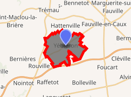
| |
 Yébleron  Yébleron | |
| Coordinates: 49°38′01″N 0°32′16″E | |
| Country | France |
| Region | Normandy |
| Department | Seine-Maritime |
| Arrondissement | Le Havre |
| Canton | Saint-Valery-en-Caux |
| Intercommunality | Caux Seine Agglo |
| Government | |
| • Mayor (2014-2020) | Georges Courraëy |
| Area 1 | 10.39 km2 (4.01 sq mi) |
| Population (2017-01-01)[1] | 1,284 |
| • Density | 120/km2 (320/sq mi) |
| Time zone | UTC+01:00 (CET) |
| • Summer (DST) | UTC+02:00 (CEST) |
| INSEE/Postal code | 76751 /76640 |
| Elevation | 122–150 m (400–492 ft) (avg. 140 m or 460 ft) |
| 1 French Land Register data, which excludes lakes, ponds, glaciers > 1 km2 (0.386 sq mi or 247 acres) and river estuaries. | |
Geography
A farming village in the Pays de Caux, situated some 18 miles (29 km) northeast of Le Havre, at the junction of the D18, D104 and D149 roads. The A29 autoroute forms part of the commune's southern border.
Population
| Year | Pop. | ±% |
|---|---|---|
| 2006 | 1,364 | — |
| 2007 | 1,370 | +0.4% |
| 2008 | 1,376 | +0.4% |
| 2009 | 1,376 | +0.0% |
| 2010 | 1,375 | −0.1% |
| 2011 | 1,375 | +0.0% |
| 2012 | 1,375 | +0.0% |
| 2013 | 1,387 | +0.9% |
| 2014 | 1,358 | −2.1% |
| 2015 | 1,330 | −2.1% |
| 2016 | 1,301 | −2.2% |
.jpg)
Church of St. Leger
Places of interest
- The church of St. Leger, dating from the thirteenth century.
- A seventeenth-century stone cross.
- A medieval enclosure.
References
- "Populations légales 2017". INSEE. Retrieved 6 January 2020.
| Wikimedia Commons has media related to Yébleron. |
| Authority control |
|
|---|
This article is issued from Wikipedia. The text is licensed under Creative Commons - Attribution - Sharealike. Additional terms may apply for the media files.