Quévreville-la-Poterie
Quévreville-la-Poterie is a commune in the Seine-Maritime department in the Normandy region in northern France.
Quévreville-la-Poterie | |
|---|---|
 Coat of arms | |
Location of Quévreville-la-Poterie 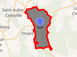
| |
 Quévreville-la-Poterie  Quévreville-la-Poterie | |
| Coordinates: 49°21′19″N 1°11′27″E | |
| Country | France |
| Region | Normandy |
| Department | Seine-Maritime |
| Arrondissement | Rouen |
| Canton | Darnétal |
| Intercommunality | Métropole Rouen Normandie |
| Government | |
| • Mayor (2001 - 2008) | Maurice Le Floch |
| Area 1 | 4.68 km2 (1.81 sq mi) |
| Population (2017-01-01)[1] | 992 |
| • Density | 210/km2 (550/sq mi) |
| Time zone | UTC+01:00 (CET) |
| • Summer (DST) | UTC+02:00 (CEST) |
| INSEE/Postal code | 76514 /76520 |
| Elevation | 40–156 m (131–512 ft) (avg. 120 m or 390 ft) |
| 1 French Land Register data, which excludes lakes, ponds, glaciers > 1 km2 (0.386 sq mi or 247 acres) and river estuaries. | |
Geography
A farming village situated some 9 miles (14 km) southeast of Rouen at the junction of the D13 and the D95 roads. The commune borders the department of Eure.
Heraldry
Arms of Quévreville-la-Poterie |
The arms of Quévreville-la-Poterie are blazoned : Per fess vert and gules, 3 goats couchant (1st to dexter contourny, 2nd in center overlapping, 3rd smaller and to sinister chief), and a necked pot proper. |
Population
| 1962 | 1968 | 1975 | 1982 | 1990 | 1999 | 2006 |
|---|---|---|---|---|---|---|
| 203 | 205 | 573 | 816 | 1044 | 987 | 947 |
| Starting in 1962: Population without duplicates | ||||||
Places of interest
- The church of Notre-Dame, dating from the eleventh century.
- A medieval manorhouse.
References
- "Populations légales 2017". INSEE. Retrieved 6 January 2020.
External links
| Wikimedia Commons has media related to Quévreville-la-Poterie. |
- Quévreville-la-Poterie on the Quid website (in French)
| Authority control |
|
|---|
This article is issued from Wikipedia. The text is licensed under Creative Commons - Attribution - Sharealike. Additional terms may apply for the media files.