Saint-Riquier-ès-Plains
Saint-Riquier-ès-Plains is a commune in the Seine-Maritime department in the Normandy region in northern France.
Saint-Riquier-ès-Plains | |
|---|---|
Location of Saint-Riquier-ès-Plains 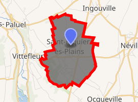
| |
 Saint-Riquier-ès-Plains  Saint-Riquier-ès-Plains | |
| Coordinates: 49°49′28″N 0°40′02″E | |
| Country | France |
| Region | Normandy |
| Department | Seine-Maritime |
| Arrondissement | Dieppe |
| Canton | Saint-Valery-en-Caux |
| Intercommunality | CC Côte d'Albâtre |
| Government | |
| • Mayor (2008–2014) | Patrick Victor |
| Area 1 | 6.22 km2 (2.40 sq mi) |
| Population (2017-01-01)[1] | 585 |
| • Density | 94/km2 (240/sq mi) |
| Time zone | UTC+01:00 (CET) |
| • Summer (DST) | UTC+02:00 (CEST) |
| INSEE/Postal code | 76646 /76460 |
| Elevation | 35–96 m (115–315 ft) (avg. 90 m or 300 ft) |
| 1 French Land Register data, which excludes lakes, ponds, glaciers > 1 km2 (0.386 sq mi or 247 acres) and river estuaries. | |
Geography
A farming village situated in the Pays de Caux, some 24 miles (39 km) southwest of Dieppe at the junction of the D69, D269 and the D925 roads.
Population
| 1962 | 1968 | 1975 | 1982 | 1990 | 1999 | 2006 |
|---|---|---|---|---|---|---|
| 283 | 335 | 319 | 459 | 513 | 578 | 611 |
| Starting in 1962: Population without duplicates | ||||||
Places of interest
- The church of St.Riquier, dating from the fourteenth century.
References
- "Populations légales 2017". INSEE. Retrieved 6 January 2020.
External links
| Wikimedia Commons has media related to Saint-Riquier-ès-Plains. |
- Saint-Riquier-ès-Plains official website (in French)
- Saint-Riquier-ès-Plains on the Quid website (in French)
| Authority control |
|
|---|
This article is issued from Wikipedia. The text is licensed under Creative Commons - Attribution - Sharealike. Additional terms may apply for the media files.