Quiberville
Quiberville is a commune in the Seine-Maritime department in the Normandy region in northern France.
Quiberville | |
|---|---|
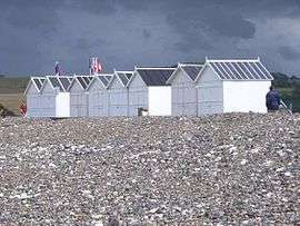 The beach at Quiberville | |
 Coat of arms | |
Location of Quiberville 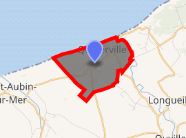
| |
 Quiberville  Quiberville | |
| Coordinates: 49°53′57″N 0°55′13″E | |
| Country | France |
| Region | Normandy |
| Department | Seine-Maritime |
| Arrondissement | Dieppe |
| Canton | Dieppe-1 |
| Intercommunality | CC Terroir de Caux |
| Government | |
| • Mayor | J-F Bloc |
| Area 1 | 3.35 km2 (1.29 sq mi) |
| Population (2017-01-01)[1] | 552 |
| • Density | 160/km2 (430/sq mi) |
| Time zone | UTC+01:00 (CET) |
| • Summer (DST) | UTC+02:00 (CEST) |
| INSEE/Postal code | 76515 /76860 |
| Elevation | 0–58 m (0–190 ft) (avg. 50 m or 160 ft) |
| 1 French Land Register data, which excludes lakes, ponds, glaciers > 1 km2 (0.386 sq mi or 247 acres) and river estuaries. | |
Geography
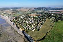
Aerial view from the west, 2019
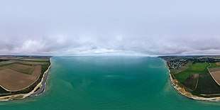
The coastline in 360°
(view as a 360° interactive panorama)
(view as a 360° interactive panorama)
A village of tourism and farming situated by the mouth of the river Saâne in the Pays de Caux at the junction of the D2, the D75 and the D127 roads, some 8 miles (13 km) west of Dieppe. Here, huge chalk cliffs look out over a pebble beach and the English Channel.
Heraldry
Arms of Quiberville |
The arms of Quiberville are blazoned : Azure, 3 (weavers) shuttles Or, and in chief on an inescutcheon gules, 2 leopards Or, armed and langued azure. |
Population
| 1962 | 1968 | 1975 | 1982 | 1990 | 1999 | 2006 |
|---|---|---|---|---|---|---|
| 319 | 362 | 399 | 427 | 429 | 467 | 516 |
| Starting in 1962: Population without duplicates | ||||||
Places of interest
- The church of St. Valery, dating from the twelfth century.
- A stone cross dated 1602.
References
- "Populations légales 2017". INSEE. Retrieved 6 January 2020.
External links
| Wikimedia Commons has media related to Quiberville. |
- Website of Quiberville sailing club (in French)
| Authority control |
|
|---|
This article is issued from Wikipedia. The text is licensed under Creative Commons - Attribution - Sharealike. Additional terms may apply for the media files.