Rouvray-Catillon
Rouvray-Catillon is a commune in the Seine-Maritime department in the Normandy region in northern France.
Rouvray-Catillon | |
|---|---|
Location of Rouvray-Catillon 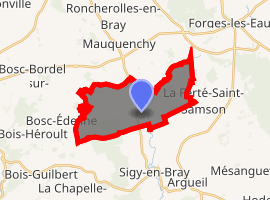
| |
 Rouvray-Catillon  Rouvray-Catillon | |
| Coordinates: 49°34′25″N 1°28′59″E | |
| Country | France |
| Region | Normandy |
| Department | Seine-Maritime |
| Arrondissement | Dieppe |
| Canton | Gournay-en-Bray |
| Intercommunality | CC 4 rivières |
| Government | |
| • Mayor | Jean-Michel Morel |
| Area 1 | 12.22 km2 (4.72 sq mi) |
| Population (2017-01-01)[1] | 228 |
| • Density | 19/km2 (48/sq mi) |
| Time zone | UTC+01:00 (CET) |
| • Summer (DST) | UTC+02:00 (CEST) |
| INSEE/Postal code | 76544 /76440 |
| Elevation | 112–225 m (367–738 ft) (avg. 121 m or 397 ft) |
| 1 French Land Register data, which excludes lakes, ponds, glaciers > 1 km2 (0.386 sq mi or 247 acres) and river estuaries. | |
Geography
A village of farming and associated light industry situated by the banks of the Andelle river in the Pays de Bray at the junction of the D61, D13 and the D118 roads, some 20 miles (32 km) northeast of Rouen.
Population
| 1962 | 1968 | 1975 | 1982 | 1990 | 1999 | 2006 |
|---|---|---|---|---|---|---|
| 252 | 258 | 210 | 216 | 211 | 195 | 182 |
| Starting in 1962: Population without duplicates | ||||||
Places of interest
- The eighteenth-century church of St. Martin.
- The church of Notre-Dame, dating from the eighteenth century.
- A museum in a 16th-century manorhouse.
- A seventeenth-century château.
- The chapel of St. Samson, dating from the nineteenth century.
External links
| Wikimedia Commons has media related to Rouvray-Catillon. |
- Rouvray-Catillon on the Quid website (in French)
| Authority control |
|
|---|
This article is issued from Wikipedia. The text is licensed under Creative Commons - Attribution - Sharealike. Additional terms may apply for the media files.