Mesnil-Panneville
Mesnil-Panneville is a commune in the Seine-Maritime department in the Normandy region in northern France.
Mesnil-Panneville | |
|---|---|
.svg.png) Coat of arms | |
Location of Mesnil-Panneville 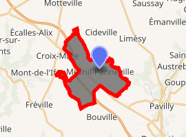
| |
 Mesnil-Panneville  Mesnil-Panneville | |
| Coordinates: 49°35′31″N 0°53′31″E | |
| Country | France |
| Region | Normandy |
| Department | Seine-Maritime |
| Arrondissement | Rouen |
| Canton | Notre-Dame-de-Bondeville |
| Government | |
| • Mayor (2001–2008) | Rémy Patin |
| Area 1 | 11.87 km2 (4.58 sq mi) |
| Population (2017-01-01)[1] | 719 |
| • Density | 61/km2 (160/sq mi) |
| Time zone | UTC+01:00 (CET) |
| • Summer (DST) | UTC+02:00 (CEST) |
| INSEE/Postal code | 76433 /76570 |
| Elevation | 85–154 m (279–505 ft) (avg. 120 m or 390 ft) |
| 1 French Land Register data, which excludes lakes, ponds, glaciers > 1 km2 (0.386 sq mi or 247 acres) and river estuaries. | |
Geography
A farming commune made up of the main village and several hamlets, situated in the Pays de Caux, some 15 miles (24 km) northwest of Rouen at the junction of the D63, D263 and the D6015 roads.
Population
| 1962 | 1968 | 1975 | 1982 | 1990 | 1999 | 2006 |
|---|---|---|---|---|---|---|
| 295 | 308 | 272 | 466 | 492 | 515 | 616 |
| Starting in 1962: Population without duplicates | ||||||
Places of interest
- The church of Notre-Dame, dating from the nineteenth century.
- The chapel of St. Antoine, dating from the twelfth century.
- The sixteenth century chateau de Panneville.
- The Château d'Hardouville, with parts dating from feudal times.
- A sixteenth-century house with a sculpted chimney.
- The church of Notre-Dame at Durecy, dating from the nineteenth century.
- The church of St.Sulpice, dating from the thirteenth century.
References
- "Populations légales 2017". INSEE. Retrieved 6 January 2020.
| Wikimedia Commons has media related to Mesnil-Panneville. |
| Authority control |
|
|---|
This article is issued from Wikipedia. The text is licensed under Creative Commons - Attribution - Sharealike. Additional terms may apply for the media files.