Mathonville
Mathonville is a commune in the Seine-Maritime department in the Normandy region in northern France.
Mathonville | |
|---|---|
Location of Mathonville 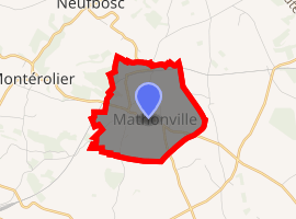
| |
 Mathonville  Mathonville | |
| Coordinates: 49°37′20″N 1°22′59″E | |
| Country | France |
| Region | Normandy |
| Department | Seine-Maritime |
| Arrondissement | Dieppe |
| Canton | Neufchâtel-en-Bray |
| Intercommunality | CC Bray-Eawy |
| Government | |
| • Mayor | Patrick Guerard |
| Area 1 | 4.09 km2 (1.58 sq mi) |
| Population (2017-01-01)[1] | 319 |
| • Density | 78/km2 (200/sq mi) |
| Time zone | UTC+01:00 (CET) |
| • Summer (DST) | UTC+02:00 (CEST) |
| INSEE/Postal code | 76416 /76680 |
| Elevation | 170–229 m (558–751 ft) (avg. 220 m or 720 ft) |
| 1 French Land Register data, which excludes lakes, ponds, glaciers > 1 km2 (0.386 sq mi or 247 acres) and river estuaries. | |
Its inhabitants are called Mathonville and Mathonvillaises.
Geography
A small farming village situated in the Pays de Bray, some 35 miles (56 km) southeast of Dieppe at the junction of the D118 and the D38 roads.
Surrounded by the municipalities of Bosc-Bordel, Montérolier and Buchy, Mathonville is located 28 km northeast of Mont-Saint-Aignan, the largest city nearby.[2]
Population
| 1962 | 1968 | 1975 | 1982 | 1990 | 1999 | 2006 |
|---|---|---|---|---|---|---|
| 108 | 110 | 139 | 137 | 154 | 174 | 223 |
| Starting in 1962: Population without duplicates | ||||||
References
- "Populations légales 2017". INSEE. Retrieved 6 January 2020.
- "annuaire-mairie"
| Wikimedia Commons has media related to Mathonville. |
| Authority control |
|
|---|
This article is issued from Wikipedia. The text is licensed under Creative Commons - Attribution - Sharealike. Additional terms may apply for the media files.