Criquetot-sur-Longueville
Criquetot-sur-Longueville is a commune in the Seine-Maritime département of the Normandy region of northern France.
Criquetot-sur-Longueville | |
|---|---|
 The church in Criquetot-sur-Longueville | |
Location of Criquetot-sur-Longueville 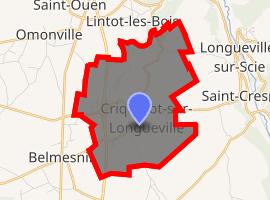
| |
 Criquetot-sur-Longueville  Criquetot-sur-Longueville | |
| Coordinates: 49°46′36″N 1°04′34″E | |
| Country | France |
| Region | Normandy |
| Department | Seine-Maritime |
| Arrondissement | Dieppe |
| Canton | Luneray |
| Intercommunality | CC Terroir de Caux |
| Government | |
| • Mayor | Nicolas Leforestier |
| Area 1 | 7.22 km2 (2.79 sq mi) |
| Population (2017-01-01)[1] | 228 |
| • Density | 32/km2 (82/sq mi) |
| Time zone | UTC+01:00 (CET) |
| • Summer (DST) | UTC+02:00 (CEST) |
| INSEE/Postal code | 76197 /76590 |
| Elevation | 75–137 m (246–449 ft) (avg. 101 m or 331 ft) |
| 1 French Land Register data, which excludes lakes, ponds, glaciers > 1 km2 (0.386 sq mi or 247 acres) and river estuaries. | |
Geography
A small farming village situated in the Pays de Caux, some 12 miles (19 km) south of Dieppe, at the junction of the N27, the D276 and the D149 roads.
Population
| Year | 1962 | 1968 | 1975 | 1982 | 1990 | 1999 | 2005 |
|---|---|---|---|---|---|---|---|
| Population | 150 | 160 | 137 | 163 | 153 | 159 | 161 |
| From the year 1962[2] on: No double counting—residents of multiple communes (e.g. students and military personnel) are counted only once. | |||||||
Places of interest
- The church of St.Julien, dating from the twelfth century.
Notes
- This article is based on the equivalent article from the French Wikipedia, consulted 24 October 2008.
- "Populations légales 2017". INSEE. Retrieved 6 January 2020.
- Criquetot-sur-Longueville on the Insee website (in French)
| Wikimedia Commons has media related to Criquetot-sur-Longueville. |
| Authority control |
|
|---|
This article is issued from Wikipedia. The text is licensed under Creative Commons - Attribution - Sharealike. Additional terms may apply for the media files.