Saint-Gilles-de-Crétot
Saint-Gilles-de-Crétot is a commune in the Seine-Maritime department in the Normandy region in northern France.
Saint-Gilles-de-Crétot | |
|---|---|
.svg.png) Coat of arms | |
Location of Saint-Gilles-de-Crétot 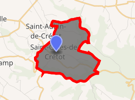
| |
 Saint-Gilles-de-Crétot  Saint-Gilles-de-Crétot | |
| Coordinates: 49°33′33″N 0°38′43″E | |
| Country | France |
| Region | Normandy |
| Department | Seine-Maritime |
| Arrondissement | Rouen |
| Canton | Notre-Dame-de-Gravenchon |
| Intercommunality | CA Caux vallée de Seine |
| Government | |
| • Mayor | Colette Vanier |
| Area 1 | 6.02 km2 (2.32 sq mi) |
| Population (2017-01-01)[1] | 434 |
| • Density | 72/km2 (190/sq mi) |
| Time zone | UTC+01:00 (CET) |
| • Summer (DST) | UTC+02:00 (CEST) |
| INSEE/Postal code | 76585 /76490 |
| Elevation | 32–141 m (105–463 ft) (avg. 135 m or 443 ft) |
| 1 French Land Register data, which excludes lakes, ponds, glaciers > 1 km2 (0.386 sq mi or 247 acres) and river estuaries. | |
Geography
A small farming village situated in the Pays de Caux, some 25 miles (40 km) northwest of Rouen near the junction of the D40 with the D440 road.
Heraldry
Arms of Saint-Gilles-de-Crétot |
The arms of Saint-Gilles-de-Crétot are blazoned : Azure, an armed senestrochere argent holding a lance palewise Or, from which a banner argent a bend wavy gules. |
Population
| 1962 | 1968 | 1975 | 1982 | 1990 | 1999 | 2006 |
|---|---|---|---|---|---|---|
| 184 | 188 | 182 | 194 | 253 | 268 | 338 |
| Starting in 1962: Population without duplicates | ||||||
Places of interest
- The church of St. Gilles, dating from the sixteenth century.
- Two châteaux, de La Viézaire and de La Picottière.
References
- "Populations légales 2017". INSEE. Retrieved 6 January 2020.
External links
| Wikimedia Commons has media related to Saint-Gilles-de-Crétot. |
- Saint-Gilles-de-Crétot on the Quid website (in French)
| Authority control |
|
|---|
This article is issued from Wikipedia. The text is licensed under Creative Commons - Attribution - Sharealike. Additional terms may apply for the media files.