Raffetot
Raffetot is a commune in the Seine-Maritime department in the Normandy region in northern France.
Raffetot | |
|---|---|
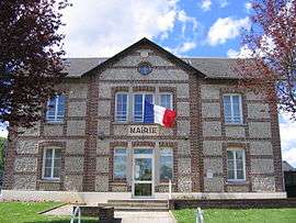 The town hall in Raffetot | |
Location of Raffetot 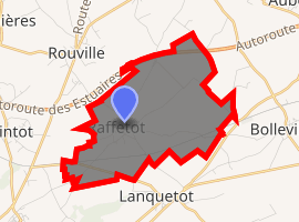
| |
 Raffetot  Raffetot | |
| Coordinates: 49°36′03″N 0°30′55″E | |
| Country | France |
| Region | Normandy |
| Department | Seine-Maritime |
| Arrondissement | Le Havre |
| Canton | Bolbec |
| Intercommunality | CA Caux vallée de Seine |
| Government | |
| • Mayor | Philippe Bellet |
| Area 1 | 6.85 km2 (2.64 sq mi) |
| Population (2017-01-01)[1] | 503 |
| • Density | 73/km2 (190/sq mi) |
| Time zone | UTC+01:00 (CET) |
| • Summer (DST) | UTC+02:00 (CEST) |
| INSEE/Postal code | 76518 /76210 |
| Elevation | 127–144 m (417–472 ft) (avg. 136 m or 446 ft) |
| 1 French Land Register data, which excludes lakes, ponds, glaciers > 1 km2 (0.386 sq mi or 247 acres) and river estuaries. | |
Geography
A farming village in the Pays de Caux, situated some 21 miles (34 km) northeast of Le Havre, sandwiched between the D30 road and the A29 autoroute.
Population
| 1962 | 1968 | 1975 | 1982 | 1990 | 1999 | 2006 |
|---|---|---|---|---|---|---|
| 351 | 399 | 373 | 427 | 467 | 475 | 455 |
| Starting in 1962: Population without duplicates | ||||||
Places of interest
- The church of St. Anne, dating from the thirteenth century.
References
- "Populations légales 2017". INSEE. Retrieved 6 January 2020.
| Wikimedia Commons has media related to Raffetot. |
| Authority control |
|
|---|
This article is issued from Wikipedia. The text is licensed under Creative Commons - Attribution - Sharealike. Additional terms may apply for the media files.