Saint-Jean-du-Cardonnay
Saint-Jean-du-Cardonnay is a commune in the Seine-Maritime department in the Normandy region in northern France.
Saint-Jean-du-Cardonnay | |
|---|---|
 The town hall in Saint-Jean-du-Cardonnay | |
.svg.png) Coat of arms | |
Location of Saint-Jean-du-Cardonnay 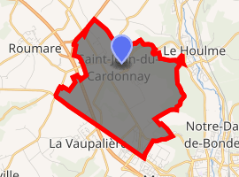
| |
 Saint-Jean-du-Cardonnay  Saint-Jean-du-Cardonnay | |
| Coordinates: 49°30′25″N 1°00′36″E | |
| Country | France |
| Region | Normandy |
| Department | Seine-Maritime |
| Arrondissement | Rouen |
| Canton | Notre-Dame-de-Bondeville |
| Government | |
| • Mayor | Jacques Niel |
| Area 1 | 7.52 km2 (2.90 sq mi) |
| Population (2017-01-01)[1] | 1,377 |
| • Density | 180/km2 (470/sq mi) |
| Time zone | UTC+01:00 (CET) |
| • Summer (DST) | UTC+02:00 (CEST) |
| INSEE/Postal code | 76594 /76150 |
| Elevation | 55–146 m (180–479 ft) (avg. 130 m or 430 ft) |
| 1 French Land Register data, which excludes lakes, ponds, glaciers > 1 km2 (0.386 sq mi or 247 acres) and river estuaries. | |
Geography
A village of forestry and farming situated in the Roumois, just 7 miles (11 km) northwest of the centre of Rouen at the junction of the D90, D267 with the D6015 road.
Population
| 1962 | 1968 | 1975 | 1982 | 1990 | 1999 | 2006 |
|---|---|---|---|---|---|---|
| 773 | 773 | 1015 | 1094 | 1270 | 1298 | 1385 |
| Starting in 1962: Population without duplicates | ||||||
Places of interest
- The church of St.Jean, dating from the sixteenth century.
- A seventeenth-century chateau.
- A chapel built in 1820.
References
- "Populations légales 2017". INSEE. Retrieved 6 January 2020.
| Wikimedia Commons has media related to Saint-Jean-du-Cardonnay. |
| Authority control |
|
|---|
This article is issued from Wikipedia. The text is licensed under Creative Commons - Attribution - Sharealike. Additional terms may apply for the media files.