Sierville
Sierville is a commune in the Seine-Maritime department in the Normandy region in northern France.
Sierville | |
|---|---|
Location of Sierville 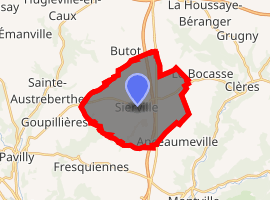
| |
 Sierville  Sierville | |
| Coordinates: 49°35′26″N 1°02′14″E | |
| Country | France |
| Region | Normandy |
| Department | Seine-Maritime |
| Arrondissement | Rouen |
| Canton | Bois-Guillaume |
| Government | |
| • Mayor | Yves Loisel |
| Area 1 | 15.91 km2 (6.14 sq mi) |
| Population (2017-01-01)[1] | 1,039 |
| • Density | 65/km2 (170/sq mi) |
| Time zone | UTC+01:00 (CET) |
| • Summer (DST) | UTC+02:00 (CEST) |
| INSEE/Postal code | 76675 /76690 |
| Elevation | 120–181 m (394–594 ft) (avg. 150 m or 490 ft) |
| 1 French Land Register data, which excludes lakes, ponds, glaciers > 1 km2 (0.386 sq mi or 247 acres) and river estuaries. | |
Geography
A farming village situated in the Pays de Caux, some 11 miles (18 km) north of Rouen at the junction of the D927 with the D6, D504 and the D251 roads. The A151 autoroute runs through the middle of the commune's territory.
Population
| 1962 | 1968 | 1975 | 1982 | 1990 | 1999 | 2006 |
|---|---|---|---|---|---|---|
| 381 | 442 | 485 | 687 | 817 | 859 | 916 |
| Starting in 1962: Population without duplicates | ||||||
Places of interest
- The church of St. Philibert, dating from the eleventh century.
- A thirteenth-century building in a courtyard near the presbytery.
- The eighteenth-century chateau of Bosc-Laurent.
References
- "Populations légales 2017". INSEE. Retrieved 6 January 2020.
| Wikimedia Commons has media related to Sierville. |
| Authority control |
|
|---|
This article is issued from Wikipedia. The text is licensed under Creative Commons - Attribution - Sharealike. Additional terms may apply for the media files.