Saint-Jacques-sur-Darnétal
Saint-Jacques-sur-Darnétal is a commune in the Seine-Maritime department in the Normandy region in north-western France.
Saint-Jacques-sur-Darnétal | |
|---|---|
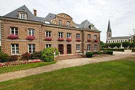 The town hall and church in Saint-Jacques-sur-Darnétal | |
Location of Saint-Jacques-sur-Darnétal 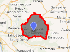
| |
 Saint-Jacques-sur-Darnétal  Saint-Jacques-sur-Darnétal | |
| Coordinates: 49°26′28″N 1°12′14″E | |
| Country | France |
| Region | Normandy |
| Department | Seine-Maritime |
| Arrondissement | Rouen |
| Canton | Darnétal |
| Intercommunality | Métropole Rouen Normandie |
| Government | |
| • Mayor (2014–2020) | Danielle Pignat |
| Area 1 | 16.71 km2 (6.45 sq mi) |
| Population (2017-01-01)[1] | 2,835 |
| • Density | 170/km2 (440/sq mi) |
| Time zone | UTC+01:00 (CET) |
| • Summer (DST) | UTC+02:00 (CEST) |
| INSEE/Postal code | 76591 /76160 |
| Elevation | 55–172 m (180–564 ft) (avg. 143 m or 469 ft) |
| 1 French Land Register data, which excludes lakes, ponds, glaciers > 1 km2 (0.386 sq mi or 247 acres) and river estuaries. | |
Geography
A small town of forestry, farming and light industry, just 5 miles (8.0 km) east of the centre of Rouen at the junction of the D 7, D 43, D 91 with the N 31 (former N 30) road.
Population
| 1962 | 1968 | 1975 | 1982 | 1990 | 1999 | 2006 | 2006 | 2006 |
|---|---|---|---|---|---|---|---|---|
| 1110 | 1175 | 1561 | 2040 | 2407 | 2492 | 2564 | 2588 | 2597 |
| Starting in 1962: Population without duplicates | ||||||||
Places of interest
- The church of St. Jacques, dating from the 19th century.
- A 16th-century cemetery cross.
- The chapel at Quévreville la Milon, built in 1828.
References
- "Populations légales 2017". INSEE. Retrieved 6 January 2020.
External links
| Wikimedia Commons has media related to Saint-Jacques-sur-Darnétal. |
- Saint-Jacques-sur-Darnétal on the Quid website (in French)
| Authority control |
|
|---|
This article is issued from Wikipedia. The text is licensed under Creative Commons - Attribution - Sharealike. Additional terms may apply for the media files.