Tocqueville-les-Murs
Tocqueville-les-Murs is a commune in the Seine-Maritime department in the Normandy region in northern France.
Tocqueville-les-Murs | |
|---|---|
.svg.png) Coat of arms | |
Location of Tocqueville-les-Murs 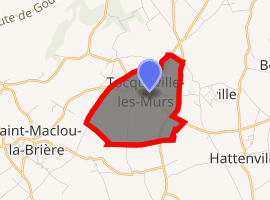
| |
 Tocqueville-les-Murs  Tocqueville-les-Murs | |
| Coordinates: 49°39′59″N 0°30′19″E | |
| Country | France |
| Region | Normandy |
| Department | Seine-Maritime |
| Arrondissement | Le Havre |
| Canton | Saint-Romain-de-Colbosc |
| Intercommunality | CC Campagne de Caux |
| Area 1 | 3.47 km2 (1.34 sq mi) |
| Population (2017-01-01)[1] | 278 |
| • Density | 80/km2 (210/sq mi) |
| Time zone | UTC+01:00 (CET) |
| • Summer (DST) | UTC+02:00 (CEST) |
| INSEE/Postal code | 76695 /76110 |
| Elevation | 114–138 m (374–453 ft) (avg. 135 m or 443 ft) |
| 1 French Land Register data, which excludes lakes, ponds, glaciers > 1 km2 (0.386 sq mi or 247 acres) and river estuaries. | |
Geography
A farming village in the Pays de Caux, situated some 22 miles (35 km) northeast of Le Havre, at the junction of the D11, D28 and D75 roads.
Population
| 1962 | 1968 | 1975 | 1982 | 1990 | 1999 | 2006 |
|---|---|---|---|---|---|---|
| 170 | 185 | 171 | 236 | 223 | 209 | 276 |
| Starting in 1962: Population without duplicates | ||||||
Places of interest
- The church of St. Germain, dating from the twelfth century.
- The nineteenth-century chateau.
- Traces of a feudal castle.
References
- "Populations légales 2017". INSEE. Retrieved 6 January 2020.
| Wikimedia Commons has media related to Tocqueville-les-Murs. |
| Authority control |
|
|---|
This article is issued from Wikipedia. The text is licensed under Creative Commons - Attribution - Sharealike. Additional terms may apply for the media files.