Saint-Pierre-Bénouville
Saint-Pierre-Bénouville is a commune in the Seine-Maritime department in the Normandy region in north-western France.
Saint-Pierre-Bénouville | |
|---|---|
Location of Saint-Pierre-Bénouville 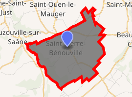
| |
 Saint-Pierre-Bénouville  Saint-Pierre-Bénouville | |
| Coordinates: 49°44′29″N 0°58′18″E | |
| Country | France |
| Region | Normandy |
| Department | Seine-Maritime |
| Arrondissement | Dieppe |
| Canton | Luneray |
| Intercommunality | CC Terroir de Caux |
| Government | |
| • Mayor (2014-2020) | Bernard Pade |
| Area 1 | 8.39 km2 (3.24 sq mi) |
| Population (2017-01-01)[1] | 379 |
| • Density | 45/km2 (120/sq mi) |
| Time zone | UTC+01:00 (CET) |
| • Summer (DST) | UTC+02:00 (CEST) |
| INSEE/Postal code | 76632 /76890 |
| Elevation | 69–148 m (226–486 ft) (avg. 130 m or 430 ft) |
| 1 French Land Register data, which excludes lakes, ponds, glaciers > 1 km2 (0.386 sq mi or 247 acres) and river estuaries. | |
Geography
A farming village situated by the banks of the Saâne river in the Pays de Caux, at the junction of the D 101 and the D 55 roads, some 12 miles (19 km) south of Dieppe.
Population
| 1793 | 1831 | 1962 | 1968 | 1975 | 1982 | 1990 | 1999 | 2006 | 2011 |
|---|---|---|---|---|---|---|---|---|---|
| 301 | 918 | 303 | 309 | 284 | 336 | 337 | 326 | 320 | 350 |
| Starting in 1962: Population without duplicates | |||||||||
Places of interest
- The church of St. Pierre, dating from the sixteenth century.
- The church of St. Étienne at Dracqueville, dating from the twelfth century.
References
- "Populations légales 2017". INSEE. Retrieved 6 January 2020.
External links
| Wikimedia Commons has media related to Saint-Pierre-Bénouville. |
- Saint-Pierre-Bénouville on the Quid website (in French)
| Authority control |
|
|---|
This article is issued from Wikipedia. The text is licensed under Creative Commons - Attribution - Sharealike. Additional terms may apply for the media files.