Parc-d'Anxtot
Parc-d’Anxtot is a commune in the Seine-Maritime department in the Normandy region in northern France.
Parc-d’Anxtot | |
|---|---|
Location of Parc-d’Anxtot 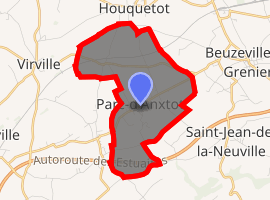
| |
 Parc-d’Anxtot  Parc-d’Anxtot | |
| Coordinates: 49°34′57″N 0°23′27″E | |
| Country | France |
| Region | Normandy |
| Department | Seine-Maritime |
| Arrondissement | Le Havre |
| Canton | Bolbec |
| Intercommunality | CA Caux vallée de Seine |
| Area 1 | 5.83 km2 (2.25 sq mi) |
| Population (2017-01-01)[1] | 567 |
| • Density | 97/km2 (250/sq mi) |
| Time zone | UTC+01:00 (CET) |
| • Summer (DST) | UTC+02:00 (CEST) |
| INSEE/Postal code | 76494 /76210 |
| Elevation | 82–130 m (269–427 ft) (avg. 114 m or 374 ft) |
| 1 French Land Register data, which excludes lakes, ponds, glaciers > 1 km2 (0.386 sq mi or 247 acres) and river estuaries. | |
Geography
A farming village in the Pays de Caux, situated some 15 miles (24 km) northeast of Le Havre, on the D80 road. The A29 autoroute crosses the commune's southern border.
Population
| 1962 | 1968 | 1975 | 1982 | 1990 | 1999 | 2006 |
|---|---|---|---|---|---|---|
| 251 | 258 | 266 | 302 | 382 | 482 | 543 |
| Starting in 1962: Population without duplicates | ||||||
Places of interest
- The church of St. Blaise, dating from the sixteenth century.
References
- "Populations légales 2017". INSEE. Retrieved 6 January 2020.
External links
| Wikimedia Commons has media related to Parc-d'Anxtot. |
- Parc-d’Anxtot on the Quid website (in French)
| Authority control |
|
|---|
This article is issued from Wikipedia. The text is licensed under Creative Commons - Attribution - Sharealike. Additional terms may apply for the media files.