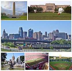
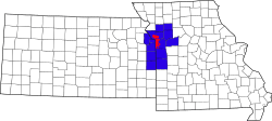
Kansas City metropolitan area
The Kansas City metropolitan area is a bi-state metropolitan area anchored by Kansas City, Missouri. Its 14 counties straddles the border between the U.S. states of Missouri (9 counties) and Kansas (5 counties). It is the second-largest metropolitan area centered in Missouri (after Greater St. Louis) and is the largest metropolitan area in Kansas, though Wichita is the largest metropolitan area centered in Kansas.[1] Alongside Kansas City, these are other cities and suburbs with populations above 100,000: Overland Park, Kansas (the largest); Kansas City, Kansas; Olathe, Kansas; and Independence, Missouri. The Mid-America Regional Council (MARC) serves as the Council of Governments and the Metropolitan Planning Organization for the area.
Kansas City metropolitan area | |
|---|---|
| Kansas City, MO–KS | |
 | |
 | |
| Coordinates: 39°06′N 94°35′W | |
| Country | United States |
| State(s) | - Missouri - Kansas |
| Largest city | Kansas City, Missouri |
| Other cities | - Overland Park, Kansas - Kansas City, Kansas - Independence, Missouri - Olathe, Kansas - Lee's Summit, Missouri - Shawnee, Kansas - Blue Springs, Missouri - Liberty, Missouri - Lenexa, Kansas - Leavenworth, Kansas - Leawood, Kansas |
| Area | |
| • Total | 8,472 sq mi (21,940 km2) |
| Highest elevation | 1,1601 ft (353.51 m) |
| Lowest elevation | 6901 ft (210.31 m) |
| Population | |
| • Total | (2,015) 2,159,159 |
| • Rank | 30th MSA (2,087,471), 24th CSA (2,428,362) in the U.S. |
| • Density | 260.0/sq mi (100.4/km2) |
Geographic overview
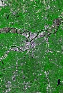
The larger Kansas City Metropolitan Area as seen on a map can be visualized roughly as four quadrants:
The southeast quadrant includes Kansas City, Missouri, and surrounding areas in Missouri. It includes the notorious Grandview Triangle.
The southwest quadrant includes all of Johnson County, Kansas, which includes the towns in the area known as Shawnee Mission, Kansas. Interstate 35 runs diagonally through Johnson County, Kansas, from the southwest to downtown Kansas City, Missouri.
The northwest quadrant contains Wyandotte, and Leavenworth, counties in Kansas and parts of Platte County, Missouri. Wyandotte County, Kansas (sometimes referred to as just Wyandotte), contains Kansas City, Kansas; Bonner Springs, Kansas; and Edwardsville, Kansas; it is governed by a single unified government. Often the Wyandotte government is referred to simply as "The Unified Government". Another bend in the Missouri River forms the county line between Wyandotte County, Kansas, and Platte County, Missouri, to the north and northeast.
The map's northeast quadrant is locally referred to as "north of the river" or "the Northland". It includes parts of Clay County, Missouri, including North Kansas City, Missouri. North Kansas City is bounded by a bend in the Missouri River that defines a border between Wyandotte County, Kansas, and Clay County, Missouri, running approximately North-South and a border between North Kansas City, Missouri, and Kansas City, Missouri, running approximately East-West. The river bend's sharpest part forms a peninsula containing the Kansas City Downtown Airport.
Divisions
Jackson County, Missouri
Downtown
"Downtown" almost always refers to downtown Kansas City, Missouri which has a population of 25,204.[2] Downtown is Kansas City's historic center, located entirely within Kansas City, Missouri, and contains the city's original town site, business districts, and residential neighborhoods. Downtown is bounded by the Missouri River on the north, the Missouri-Kansas state line on the west, 31st Street on the south and Woodland Avenue on the east. The downtown area includes the Central Business District and its buildings, which form the city's skyline. The Downtown Loop is formed by Interstates 670, 70 and 35. Within the downtown loop are many of the tall buildings and skyscrapers that make up the city's skyline. The downtown loop also has small, distinct neighborhoods such as Quality Hill, the Garment District, the Financial District, the Convention Center District, and the Power and Light District.
Other neighborhoods within downtown are the River Market and Columbus Park, both located between the downtown loop and the Missouri River. Between the downtown loop and the state line are the Westside neighborhood and the West Bottoms, located at the bottom of the bluff adjacent to Kaw Point. East of the loop are the 18th & Vine District, the North Bottoms, and Northeast Kansas City (the East Bottoms, Northeast, and Pendleton Heights). South of the loop is the Crossroads District, Union Hill, Crown Center, Hospital Hill, Longfellow, Wendell Phillips, and Washington Wheatley.
The Kansas City Convention Center, Municipal Auditorium, City Hall, Lyric Theater, Midland Theatre, Ilus Davis Park, and Barney Allis Plaza are within the Central Business District inside the downtown loop. The Sprint Center and the College Basketball Experience are within the Power & Light District, also within the downtown loop. The Kauffman Center for the Performing Arts is perched upon a high point immediately south of the downtown loop. South of the loop is the Crossroads District, Union Station, Crown Center, the National World War I Museum, Liberty Memorial, Penn Valley Park, Truman Medical Center, Children's Mercy Hospital, and the 18th & Vine District. North of the loop are City Market within the River Market and Richard L. Berkeley Riverfront Park. West of the loop within the West Bottoms are Kemper Arena and Hale Arena.
Midtown/Plaza
Midtown/Plaza is entirely within Kansas City, Missouri with a population of 40,355.[3] It is just south of downtown, and bounded by 31st Street on the north, the state line on the west, West Gregory Boulevard (71st Street) on the south, and Troost Avenue on the east. Midtown/Plaza, the core of the metropolitan area, has many cultural attractions, shopping and entertainment areas, large hospitals, universities, and the metro area's most densely populated neighborhoods.
Midtown/Plaza has many distinct and historic neighborhoods, including Westport, Hyde Park, and Southmoreland. Shopping is centered on the Country Club Plaza, which has luxury retailers, hotels, and restaurants. Brookside and Westport also contain smaller-scale, neighborhood-oriented, and niche-market retailers. Midtown is home to Saint Luke's Hospital and Research Medical Center. Cultural attractions include the Nelson-Atkins Museum of Art, Kemper Museum of Contemporary Art, Uptown Theater, Starlight Theater, the Kansas City Zoo, Loose Park, and Swope Park. The last of these has a soccer complex that is home to the Swope Park Rangers, a USL Championship team that is the official reserve side for the area's Major League Soccer club, Sporting Kansas City. Major educational institutions include the University of Missouri–Kansas City, Rockhurst University, Kansas City Art Institute, Stowers Institute for Medical Research, Midwest Research Institute, and Penn Valley Community College.
East Side
East Side of the Metro is primarily eastern Jackson County which is an area of the Kansas City Metro that contains the far-eastern urban side of Kansas City, Missouri and the following large suburbs of Blue Springs, Independence, and Lee's Summit. Also included in this area is western Lafayette County Missouri and the far northeast portion of Cass County Missouri. The East Side of Metro includes the following Missouri suburbs of Independence, Blue Springs, Raytown, Lees Summit, Grain Valley, Oak Grove, Sugar Creek, River Bend, Lake Lotawana, Lone Jack, Greenwood, Unity Village, Buckner, Pleasant Hill, Bates City, Odessa, and Lake Tapawingo. Arrowhead Stadium, home of the NFL's Kansas City Chiefs and Kauffman Stadium, home of the MLB's Kansas City Royals are on the eastern edge of Kansas City. The Silverstein Eye Centers Arena home of the ECHL's Kansas City Mavericks and the MASL's Missouri Comets is in Independence.
Johnson County, Kansas
Johnson County, Kansas contains many municipalities, both small and large and has a population of 597,555.[4] These municipalities include Overland Park, Olathe, Shawnee, Leawood, Lenexa, Prairie Village, Gardner, Merriam, Mission, Roeland Park, Fairway, Lake Quivira, Mission Hills, Mission Woods, Westwood, and Westwood Hills. Notable headquarters include Sprint, Garmin, Black & Veatch and AMC Theatres. Many local area attractions and shopping districts are in Johnson County, such as Oak Park Mall, Town Center Plaza, and Prairie Fire.
The Northland (Missouri)
The Northland is the area north of the Missouri River, bordered by the Kansas state line on the west and Missouri Highway 291 on the east. The southern half of Platte County, and much of Clay County make up the area. The economy of the Northland is dominated by Cerner, Kansas City International Airport, Ford Kansas City Assembly Plant, the Zona Rosa shopping community and three riverboat casinos. The metro area's largest amusement park, Worlds of Fun and Oceans of Fun, is in the Northland. Communities of the Northland outside the city limits include Parkville, Kearney, Liberty, Platte City, Gladstone, Riverside, Smithville, North Kansas City, and Weatherby Lake.
KCK (Wyandotte County and Kansas City, Kansas)
Wyandotte County has a population of 165,334 and contains Kansas City, Kansas, which is locally called "KCK" to distinguish it from the larger Kansas City, Missouri (KCMO).[5] It contains many residential neighborhoods, the Fairfax Industrial District, and the Village West entertainment district. The General Motors Fairfax Assembly Plant is in the Fairfax Industrial District. Village West contains many area attractions. This includes many sporting venues such as Children's Mercy Park, home of the area MLS soccer team Sporting Kansas City, the Kansas Speedway, which hosts many NASCAR races, and T-Bones Stadium, home of the independent baseball team, the Kansas City T-Bones. Other Village West attractions include the Legends shopping district, the Providence Medical Center Amphitheater, and Schlitterbahn Waterpark.
Cass County, Missouri
Cass County, Missouri has a population of 104,954 and contains parts of “South Kansas City", this area consists of the most southern part of Kansas City, Missouri, as well as the suburbs of Harrisonville, Belton, Loch Lloyd, Peculiar and Raymore.[6]
Leavenworth County, Kansas
Has a population of 81,352 and contains the cities of Leavenworth and Lansing along with the Leavenworth state Penitentiary.[7]
Cultural attractions
| Photo | Name | City | Notes | ||||||||
|---|---|---|---|---|---|---|---|---|---|---|---|
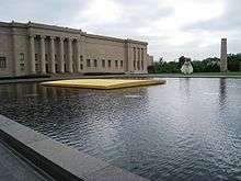 |
Nelson-Atkins Museum of Art | Kansas City, Missouri | Founded in 1933, the Nelson-Atkins maintains wide-ranging collections of more than 35,000 works of art and welcomes 500,000 visitors a year. | ||||||||
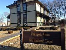 Chicago & Alton Railroad Depot, Independence, Missouri | Chicago & Alton Railroad Depot | Independence, Missouri | The oldest business building in Independence, Missouri. In 1978, the hotel, which originally served the railroad, moved from the original site just south of Main Street to its present location. | ||||||||
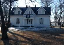
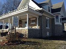 Dillingham-Lewis House Museum, Blue Springs, Missouri | Dillingham-Lewis House Museum | Blue Springs, Missouri | Built in 1906, the only native limestone structure in Blue Springs. The house is named after two families. | ||||||||
 | Fort Osage National Historic Site | Sibley, Missouri | Part of the early 19th century U.S. factory trading post system for the Osage Nation. | ||||||||
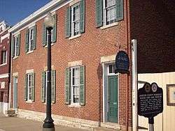 | Jackson County Jail and Marshal's House | Independence, Missouri | Former jail site, operated by the county historical society, which housed thousands of prisoners including Frank James and William Clark Quantrill. | ||||||||
 Leila's Hair Museum, Independence, Missouri | Leila's Hair Museum | Independence, Missouri | A museum of hair art dating back to the 19th century. | ||||||||
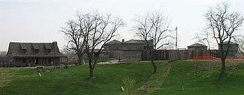
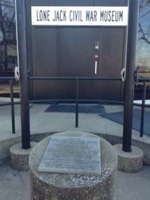 Lone Jack Battlefield Museum, Lone Jack, Missouri | Lone Jack Battlefield Museum | Lone Jack | The only Civil War Museum in Jackson County, Missouri, and one of the few battlefields where the soldiers – who perished during the battle – are still buried on the battlefield. | ||||||||
 | Midwest Genealogy Center | Independence, Missouri | The largest freestanding public genealogy research library in the USA. | ||||||||
 Photo of The National Frontier Trails Museum in Independence Missouri. | National Frontier Trails Museum | Independence, Missouri | A museum, interpretive center, and research library about the history of principle western U.S. trails. | ||||||||
 Rice-Tremonti Home, Raytown, Missouri | Rice-Tremonti Home | Raytown, Missouri | Home built on the Santa Fe Trail in 1844 by Archibald Rice and his family. | ||||||||
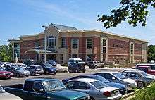
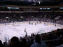 | Silverstein Eye Centers Arena | Independence, Missouri | A 5,800-seat multi-purpose arena that hosts the Kansas City Mavericks ice hockey team. | ||||||||
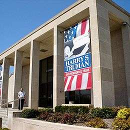
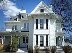
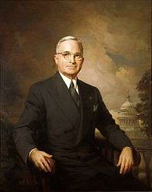 | Harry S. Truman Historic District | Independence and Grandview, Missouri |
| ||||||||
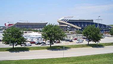 | Truman Sports Complex | Kansas City, Missouri | Two major sports venues: * Arrowhead Stadium, Kansas City Chiefs (football) * Kauffman Stadium, Kansas City Royals (baseball) | ||||||||
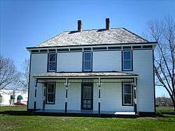
 | Grinter Place | Kansas City, Kansas | A home built in 1857 by one of the earliest settlers. | ||||||||
Population
| Historical population | |||
|---|---|---|---|
| Census | Pop. | %± | |
| 1900 | 305,427 | — | |
| 1910 | 422,180 | 38.2% | |
| 1920 | 528,833 | 25.3% | |
| 1930 | 665,655 | 25.9% | |
| 1940 | 686,643 | 3.2% | |
| 1950 | 814,357 | 18.6% | |
| 1960 | 1,266,447 | 55.5% | |
| 1970 | 1,434,793 | 13.3% | |
| 1980 | 1,504,203 | 4.8% | |
| 1990 | 1,636,528 | 8.8% | |
| 2000 | 1,836,038 | 12.2% | |
| 2010 | 2,009,342 | 9.4% | |
| Est. 2019 | 2,157,990 | [8] | 7.4% |
| U.S. Decennial Census[9] 1790–1960[10] 1900–1990[11] 1990–2000[12] | |||
The last measured population count for the Kansas City Metro Area (MO-KS) was 2,088,830 in 2017. The Kansas City Metro Area (MO-KS) experienced an average growth rate of 0.47% from the first statistic recorded in 2009. If past trends continue, the forecasted population count will be 2,135,726 by 2022.[13]
- Central City
- Kansas City, Missouri – Pop: 491,918 (2018) - 1,400/sq mi
- Municipalities with 100,000+ inhabitants
- Overland Park, Kansas – Pop: 192,536
- Kansas City, Kansas – Pop: 152,958
- Olathe, Kansas – Pop: 139,609
- Independence, Missouri – Pop: 116,925
- Municipalities with 50,000-99,999 inhabitants
- Lee's Summit, Missouri – Pop: 98,461
- Shawnee, Kansas – Pop: 65,845
- Lenexa, Kansas – Pop: 55,294
- Blue Springs, Missouri – Pop: 55,104
- Municipalities with 20,000-49,999 inhabitants
- Leavenworth, Kansas – Pop: 36,210
- Leawood, Kansas – Pop: 34,659
- Liberty, Missouri – Pop: 31,507
- Raytown, Missouri – Pop: 29,211
- Gladstone, Missouri – Pop: 27,140
- Grandview, Missouri – Pop: 25,159
- Belton, Missouri – Pop: 23,480
- Prairie Village, Kansas – Pop: 22,368
- Gardner, Kansas – Pop: 21,583
- Raymore, Missouri – Pop: 21,167
- Municipalities with 10,000-19,999 inhabitants
- Grain Valley, Missouri – Pop: 13,379
- Ottawa, Kansas – Pop: 12,387
- Lansing, Kansas – Pop: 11,767
- Excelsior Springs, Missouri – Pop: 11,486
- Merriam, Kansas – Pop: 11,288
- Municipalities with 5,000-9,999 inhabitants
- Harrisonville, Missouri – Pop: 9,986
- Cameron, Missouri (partial) – Pop: 9,933
- Mission, Kansas – Pop: 9,491
- Kearney, Missouri – Pop: 9,423
- Smithville, Missouri – Pop: 9,233
- Pleasant Hill, Missouri – Pop: 8,289
- Oak Grove, Missouri – Pop: 7,937
- Bonner Springs, Kansas – Pop: 7,606
- Roeland Park, Kansas – Pop: 6,827
- Parkville, Missouri – Pop: 6,296
- De Soto, Kansas – Pop: 6,074
- Spring Hill, Kansas – Pop: 5,981
- Richmond, Missouri – Pop: 5,595
- Greenwood, Missouri – Pop: 5,569
- Paola, Kansas – Pop: 5,527
- Basehor, Kansas – Pop: 5,403
- Tonganoxie, Kansas – Pop: 5,248
- Odessa, Missouri – Pop: 5,178
- Municipalities with fewer than 5,000 inhabitants
- Peculiar, Missouri – Pop: 4,885
- Platte City, Missouri – Pop: 4,833
- Higginsville, Missouri – Pop: 4,662
- Lexington, Missouri – Pop: 4,598
- Edwardsville, Kansas – Pop: 4,390
- North Kansas City, Missouri – Pop: 4,354
- Osawatomie, Kansas – Pop: 4,297
- Louisburg, Kansas – Pop: 4,276
- Fairway, Kansas – Pop: 3,970
- Mission Hills, Kansas – Pop: 3,601
- Sugar Creek, Missouri – Pop: 3,320
- Riverside, Missouri – Pop: 3,150
- Buckner, Missouri – Pop: 3,067
- Pleasant Valley, Missouri – Pop: 3,056
- Lawson, Missouri – Pop: 2,409
- Plattsburg, Missouri – Pop: 2,291
- Lake Lotawana, Missouri – Pop: 2,018
- Weatherby Lake, Missouri – Pop: 1,848
- Wellsville, Kansas – Pop: 1,818
- Edgerton, Kansas – Pop: 1,736
- Westwood, Kansas – Pop: 1,719
- Garden City, Missouri – Pop: 1,625
- Gower, Missouri (partial) – Pop: 1,526
- Claycomo, Missouri – Pop: 1,468
- Lone Jack, Missouri – Pop: 1,124
- Drexel, Missouri - Pop: 999
- Lake Tapawingo, Missouri - Pop: 723
- Glenaire, Missouri - Pop: 578
- Dearborn, Missouri (partial) – Pop: 496
- Avondale, Missouri - Pop: 440
- Osborn, Missouri (partial) – Pop: 423
- Sibley, Missouri - Pop: 356
- Oaks, Missouri - Pop: 129
- Unity Village, Missouri - Pop: 84
- Levasy, Missouri - Pop: 83
- Randolph, Missouri - Pop: 54
- River Bend, Missouri - Pop: 10
Counties
The MSA covers a total area of 7,952 sq mi (20,600 km2) including 97 sq mi (250 km2) of water.
| County | State | 2019 Estimate | 2010 Census | Change |
|---|---|---|---|---|
| Jackson | MO | 706,164 | 674,158 | +4.75% |
| Johnson | KS | 605,721 | 544,179 | +11.31% |
| Clay | MO | 249,432 | 221,939 | +12.39% |
| Wyandotte | KS | 167,635 | 157,505 | +6.43% |
| Cass | MO | 103,832 | 99,478 | +4.38% |
| Platte | MO | 105,032 | 89,322 | +17.59% |
| Leavenworth | KS | 82,554 | 76,277 | +8.23% |
| Miami | KS | 33,655 | 32,787 | +2.65% |
| Lafayette | MO | 32,432 | 33,381 | −2.84% |
| Ray | MO | 22,676 | 23,494 | −3.48% |
| Clinton | MO | 20,501 | 20,743 | −1.17% |
| Bates | MO | 16,138 | 17,049 | −5.34% |
| Linn | KS | 9,746 | 9,656 | +0.93% |
| Caldwell | MO | 9,011 | 9,424 | −4.38% |
| Total | 2,164,529 | 2,009,342 | +7.72% |
Associated areas
Often associated with Kansas City, the cities of Lawrence, Kansas and Saint Joseph, Missouri are identified as separate Metropolitan Statistical Areas.[14]
The Kansas City-Overland Park-Kansas City MO-KS (USA) Combined Statistical Area (CSA) encompasses the Metropolitan statistical areas (MSA) of Kansas City MO-KS, the St. Joseph metropolitan area and the Lawrence, Kansas metropolitan area with the Micropolitan Statistical Areas (μSA) of Warrensburg, Missouri, Atchison, Kansas, and Ottawa, Kansas. (Warrensburg is in Johnson County, Missouri. Atchison is in Atchison County, Kansas. Ottawa is in Franklin County, Kansas.) The combined statistical area covers a total area of 9,220 sq mi (23,900 km2) including 103 sq mi (270 km2) of water.[15]
Economy
As of 2019 Missouri accounted for 56% of employment and Kansas accounted for 44% of employment. From 2018 to 2019 Kansas added 13,000 jobs and Missouri added 6,500 jobs. Kansas side employment grew by 2.7% and Missouri side employment grew by 1.1%. The Kansas side growing more than twice as fast as the Missouri. Professional and business employment growth was due entirely to a gain of 5,200 jobs in the Kansas portion of the metro area.[16]
Annual Payroll by county
Annual Payroll (X 1,000$)
- 1 Johnson County, KS - 18,150,635[17]
- 2 Jackson County, MO - 17,680,969[18]
- 3 Clay County, MO - 5,507,210[19]
- 4 Wyandotte County, KS - 3,347,000[5]
- 5 Platte County, MO - 1,818,308[20]
- 6 Cass County, MO - 705,125[6]
- 7 Leavenworth County, KS - 561,658[21]
- 8 Miami County, KS - 251,076[22]
- 9 Lafayette County, MO - 206,348[23]
- 10 Ray County, MO - 103,322[24]
- 11 Clinton County, MO - 92,229[25]
- 12 Bates County, MO - 86,102[26]
- 13 Linn County, KS - 64,879[27]
- 14 Caldwell County, MO - 41,771[28]
Unemployment Rate By County Lowest to Highest [29]
- 1 Johnson County, KS - 3.3%
- 2 Platte County, MO - 3.9%
- 2 Miami County, KS - 3.9%
- 4 Clay County, MO - 4.0%
- 5 Leavenworth County, KS - 4.1%
- 5 Lafayette County, MO - 4.1%
- 5 Clinton County, MO - 4.1%
- 8 Cass County, MO - 4.3%
- 9 Ray County, MO - 4.6%
- 10 Caldwell County, MO- 4.8%
- 11 Bates County, MO - 5.3%
- 12 Jackson County, MO - 5.4%
- 13 Wyandotte County, KS - 5.7%
- 14 Linn County, KS - 6.5%
Average Income by County
Median Household income
- 1 Johnson County, KS- 81,121 $
- 2 Platte County, MO- 74,199 $
- 3 Leavenworth County, KS - 70,022 $
- 4 Clay County, MO -65,675 $
- 5 Cass County, MO - 65,352 $
- 6 Miami County, KS - 63,501 $
- 7 Clinton County, MO - 57,591 $
- 8 Ray County, MO - 57,270 $
- 9 Lafayette County, MO - 52,557 $
- 10 Jackson County, MO - 50,652 $
- 11 Linn County, KS - 46,576 $
- 12 Bates County, MO - 45,605 $
- 13 Caldwell County, MO - 44,975 $
- 14 Wyandotte County, KS 42,783 $
In 2015 the metropolitan area accounted for 40.9% of the total GDP in the state of Kansas and 22.7% of the total GDP in the state of Missouri.[30]
Crime
This is ranking of violent crime by county, from highest to lowest:[31]
Transportation
Highways
The Kansas City metropolitan area has more freeway lane miles per capita than any other large metropolitan area in the United States (over 27% more than the second-place Dallas/Fort Worth Metroplex), over 50% more than the average American metro area, and nearly 75% more than the large metro area with the least: Las Vegas.[32]
Interstates
The Kansas City area is a confluence of four major U.S. interstate highways:


Other interstates that cross through the area include:


US Highways
U.S. Highways serving the Kansas City Metro Area include:


Kansas state highways
Kansas highways in the area include:


Missouri state highways
Missouri highways in the area include:


Other roads
These are other notable roads in the area:
- 18th Street Expressway – a freeway carrying US-69 through central Wyandotte County from I-35 to I-70.
- Ward Parkway – A scenic parkway in Kansas City, Missouri, near the Kansas-Missouri state line, where many large historic mansions and fountains are located.
- Broadway – A street that runs from the west side of downtown Kansas City to Westport. The street has long been an entertainment center, with various bars, live jazz outlets, and restaurants along it. It also forms the eastern border of Quality Hill, one of the oldest neighborhoods in Kansas City.
- The Paseo (Renamed Martin Luther King Jr. Boulevard) – Part of the city's original system of parks and boulevards developed beginning in the late 1880s, it is the longest of the original boulevards, and the only one that runs the entire length of the pre-World War II city boundary, from the Missouri River bluffs in the north to 79th Street on the south.[33]
- Shawnee Mission Parkway – Former alignment of K-10 from 1929 to 1983; K-58 from 1956 to 1979; US-56 from 1957 to 1968; K-12 from 1983 to 1998. Serves Shawnee Mission.
- Troost Avenue – A north-south thoroughfare 11 blocks east of Main Street, named for an early Kansas City settler and dentist, Benoist Troost. The street roughly divides the city's mostly black neighborhoods to its east from its mostly white ones to its west.
- Swope Parkway – Running on the south side of the Brush Creek valley eastward from The Paseo, then southward from its junction with Benton Boulevard, this street is the main route from the city's midtown to its largest city park, Swope Park.
- North Oak Trafficway – A major road in the Northland. The roadway is designated as MO-283 from MO-9 to I-29. It is a major commercial road in the Northland and serves as the main street in Gladstone, Missouri.
- Barry Road – Runs along the former route of Military Road, which ran from Liberty to Fort Leavenworth. It is now a major commercial street in the Northland, although it has been paralleled by MO-152 for its entire route and effectively replaced it east of Indiana Avenue.
- 87th Street Parkway – A major parkway that extends from Overland Park to De Soto. Former alignment of K-10 from 1929 to 1983.
Air
The Kansas City metropolitan area is served by several airports. It is primarily served by Kansas City International Airport, 15 miles northwest of downtown Kansas City, Missouri, was built to serve as a world hub for the supersonic transport and Boeing 747. The airport's gates were positioned 100 feet (30 m) from the street; however, since the September 11, 2001 attacks, these have undergone expensive overhauls, retrofitting it to incorporate elements of conventional security systems.
The much smaller Charles B. Wheeler Downtown Airport, to the immediate north of downtown near the Missouri River, was the original headquarters of Trans World Airlines (TWA) and houses the Airline History Museum. It served as the area's major airport until 1972, when Kansas City International (then known as Mid-Continent International Airport and was home to an Overhaul Base for TWA) became the primary airport for the metropolitan area after undergoing $150 million in upgrades that were approved by voters in a 1966 bond issue. Downtown Airport is still used to this day for general aviation and airshows.
There are two general aviation airports in Johnson County, Kansas. New Century AirCenter borders southwest Olathe and northeast Gardner. The primary runway at New Century AirCenter is the second longest runway in the region next to those at Kansas City International Airport. It is 7 miles from the Logistics Park Kansas City Intermodal Facility. The other airport, Johnson County Executive Airport has one runway on 500 acres and is the fourth busiest towered airport in the state of Kansas.
Rail and bus
Kansas City is a freight and passenger rail hub centered at Union Station in Kansas City, Missouri and managed by the Kansas City Terminal Railway. Amtrak operates two daily, long-distance passenger rail services:
- Missouri River Runner twice daily from Kansas City to Saint Louis connecting to Chicago via the Lincoln Service;
- Southwest Chief from Chicago to Los Angeles.
There are no commuter rail services.
The Kansas City Downtown Streetcar is a 2.2-mile modern streetcar line in downtown Kansas City, Missouri. Opened to the public in May 2016, it is maintained and operated by the Kansas City Streetcar Authority, a non-profit corporation made up of private sector stakeholders and city appointees. A ballot initiative to fund construction of the $102 million line was approved by voters on December 12, 2012.[34] The system runs between River Market and Union Station, mostly along Main Street, with extensions north and south under consideration.[35]
City buses operated by the Kansas City Area Transportation Authority (KCATA) provide most public transportation in the Kansas City area. The Metro Area Express (MAX) went online as Kansas City, Missouri's first bus rapid transit line in July 2005, and operates and is marketed akin to a rail system as opposed to a local bus line; the MAX links the River Market, Downtown, Union Station, Crown Center and the Country Club Plaza.[36][37] Buses in Johnson County, Kansas, are operated by Johnson County Transit (known as "The JO").
Local navigation tips
See related article: voy:Kansas City (Missouri) at Wikivoyage
Street numbers
The Missouri side of the metropolitan area south of the Missouri River shares a grid system with Johnson County on the Kansas side. Most east-west streets are numbered and most north-south streets named. Addresses on east-west streets are numbered from Main Street in Kansas City, Missouri, and on north-south streets from St. John Avenue (or the Missouri River, in the River Market area). The direction 'South' in street and address numbers is generally implied if 'North' is not specified, except for numbered 'avenues' in North Kansas City. In the northland, east-west streets use the prefix N.E. or N.W., depending on the side of N. Main on which they lie.
Highways
- Kansas Citians tend to express U.S. and Missouri highway designations with the number before the word "highway," (e.g., 40 highway, 71 highway). This colloquialism tends not to apply to interstates or Kansas route numbers (e.g., "I-70", "K-10").
- 69 Highway, runs southbound on I-35 from Kansas City, Missouri towards Johnson County. There are two exits marked South 69 on the roadway. The first – or northern – exit on Metcalf Ave/I-635, is a left lane exit and leads to Metcalf, an at-grade trafficway, before turning west along Shawnee Mission Parkway, to rejoin I-35. The southern US-69 exit is a two-lane right lane exit between the 75th and 87th street exits and begins a four-lane highway known as the Overland Parkway.
- Bruce R. Watkins Drive is the name of the new section of U.S. Route 71 in Kansas City, Missouri. The old U.S. 71 ran mostly on Prospect Avenue.
- When traveling north on I-35 from Johnson County, the first signs that are designated as I-70 East actually guide drivers through the southern portion of I-670, which takes motorists into the southern part of the Downtown Freeway Loop, and runs underneath the Bartle Hall Convention Center and some downtown overpasses. This is sometimes referred to as "going under downtown".
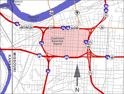
- The Downtown Loop is a complex layout of freeways in downtown Kansas City, Missouri involving 23 exits, four Interstate highways, four U.S. highways and numerous city streets. Each exit in the freeway loop is numbered "2" and suffixed with every letter of the alphabet – except I, O and Z (which would resemble 1, 0 and 2 on the exit signs), although some of the exits are under construction/renovation and closed to traffic. The loop's circumference is just over 4-mile (6.4 km).
Navigation landmarks
- The KCTV-Tower is a 1,042 feet (318 m) pyramid-shaped television and radio tower used primarily by local CBS affiliate KCTV (channel 5). It is at the corner of 31st and Main Streets, next to the studio facilities of PBS member station KCPT (which formerly housed the original studios of KCTV), and is visible from many parts of the city, especially at night due to the string of lights adorning the tower.
- The twin red-brick towers of the American Century Investments complex are oriented north and south along Main at 45th Street, just north of the Country Club Plaza (the Kemper Museum of Contemporary Art is slightly east, and the Nelson-Atkins Museum of Art is east and slightly south).
- Kansas City Community Christian Church, at 4601 Main Street, has a group of lights that shoot a beam upwards to the sky at night. Designed by Frank Lloyd Wright in the 1950s, it is slightly south of and across the street from the American Century Investment Towers (the Nelson Atkins is to the east, and the Kemper Museum is to the north and slightly east).
- Bartle Hall has a section that somewhat resembles a north-south suspension bridge, crossing over I-670 at the southwest corner of the downtown loop. It has four towers, with metal sculptures on top of each tower.
- The Veterans Affairs Medical Center, near the intersection of I-70, Linwood Boulevard and Van Brunt Boulevard, has a large "VA" emblem.
- The Kauffman Center for the Performing Arts, at 16th Street and Broadway (just south of the downtown loop), with its tiered glass and steel half-domes, has a design reminiscent of the world-famous Sydney Opera House.
Areas of the metropolitan area
- Downtown Kansas City is a section of western Kansas City, Missouri, where 04% of the area's employees work, and where much of the city's entertainment facilities are located. The area has been undergoing a massive revitalization since 2000, and increased its population by over 7,000 people between 2000 and 2005. The Power and Light District and the Sprint Center are in the downtown area.
- "The Northland" refers to a section of the metropolitan area north of the Missouri River, comprising Clay and Platte Counties in Missouri. This area includes the northern half of Kansas City, Missouri, which is referred to as "Kansas City, North" to distinguish it from the rest of the Northland and the city of North Kansas City. The area is also referred to as "North of the River" by local residents and by local television stations in news and traffic reports.
- River Market is an area north of downtown, south of the Missouri River and west of Highway 9, and is home to a large farmer's market.
- "North Kansas City" (abbreviated as NKC, and also known as Northtown) is a separate city that is completely surrounded by Kansas City, Missouri.
- Shawnee Mission is an area recognized by the United States Postal Service that includes many towns in Johnson County, Kansas.
- The Waldo Residential District (also known as simply Waldo) is area of Kansas City, Missouri, near 75th Street and Wornall Road.
- Country Club Plaza (also simply known as "the Plaza") is an upscale shopping district built by the J.C. Nichols Company in 1923, and was the first suburban shopping district in the United States.[38]
- The Country Club District is an associated group of neighborhoods built along Ward Parkway by J.C. Nichols, which is just south of the Country Club Plaza and includes Sunset Hill, Brookside, Crestwood, and Mission Hills, Kansas.
- 39th Street (also referred to as the Volker neighborhood or "Restaurant Row") is a small section of West 39th Street between State Line Road and the Southwest Trafficway in Kansas City, Missouri. The area has many restaurants, bars and shops, and is just across the state line from the University of Kansas Medical Center.
- University of Kansas Hospital (KUMED) is the corporate name of the hospital on the KU Medical Center campus.
- Benton Curve is a curve at the cross-section of Interstate 70 and Benton Avenue in Kansas City, Missouri; the area has long been prone to traffic accidents.
- Pendleton Heights is a historic neighborhood in the northeast side of Kansas City, Missouri, which is bordered by Cliff Drive to the north, Chestnut Trafficway to the east, Independence Avenue to the south and the Paseo Trafficway to the west. It is Kansas City's oldest surviving neighborhood, and is home to the city's largest concentration of Victorian homes.
- The Grandview Triangle is the intersection of three major highways: Interstate 435, Interstate 470, and U.S. Route 71 (Bruce R. Watkins Drive). Notorious for fatal accidents, the Triangle has undergone improvements and upgrades in recent years.
- Emanuel Cleaver II Boulevard, named for former mayor and current Congressman Emanuel Cleaver, comprises recently renamed portions of 47th Street and Brush Creek Boulevard in Kansas City, Missouri.
- 18th and Vine Historic District (known simply as 18th and Vine) is a district on Kansas City, Missouri's north side that contains the Negro Leagues Baseball Museum and the American Jazz Museum.
- The Library District is a recently defined district around the new Central Library at 14 West 10th Street in Kansas City, Missouri.[39]
- 135th Street (Overland Park, Kansas) - Shopping area featuring several indoor and outlet malls, restaurants, and two movie theaters.
- Strawberry Hill is a historical area in Kansas City, Kansas that was home to many eastern European immigrants. Later, the neighborhood became home to many Latino/Chicano families. However, in recent years, Strawberry Hill has seen residents immigrating to the area from Eastern Europe.
- Hospital Hill is an area near 23rd Street and Holmes Avenue in Kansas City, Missouri, and consists of two major hospitals (Truman Medical Center and the Children's Mercy Hospital) and the University of Missouri-Kansas City's School of Medicine, School of Dentistry, School of Pharmacy and School of Nursing.
- Argentine is a part of Kansas City, Kansas, near 30th and Argentine Streets. It is one of the oldest Mexican/Latino neighborhoods in Kansas City, with Mexican immigration to that area dating to the 1800s.
- The Crossroads Arts District is a neighborhood in the downtown area between the Central Business District and Union Station, centered around the intersection of 19th Street and Baltimore Avenue in Kansas City, Missouri. It contains dozens of art galleries, and is considered to be the center of the arts culture in the metropolitan area. Local artists sponsor exhibits in the district on the first Friday of each month.
- Quality Hill is a residential and commercial neighborhood atop of a western hill in the Central Business District of Downtown Kansas City, across the river from the Charles B. Wheeler Airport.
- Washington-Wheatley is a historically Black neighborhood southeast of the 18th and Vine Historical District.
- The Westside is a historically African American and Chicano/Latino neighborhood near Southwest Blvd. and Interstate 35.
- Westport is a historic district which is home to much of the metropolitan area's entertainment and nightlife.
- Valentine
- West Bottoms is home to many of downtown's oldest buildings and the former location of the city's stockyards. It is now known for its arts community, the American Royal, Kemper Arena, antique stores, and First Fridays events.
- Rosedale
- Union Hill[40]
- Armordale is a residential and commercial neighborhood in Kansas City, Kansas, and is one of the historically Chicano(a) neighborhoods of the Kansas City metropolitan area.
- Sheffield
- East Bottoms Also known as the Industrial District, it is primarily known for its industrial businesses and railroad activity. There are however burgeoning cultural attractions at the intersection of Montgall and Guinotte Avenues related to handmade goods, food, music and a distillery.
- Brookside is a pedestrian-friendly district built in the 1920s, centered on the Brookside Shopping District at 63rd Street and Brookside Blvd.
- Hanover Heights is a small neighborhood in Kansas City, Kansas that was once primarily noted for the antiques shops along 45th Street, with the neighborhood's boundaries running mainly between Rainbow Blvd. and State Line Road, running south of the KU Medical Center to the Johnson County border.
- The Historic Old Northeast District (or simply Northeast) is a working-class immigrant collection of neighborhoods between downtown Kansas City and the smaller city of Independence.
- The Truman Sports Complex, at the corner of I-70 and I-435 (east of downtown Kansas City, Missouri), is home to several professional sports attractions. It is anchored by Arrowhead Stadium, home of the Kansas City Chiefs NFL franchise; and Kauffman Stadium, home of Major League Baseball's Kansas City Royals.
Colleges and universities
Top 5 largest colleges by total enrollment (within the MSA) [41]
- 1. Johnson County Community College - 18,638
- 2. Metropolitan Community College - 17,025
- 3. University of Missouri-Kansas City - 16,383
- 4. Park University - 9,512
- 5. Pittsburg State University - 8,733
List of institutions (including those in the CSA):
- Avila University - Kansas City, MO
- Baker University - Baldwin City, KS
- Benedictine College - Atchison, KS
- Calvary University - Kansas City, MO
- Cleveland University-Kansas City - Kansas City, KS
- DeVry University - Kansas City, MO
- Donnelly College - Kansas City, KS
- Friends University - Lenexa, KS
- Graceland University - Independence, MO
- Grantham University - Lenexa, KS
- Haskell Indian Nations University - Lawrence, KS
- Johnson County Community College - Overland Park, KS
- Kansa Christian College - Overland Park, KS
- Kansas City Art Institute - Kansas City, MO
- Kansas City Kansas Community College - Kansas City, KS
- Kansas City University of Medicine and Biosciences - Kansas City, MO
- Kansas State University Olathe Innovation Campus - Olathe, KS
- Metropolitan Community College[42] (Penn Valley, Maple Woods, Business and Technology Center, Blue River, and Longview) - Kansas City, MO
- MidAmerica Nazarene University - Olathe, KS
- Midwestern Baptist Theological Seminary - Kansas City, MO
- Missouri Western State University - St. Joseph, MO
- National American University - Kansas City, MO
- Nazarene Theological Seminary - Kansas City, MO
- Northwest Missouri State University - Maryville, MO
- Ottawa University - Overland Park, KS
- Park University - Parkville, MO
- Pinnacle Career Institute - Kansas City, KS
- Pittsburg State University - Lenexa, KS
- Rasmussen College - Overland Park, KS
- Rockhurst University - Kansas City, MO
- Saint Paul School of Theology - Leawood, KS
- University of Central Missouri - Warrensburg, MO
- University of Kansas - Lawrence, KS
- University of Kansas Edwards Campus - Overland Park, KS
- University of Kansas Medical Center - Kansas City, KS
- University of Missouri–Kansas City - Kansas City, MO
- University of Saint Mary - Overland Park, KS
- Webster University - Webster Groves, MO
- William Jewell College - Liberty, MO
Libraries
Johnson County Library Branches
- Antioch
- Blue Valley
- Cedar Roe
- Central Resource
- Corinth
- De Soto
- Edgerton
- Friends Library
- Gardner
- Glenwood
- Lackman
- Leawood Pioneer
- Merriam
- Monticello
- Oak Park
- Shawnee Mission
- Spring Hill
Kansas City, Kansas Public Library
- F.L. Schlagle Library
- Main Library
- Mobile Library
- South Branch
- Turner Community Library
- West Wyandotte Library
Kansas City Public Library (Missouri)
- Central Library
- Irene H. Ruiz Biblioteca de las Americas
- Lucile H. Bluford Branch
- North-East Branch
- Plaza Branch
- Southeast Branch
- Sugar Creek Branch
- Trails West Branch
- Waldo Branch
- Westport Branch
Mid-Continent Public Library Branches
- Antioch
- Blue Ridge
- Blue Springs North
- Blue Springs South
- Boardwalk
- Buckner
- Camden Point
- Claycomo
- Colbern Road
- Dearborn
- Edgerton
- Excelsior Springs
- Grain Valley
- Grandview
- Kearney
- Lee's Summit
- Liberty
- Lone Jack
- Midwest Genealogy Center
- North Independence
- North Oak
- Oak Grove
- Parkville
- Platte City
- Raytown
- Red Bridge
- Riverside
- Smithville
- South Independence
- Weston
- Woodneath Library Center
Olathe Public Library
Media
Print
The Kansas City Star is the metropolitan area's major daily newspaper. The McClatchy Company, which owns The Star, also owns two suburban weeklies, Lee's Summit Journal and Olathe Journal.
The Kansas City Kansan serves Wyandotte County, having moved from print to an online format in 2009. Additional weekly papers in the metropolitan area include the Liberty Tribune, Sun Newspapers of Johnson County, The Examiner in Independence and eastern Jackson County, The Pitch, and the Kansas-Missouri Sentinel. The area is also served by two newspapers focused the area's faith-based population: The Metro Voice Christian Newspaper and the Jewish Chronicle. The city's Hispanic and Latino American community is served by Dos Mundos, a bilingual newspaper with articles in Spanish and English, and Mi Raza magazine, the area's only weekly Hispanic publication printed in Spanish. The Kansas City Call serves the African American community publishing its paper weekly.
Broadcast
According to Arbitron, about 1.5 million people over the age of 12 live within the Kansas City DMA, making it the 30th largest market for radio and 31st for television according to Nielsen. The Kansas City television and radio markets cover 32 counties encompassing northwestern Missouri and northeast Kansas.
Television
Television stations in the Kansas City metropolitan area, with all major network affiliates represented, include:
- WDAF-TV, channel 4 (Fox)
- KCTV, channel 5 (CBS)
- KMBC-TV, channel 9 (ABC)
- KTAJ-TV, channel 16 (TBN)
- KCPT, channel 19 (PBS)
- KCKS-LD, channel 25 (simulcast of sister station WROB-LD)
- KCWE, channel 29 (The CW)
- KSHB-TV, channel 41 (NBC)
- KMCI-TV, channel 38 (independent)
- KGKC, Channel 39 (Telemundo Kansas City)[43]
- KUKC-LP, channel 48 (Univision)
- KPXE-TV, channel 50 (Ion Television)
- KSMO-TV, channel 62 (MyNetworkTV)
The Kansas City television market is in very close proximity to two other media markets, St. Joseph and Topeka. As such, most of the television stations in the Kansas City area are receivable over-the-air in portions of both markets, including their principal cities; likewise, stations from Topeka are receivable as far east as Kansas City, Kansas and stations from St. Joseph are viewable as far south as Kansas City, Missouri's immediate northern suburbs.
Radio
Over 30 FM and 20 AM radio stations broadcast in the Kansas City area, with stations from Topeka, St. Joseph and Carrollton also reaching into the metropolitan area. The highest-rated radio stations, according to Arbitron are:
KPRS (103.3 FM) – Urban
- KCMO-FM (94.9) – Classic Hits
- KQRC (98.9 FM) – Rock
- KRBZ-FM (96.5) – Alternative
- KMBZ (98.1 FM) – News/Talk
- WDAF-FM (106.5) – Country, Kansas City Chiefs flagship
- KZPT (99.7) - Adult Top 40
- KCSP (610 AM) - Sports, Kansas City Royals flagship
- KMXV (93.3) - Top 40
- KFKF (94.1) - Country
- KCFX (101.1) - Classic Rock
- KCHZ (95.7 FM) – Top 40/Rhythmic
Public and community radio
Business interests
The Kansas City metropolitan area's largest private employer is Cerner Corporation.[44] Cerner, a global healthcare IT company which is headquartered in North Kansas City, employs nearly 10,000 people in the area with a total workforce of nearly 20,000 people including global employees. In August 2014, the company announced its acquisition of competitor Siemens Healthcare, which, if approved, will further increase Cerner's total number of employees.[45] Cerner has several campuses across the area with its World Headquarters building in North Kansas City, Innovations Campus in South Kansas City, and Continuous Campus in the Kansas City, Kansas area.
Other major employers and business enterprises are AT&T, BNSF Railway, GEICO, Asurion, Sprint Corporation, Citigroup, EMBARQ, Farmers Insurance Group, Garmin, Hallmark Cards, Harley-Davidson, Husqvarna, H&R Block, General Motors, Honeywell, Ford Motor Company, MillerCoors, State Street Corporation, The Kansas City Star, and Waddell & Reed, some of which are headquartered in the metropolitan area. Kansas City also has a large pharmaceutical industry, with companies such as Bayer and Aventis having a large presence.
Headquarters
The following companies and organizations, excluding educational institutions, are among the larger ones that are headquartered in or have since relocated from the metropolitan area (headquarters of most companies are located in Kansas City, Missouri, unless otherwise noted):
- American Century Investments, an investment management firm
- AMC Theatres, a movie theater chain (Leawood, Kansas)
- Andrews McMeel Universal, a syndication and publication company which represents media/entertainment features such as Dear Abby, Garfield, Calvin and Hobbes and Doonesbury
- Applebee's, a restaurant chain (Lenexa, Kansas)
- BATS Global Markets, a stock exchange (Lenexa, Kansas)
- Black & Veatch Corporation, engineering firm (Overland Park, Kansas)
- Burns & McDonnell Engineering, an engineering and architectural firm
- CenturyLink (formerly Embarq Corporation), telecommunications company (headquarters in Monroe, Louisiana)
- Cerner, supplier of healthcare information technology solutions (North Kansas City, Missouri)
- Church of the Nazarene
- Commerce Bancshares, a bank serving Kansas, Missouri and Illinois
- Community of Christ, International Headquarters (Independence, Missouri)
- DST Systems, provider of information processing and computer software services and products
- Engineered Air, worldwide supplier and manufacturer of industrial air conditioners (De Soto)
- Fellowship of Christian Athletes (FCA)
- Ferrellgas, retailer and distributor of natural gas (Liberty, Missouri)
- FishNet Security, a provider of information security services and technology resale - Overland Park, KS
- Fort Dodge Animal Health, an animal health pharmaceutical and vaccine manufacturer and a division of Wyeth (Overland Park, Kansas)
- Freightquote.com, largest online third party logistics provider
- Garmin, largest maker of GPS-based electronics (Olathe, Kansas)
- Goodcents Sub's and Pasta's, notable midwest restaurant chain (De Soto)
- Hallmark Cards, largest maker of greeting cards in the U.S.
- HNTB Corporation, architectural and engineering firm
- H&R Block, financial corporation and former parent company of CompuServe, known mostly for their income tax preparation services
- Hostess Brands Maker of Twinkies and other snack cakes.
- Huhtamaki, makers of Chinet paper dinnerware (De Soto)
- Inergy, L.P., retailers and distributors of natural gas
- International Brotherhood of Boilermakers, Iron Ship Builders, Blacksmiths, Forgers and Helpers
- J. E. Dunn Construction Group, construction contractor
- Kansas City Board of Trade, a commodity futures and options exchange
- Kansas City Power and Light Company, a regulated provider of electricity and energy-related products and services
- Kansas City Southern Industries, operators of a Class I railroad
- Lockton Companies, the largest privately held insurance brokerage in the U.S.
- Merck Health Institutions, pharmaceutical corporation (De Soto)
- MK12 Studios, a filmmaking, animation, and design studio
- National Association of Intercollegiate Athletics (NAIA)
- Newport Television – privately held broadcasting company
- North Kansas City Hospital (North Kansas City, Missouri)
- People to People International, a voluntary organization founded by President Dwight Eisenhower
- Perceptive Software, makers of "Image NOW" software (Lenexa, Kansas)
- Polsinelli, AmLaw100-ranked national law firm
- Populous (formerly HOK Sport + Venue + Event), a major sports architectural firm
- Russell Stover Candies
- Sprint Nextel Corporation, a telecommunication company (Overland Park, Kansas)
- Tradebot, a high-frequency trading firm
- Triumph Structures Kansas City, An Aerospace manufacturing leader.
- UMB Financial Corporation, a commercial bank serving a multistate area of the Midwest
- Unity Church
- Veterans of Foreign Wars
- Waddell & Reed, an investment management and brokerage firm (Overland Park, Kansas)
- Walton Construction, a construction contractor
- YRC Worldwide Inc., known mostly from its former name and brand "Yellow Freight", one of the largest transportation service providers in the world (Overland Park, Kansas)
The Kansas City Federal Reserve Bank is one of twelve such banks located in the United States.
Hospitals
- Centerpoint Medical Center
- Children's Mercy Hospital
- Kansas City Orthopaedic Institute
- Kansas City Veterans Affairs Hospital
- Kindred Hospital Kansas City
- Lee's Summit Medical Center
- Menorah Medical Center
- North Kansas City Hospital
- Olathe Medical Center
- Overland Park Regional Medical Center
- Providence Medical Center
- Research Medical Center
- Shawnee Mission Medical Center
- St. Joseph Medical Center
- St. Luke's Hospital
- St. Mary's Medical Center
- Truman Medical Center-Hospital Hill
- University of Kansas Hospital (KU Med Center)
Shopping centers
- Adams Dairy Landing
- Blue Ridge Crossing
- Crown Center
- Country Club Plaza
- The Great Mall of the Great Plains (Demolished March 2017)
- Independence Center
- The Landing Mall
- Legends Outlets Kansas City
- Metcalf South Shopping Center (Demolished June/July 2017)
- Metro North Mall (Demolished 2016)
- Oak Park Mall
- Park Place
- Summit Fair
- Summit Woods Crossing
- Town Center Plaza
- Town Pavilion
- Ward Parkway Center
- Zona Rosa
Natural environment
The USDA provides estimates of the number of trees by county in the Kansas City metropolitan area.[46]
- Cass County, MO - 43,740,000
- Miami County, KS - 38,700,000
- Leavenworth County, KS - 33,210,000
- Jackson County, MO - 32,540,000
- Clay County, MO - 26,940,000
- Johnson County, KS - 25,490,000
- Ray County, MO - 22,710
- Platte County, MO - 19,590,000
- Wyandotte County, KS - 6,530,000
- Total - 249,450,000
The five most common species in the region's urban and rural forest were American elm (28.9 percent), northern hackberry (14.0 percent), Osage-orange (7.2 percent), honeylocust (6.7 percent), and eastern redcedar (5.0 percent).
Local organizations
- Irish Museum and Cultural Center
- Congregation Beth Israel Abraham Voliner
- South Kansas City Chamber of Commerce
- Big Brothers Big Sisters of Greater Kansas City
- ArtsKC Regional Arts Council
- Central Exchange
- Shepherd's Center KC Central
See also
- List of people from Kansas City
- Architecture of Kansas City
References
- "Annual Estimates of the Resident Population: April 1, 2010 to July 1, 2018". United States Census Bureau, Population Division. April 2019. Archived from the original on February 13, 2020. Retrieved May 30, 2019.
- "Living in Greater Downtown". Niche.
- "Living in Midtown / Plaza". Niche.
- "U.S. Census Bureau QuickFacts: Johnson County, Kansas". www.census.gov.
- "U.S. Census Bureau QuickFacts: Wyandotte County, Kansas". www.census.gov.
- "U.S. Census Bureau QuickFacts: Cass County, Missouri". www.census.gov.
- "U.S. Census Bureau QuickFacts: Leavenworth County, Kansas". www.census.gov.
- "Population and Housing Unit Estimates". Retrieved May 10, 2019.
- "U.S. Decennial Census". United States Census Bureau. Retrieved May 18, 2014.
- "Historical Census Browser". University of Virginia Library. Retrieved May 18, 2014.
- "Population of Counties by Decennial Census: 1900 to 1990". United States Census Bureau. Retrieved May 18, 2014.
- "Census 2000 PHC-T-4. Ranking Tables for Counties: 1990 and 2000" (PDF). United States Census Bureau. Retrieved May 18, 2014.
- "Population Rate of Change Data for Kansas City Metro Area (MO-KS)". Open Data Network.
- "Bulletin" (PDF). Archived (PDF) from the original on December 15, 2008. Retrieved July 10, 2013.
- https://www2.census.gov/geo/maps/metroarea/us_wall/Sep2018/CSA_WallMap_Sep2018.pdf?#
- "Kansas City Area Employment – February 2020 : Mountain–Plains Information Office : U.S. Bureau of Labor Statistics". www.bls.gov.
- "U.S. Census Bureau QuickFacts: Johnson County, Kansas". www.census.gov.
- "U.S. Census Bureau QuickFacts: Jackson County, Missouri". www.census.gov.
- "U.S. Census Bureau QuickFacts: Clay County, Missouri". www.census.gov.
- "U.S. Census Bureau QuickFacts: Platte County, Missouri". Census Bureau QuickFacts.
- "U.S. Census Bureau QuickFacts: Leavenworth County, Kansas". www.census.gov.
- "U.S. Census Bureau QuickFacts: Miami County, Kansas". www.census.gov.
- "U.S. Census Bureau QuickFacts: Lafayette County, Missouri". www.census.gov.
- "U.S. Census Bureau QuickFacts: Ray County, Missouri". www.census.gov.
- "U.S. Census Bureau QuickFacts: Clinton County, Missouri". www.census.gov.
- "U.S. Census Bureau QuickFacts: Bates County, Missouri". www.census.gov.
- "U.S. Census Bureau QuickFacts: Linn County, Kansas". www.census.gov.
- "U.S. Census Bureau QuickFacts: Caldwell County, Missouri". www.census.gov.
- https://www.bestplaces.net/economy/county/kansas/wyandotte
- https://www.marc.org/Data-Economy/pdf/2020EconomicForecast.aspx
- https://www.bestplaces.net/crime/county/kansas/wyandotte
- "publicpurpose.com". publicpurpose.com. January 10, 2002. Archived from the original on September 27, 2011. Retrieved October 12, 2011.
- "With Paseo name change going up for vote, KC historian looks back at street's roots". June 8, 2019.
- "Kansas City voters approve streetcar plan". Kansas City Business Journal. Archived from the original on July 30, 2013. Retrieved January 26, 2013.
- "FAQS". KC Streetcar. Retrieved June 10, 2019.
- "Maps and Schedules". KCATA. Archived from the original on April 20, 2010. Retrieved March 16, 2010.
- "Light Rail and MAX". KCATA. Archived from the original on January 15, 2010. Retrieved March 16, 2010.
- "Official web site of the". Country Club Plaza. Archived from the original on October 11, 2011. Retrieved October 12, 2011.
- Library district walking tour Archived 2012-11-01 at the Wayback Machine Retrieved August 4, 2013
- The Union Hill Historic District Archived 2013-08-08 at the Wayback Machine Retrieved August 4, 2013
- https://www.bizjournals.com/kansascity/subscriber-only/2017/12/01/largest-colleges-and-universities-in-kc.html
- "Metropolitan Community College, Kansas City". Mcckc.edu. Archived from the original on October 11, 2011. Retrieved October 12, 2011.
- KGKC, Wikidata Q64760086
- "Archived copy". Archived from the original on September 16, 2014. Retrieved September 16, 2014.CS1 maint: archived copy as title (link)
- "Newsroom: Cerner.com". cerner.com. Archived from the original on September 16, 2014. Retrieved April 27, 2018.
- https://www.nrs.fs.fed.us/pubs/rb/rb_nrs75.pdf
Further reading
- Shortridge, James R. Kansas City and How It Grew, 1822–2011 (University Press of Kansas; 2012) 248 pages; historical geography
External links
Kansas City metropolitan area's cities and counties | ||
|---|---|---|
| Central city | 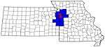 | |
| Largest cities (over 100,000 in 2000) | ||
| Medium-sized cities (10,000 to 100,000 in 2000) | ||
| Smaller Cities (between 5,000 and 9,900 in 2010) | ||
| Counties | ||