Avondale, Missouri
Avondale is a city in Clay County, Missouri, United States. The population was 440 at the 2010 census. It is part of the Kansas City metropolitan area.
Avondale, Missouri | |
|---|---|
 Location of Avondale, Missouri | |
| Coordinates: 39°9′19″N 94°32′48″W | |
| Country | United States |
| State | Missouri |
| County | Clay |
| Area | |
| • Total | 0.14 sq mi (0.35 km2) |
| • Land | 0.14 sq mi (0.35 km2) |
| • Water | 0.00 sq mi (0.00 km2) |
| Elevation | 787 ft (240 m) |
| Population | |
| • Total | 440 |
| • Estimate (2019)[3] | 451 |
| • Density | 3,340.74/sq mi (1,288.02/km2) |
| Time zone | UTC-6 (Central (CST)) |
| • Summer (DST) | UTC-5 (CDT) |
| ZIP code | 64117 |
| Area code(s) | 816 |
| FIPS code | 29-02800[4] |
| GNIS feature ID | 0730051[5] |
History
A post office called Avondale was established in 1915.[6] The city was named after the River Avon, in England.[7]
Geography
Avondale is located at 39°9′19″N 94°32′48″W (39.155236, -94.546704).[8]
According to the United States Census Bureau, the city has a total area of 0.14 square miles (0.36 km2), all land.[9]
Demographics
| Historical population | |||
|---|---|---|---|
| Census | Pop. | %± | |
| 1920 | 314 | — | |
| 1930 | 452 | 43.9% | |
| 1940 | 435 | −3.8% | |
| 1950 | 532 | 22.3% | |
| 1960 | 663 | 24.6% | |
| 1970 | 512 | −22.8% | |
| 1980 | 612 | 19.5% | |
| 1990 | 550 | −10.1% | |
| 2000 | 529 | −3.8% | |
| 2010 | 440 | −16.8% | |
| Est. 2019 | 451 | [3] | 2.5% |
| U.S. Decennial Census[10] | |||
2010 census
As of the census[2] of 2010, there were 440 people, 199 households, and 109 families living in the city. The population density was 3,142.9 inhabitants per square mile (1,213.5/km2). There were 226 housing units at an average density of 1,614.3 per square mile (623.3/km2). The racial makeup of the city was 89.1% White, 4.1% African American, 1.1% Native American, 0.5% Asian, 0.2% Pacific Islander, 1.4% from other races, and 3.6% from two or more races. Hispanic or Latino of any race were 7.0% of the population.
There were 199 households, of which 22.1% had children under the age of 18 living with them, 37.7% were married couples living together, 11.6% had a female householder with no husband present, 5.5% had a male householder with no wife present, and 45.2% were non-families. 30.2% of all households were made up of individuals, and 9% had someone living alone who was 65 years of age or older. The average household size was 2.21 and the average family size was 2.78.
The median age in the city was 43.4 years. 18% of residents were under the age of 18; 6.1% were between the ages of 18 and 24; 27.5% were from 25 to 44; 33.6% were from 45 to 64; and 14.8% were 65 years of age or older. The gender makeup of the city was 53.0% male and 47.0% female.
2000 census
As of the census[4] of 2000, there were 529 people, 219 households, and 146 families living in the city. The population density was 3,996.3 people per square mile (1,571.1/km2). There were 224 housing units at an average density of 1,692.2 per square mile (665.3/km2). The racial makeup of the city was 94.52% White, 0.95% African American, 0.76% Native American, 0.38% Asian, 2.08% from other races, and 1.32% from two or more races. Hispanic or Latino of any race were 2.27% of the population.
There were 219 households, out of which 26.9% had children under the age of 18 living with them, 49.8% were married couples living together, 9.6% had a female householder with no husband present, and 33.3% were non-families. 22.8% of all households were made up of individuals, and 5.5% had someone living alone who was 65 years of age or older. The average household size was 2.42 and the average family size was 2.84.
In the city the population was spread out, with 20.2% under the age of 18, 10.0% from 18 to 24, 34.6% from 25 to 44, 21.9% from 45 to 64, and 13.2% who were 65 years of age or older. The median age was 37 years. For every 100 females, there were 100.4 males. For every 100 females age 18 and over, there were 107.9 males.
The median income for a household in the city was $37,159, and the median income for a family was $38,958. Males had a median income of $33,750 versus $25,833 for females. The per capita income for the city was $17,372. About 9.6% of families and 10.1% of the population were below the poverty line, including 6.3% of those under age 18 and 2.8% of those age 65 or over.
References
- "2019 U.S. Gazetteer Files". United States Census Bureau. Retrieved July 26, 2020.
- "U.S. Census website". United States Census Bureau. Retrieved 2012-07-08.
- "Population and Housing Unit Estimates". United States Census Bureau. May 24, 2020. Retrieved May 27, 2020.
- "U.S. Census website". United States Census Bureau. Retrieved 2008-01-31.
- "US Board on Geographic Names". United States Geological Survey. 2007-10-25. Retrieved 2008-01-31.
- "Post Offices". Jim Forte Postal History. Archived from the original on 6 March 2016. Retrieved 19 September 2016.
- "Clay County Place Names, 1928–1945 (archived)". The State Historical Society of Missouri. Archived from the original on 24 June 2016. Retrieved 19 September 2016.CS1 maint: BOT: original-url status unknown (link)
- "US Gazetteer files: 2010, 2000, and 1990". United States Census Bureau. 2011-02-12. Retrieved 2011-04-23.
- "US Gazetteer files 2010". United States Census Bureau. Archived from the original on 2012-01-25. Retrieved 2012-07-08.
- "Census of Population and Housing". Census.gov. Retrieved June 4, 2015.
Kansas City metropolitan area's cities and counties | ||
|---|---|---|
| Central city | 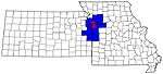 | |
| Largest cities (over 100,000 in 2000) | ||
| Medium-sized cities (10,000 to 100,000 in 2000) | ||
| Smaller Cities (between 5,000 and 9,900 in 2010) | ||
| Counties | ||

Municipalities and communities of Clay County, Missouri, United States | ||
|---|---|---|
| Cities | 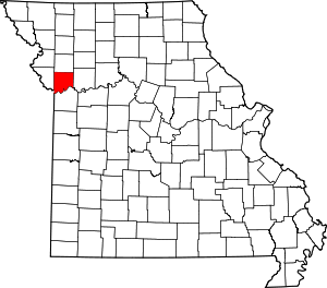 Map of Missouri highlighting Clay County | |
| Villages | ||
| Townships | ||
| Unincorporated communities | ||
| Footnotes | ‡This populated place also has portions in an adjacent county or counties | |
| Authority control |
|
|---|