Lone Jack, Missouri
Lone Jack is a city in Jackson County, Missouri, United States. The population was 1,050 at the 2010 U.S. Census.[6] It is part of the Kansas City metropolitan area.
Lone Jack, Missouri | |
|---|---|
 Location of Lone Jack, Missouri | |
| Coordinates: 38°52′14″N 94°11′17″W | |
| Country | United States |
| State | Missouri |
| County | Jackson |
| Government | |
| • Mayor | Phil Andreas |
| • Mayor Pro-tem | Natasha Ortiz |
| Area | |
| • Total | 5.85 sq mi (15.15 km2) |
| • Land | 5.85 sq mi (15.15 km2) |
| • Water | 0.00 sq mi (0.00 km2) |
| Elevation | 1,017 ft (310 m) |
| Population | |
| • Total | 1,050 |
| • Estimate (2019)[3] | 1,323 |
| • Density | 226.12/sq mi (87.30/km2) |
| Time zone | UTC-6 (Central (CST)) |
| • Summer (DST) | UTC-5 (CDT) |
| ZIP code | 64070 |
| Area code(s) | 816 |
| FIPS code | 29-43760[4] |
| GNIS feature ID | 0758307[5] |
| Website | lonejackmo |
History
Lone Jack was platted in 1841.[7] Its name comes from a single black jack tree that stood as a local landmark.[8] A post office has been in operation at Lone Jack since 1839.[9]
On August 16, 1862 Federal troops were defeated in the Battle of Lone Jack by a much larger Confederate force. The fighting literally occurred on the main street and raged for five hours before the Federals withdrew. The Confederates were unable to hold the town following their victory because of converging Union forces from other commands.[10]
Geography
Lone Jack is located at 38°52′14″N 94°11′17″W (38.870516, -94.188174).[11] According to the United States Census Bureau, the city has a total area of 3.75 square miles (9.71 km2), all land.[12]
Demographics
| Historical population | |||
|---|---|---|---|
| Census | Pop. | %± | |
| 1880 | 111 | — | |
| 1970 | 199 | — | |
| 1980 | 420 | 111.1% | |
| 1990 | 392 | −6.7% | |
| 2000 | 528 | 34.7% | |
| 2010 | 1,050 | 98.9% | |
| Est. 2019 | 1,323 | [3] | 26.0% |
| U.S. Decennial Census[13] | |||
2010 census
As of the census[2] of 2010, there were 1,050 people, 378 households, and 302 families living in the city. The population density was 280.0 inhabitants per square mile (108.1/km2). There were 404 housing units at an average density of 107.7 per square mile (41.6/km2). The racial makeup of the city was 94.3% White, 2.0% African American, 0.9% Native American, 0.5% Asian, 0.1% Pacific Islander, 0.5% from other races, and 1.8% from two or more races. Hispanic or Latino of any race were 1.2% of the population.
There were 378 households of which 44.7% had children under the age of 18 living with them, 61.4% were married couples living together, 13.2% had a female householder with no husband present, 5.3% had a male householder with no wife present, and 20.1% were non-families. 14.8% of all households were made up of individuals and 2.7% had someone living alone who was 65 years of age or older. The average household size was 2.76 and the average family size was 3.05.
The median age in the city was 32.2 years. 28.3% of residents were under the age of 18; 8.8% were between the ages of 18 and 24; 30.3% were from 25 to 44; 25.6% were from 45 to 64; and 7% were 65 years of age or older. The gender makeup of the city was 48.4% male and 51.6% female.
2000 census
As of the census[4] of 2000, there were 528 people, 202 households, and 153 families living in the city. The population density was 137.6 people per square mile (53.1/km2). There were 214 housing units at an average density of 55.8 per square mile (21.5/km2). The racial makeup of the city was 98.64% White, 0.35% African American, 0.37% Native American, 0.38% Asian, and 0.36% from two or more races. Hispanic or Latino of any race were 0.76% of the population and .13% Hawaiian.
There were 202 households out of which 39.1% had children under the age of 18 living with them, 62.4% were married couples living together, 10.4% had a female householder with no husband present, and 23.8% were non-families. 20.3% of all households were made up of individuals and 5.0% had someone living alone who was 65 years of age or older. The average household size was 2.61 and the average family size was 2.95.
In the city the population was spread out with 27.5% under the age of 18, 6.6% from 18 to 24, 31.6% from 25 to 44, 25.6% from 45 to 64, and 8.7% who were 65 years of age or older. The median age was 36 years. For every 100 females, there were 97.8 males. For every 100 females age 18 and over, there were 85.9 males.
The median income for a household in the city was $51,154, and the median income for a family was $57,500. Males had a median income of $37,031 versus $31,250 for females. The per capita income for the city was $20,558. 3.6% of the population were living below the poverty line, including 7.5% of those over 64.8. No families or minors are living below the poverty line.
Education
Lone Jack C-VI School District operates an elementary school, a middle school, and Lone Jack High School.[14]
Lone Jack has a public library, a branch of the Mid-Continent Public Library.[15]
References
- "2019 U.S. Gazetteer Files". United States Census Bureau. Retrieved July 26, 2020.
- "U.S. Census website". United States Census Bureau. Retrieved 2012-07-08.
- "Population and Housing Unit Estimates". United States Census Bureau. May 24, 2020. Retrieved May 27, 2020.
- "U.S. Census website". United States Census Bureau. Retrieved 2008-01-31.
- "US Board on Geographic Names". United States Geological Survey. 2007-10-25. Retrieved 2008-01-31.
- "Missouri by Place Geographic Comparison Table". U.S. Census Bureau. Archived from the original on 2020-02-12. Retrieved 2007-09-19.
- "Jackson County Place Names, 1928–1945 (archived)". The State Historical Society of Missouri. Archived from the original on 24 June 2016. Retrieved 16 October 2016.
- Eaton, David Wolfe (1916). How Missouri Counties, Towns and Streams Were Named. The State Historical Society of Missouri. p. 178.
- "Post Offices". Jim Forte Postal History. Retrieved 16 October 2016.
- "Lone Jack". National Park Service. Retrieved 17 October 2016.
- "US Gazetteer files: 2010, 2000, and 1990". United States Census Bureau. 2011-02-12. Retrieved 2011-04-23.
- "US Gazetteer files 2010". United States Census Bureau. Archived from the original on 2012-01-25. Retrieved 2012-07-08.
- "Census of Population and Housing". Census.gov. Retrieved June 4, 2015.
- "Lone Jack C-6 School District". Great Schools. Retrieved 18 March 2018.
- "Locations". Mid-Continent Public Library. Retrieved 17 March 2018.
External links
Municipalities and communities of Jackson County, Missouri, United States | ||
|---|---|---|
| Cities | 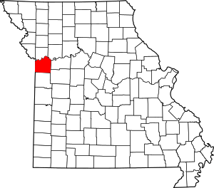 Map of Missouri highlighting Jackson County | |
| Villages | ||
| Townships | ||
| Unincorporated communities | ||
| Footnotes | ‡This populated place also has portions in an adjacent county or counties | |
Kansas City metropolitan area's cities and counties | ||
|---|---|---|
| Central city | 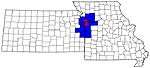 | |
| Largest cities (over 100,000 in 2000) | ||
| Medium-sized cities (10,000 to 100,000 in 2000) | ||
| Smaller Cities (between 5,000 and 9,900 in 2010) | ||
| Counties | ||

| Authority control |
|
|---|