Barton County, Missouri
Barton County is a county located in the southwestern part of the U.S. state of Missouri. As of the 2010 census, the population was 12,402.[1] Its county seat is Lamar.[2] The county was organized in 1855 and named after U.S. Senator David Barton from Missouri.[3]
Barton County | |
|---|---|
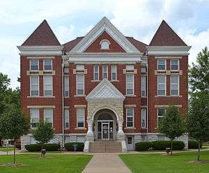 Barton County Courthouse in Lamar | |
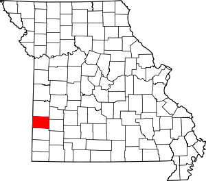 Location within the U.S. state of Missouri | |
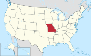 Missouri's location within the U.S. | |
| Coordinates: 37°30′N 94°20′W | |
| Country | |
| State | |
| Founded | December 12, 1855 |
| Named for | David Barton |
| Seat | Lamar |
| Largest city | Lamar |
| Area | |
| • Total | 597 sq mi (1,550 km2) |
| • Land | 592 sq mi (1,530 km2) |
| • Water | 4.8 sq mi (12 km2) 0.8% |
| Population (2010) | |
| • Total | 12,402 |
| • Estimate (2018) | 11,798 |
| • Density | 21/sq mi (8.0/km2) |
| Time zone | UTC−6 (Central) |
| • Summer (DST) | UTC−5 (CDT) |
| Congressional district | 4th |
| Website | www |
President Harry S. Truman was born in Barton County in 1884. The female bandit, Little Britches, was born in Barton County in 1879.[4]
Geography
According to the U.S. Census Bureau, the county has a total area of 597 square miles (1,550 km2), of which 592 square miles (1,530 km2) is land and 4.8 square miles (12 km2) (0.8%) is water.[5]
Adjacent counties
- Vernon County (north)
- Cedar County (northeast)
- Dade County (east)
- Jasper County (south)
- Crawford County, Kansas (west)
Major highways
.svg.png)


Airport
Lamar Municipal Airport (LLU) serves the county and surrounding communities.
Demographics
| Historical population | |||
|---|---|---|---|
| Census | Pop. | %± | |
| 1860 | 1,817 | — | |
| 1870 | 4,285 | 135.8% | |
| 1880 | 10,332 | 141.1% | |
| 1890 | 18,504 | 79.1% | |
| 1900 | 18,253 | −1.4% | |
| 1910 | 16,747 | −8.3% | |
| 1920 | 16,879 | 0.8% | |
| 1930 | 14,560 | −13.7% | |
| 1940 | 14,148 | −2.8% | |
| 1950 | 12,678 | −10.4% | |
| 1960 | 11,113 | −12.3% | |
| 1970 | 10,431 | −6.1% | |
| 1980 | 11,292 | 8.3% | |
| 1990 | 11,312 | 0.2% | |
| 2000 | 12,541 | 10.9% | |
| 2010 | 12,402 | −1.1% | |
| Est. 2018 | 11,798 | [6] | −4.9% |
| U.S. Decennial Census[7] 1790-1960[8] 1900-1990[9] 1990-2000[10] 2010-2015[1] | |||
As of the census[11] of 2000, there were 12,541 people, 4,895 households, and 3,441 families residing in the county. The population density was 21 people per square mile (8/km2). There were 5,409 housing units at an average density of 9 per square mile (4/km2). The racial makeup of the county was 96.93% White, 0.29% Black or African American, 0.83% Native American, 0.28% Asian, 0.10% Pacific Islander, 0.14% from other races, and 1.44% from two or more races. 0.95% of the population were Hispanic or Latino of any race.
There were 4,895 households, out of which 34.00% had children under the age of 18 living with them, 58.10% were married couples living together, 8.50% had a female householder with no husband present, and 29.70% were non-families. 26.40% of all households were made up of individuals, and 13.30% had someone living alone who was 65 years of age or older. The average household size was 2.53 and the average family size was 3.04.
In the county, the population was spread out, with 27.50% under the age of 18, 8.30% from 18 to 24, 26.10% from 25 to 44, 21.70% from 45 to 64, and 16.50% who were 65 years of age or older. The median age was 37 years. For every 100 females there were 96.00 males. For every 100 females age 18 and over, there were 92.40 males.
The median income for a household in the county was $29,275, and the median income for a family was $35,638. Males had a median income of $25,254 versus $19,663 for females. The per capita income for the county was $13,987. About 11.00% of families and 13.00% of the population were below the poverty line, including 13.90% of those under age 18 and 16.80% of those age 65 or over.
Education
Public schools
- Liberal R-II School District - Liberal
- Liberal Elementary School (PK-05)
- Liberal Middle School (06-08)
- Liberal High School (09-12)
- Lamar R-I School District - Lamar
- Lamar East Primary School (K-02)
- Lamar Elementary School (03-05)
- Lamar Middle School (06-08)
- Lamar High School (09-12)
- Golden City R-III School District - Golden City
- Golden City Elementary School (PK-06)
- Golden City High School (07-12)
Politics
Local
| Barton County, Missouri | ||||
|---|---|---|---|---|
| Elected countywide officials | ||||
| Assessor | Ivan Friden | Republican | ||
| Circuit Clerk | Janet B. Maupin | Republican | ||
| County Clerk | Kristina Crockett | Republican | ||
| Collector | Barba Parrish | Republican | ||
| Commissioner (Presiding) |
Mike Davis | Republican | ||
| Commissioner (District 1) |
Dennis Wilson | Republican | ||
| Commissioner (District 2) |
Jeff Tucker | Republican | ||
| Coroner | Tammy Deherrera | Republican | ||
| Prosecuting Attorney | Mike Smalley | Republican | ||
| Public Administrator | Teresa E. Moore | Republican | ||
| Recorder | Kathleen Diamond | Republican | ||
| Sheriff | Mitch Shaw | Republican | ||
| Surveyor | Lynn Calton | Republican | ||
| Treasurer | Barba Parrish | Republican | ||
State
| Year | Republican | Democratic | Third Parties |
|---|---|---|---|
| 2016 | 77.18% 4,553 | 20.39% 1,203 | 2.42% 143 |
| 2012 | 63.78% 3,644 | 33.26% 1,900 | 2.96% 169 |
| 2008 | 62.17% 3,661 | 35.47% 2,089 | 2.36% 139 |
| 2004 | 79.43% 4,743 | 19.49% 1,164 | 1.07% 64 |
| 2000 | 70.15% 3,764 | 28.61% 1,535 | 1.25% 67 |
| 1996 | 57.60% 2,911 | 39.77% 2,010 | 2.63% 133 |
| 1992 | 64.77% 3,330 | 35.23% 1,811 | 0.00% 0 |
All of Barton County is a part of Missouri’s 127th Legislative District in the Missouri House of Representatives and is represented by Mike Kelley (R-Lamar).
| Party | Candidate | Votes | % | ± | |
|---|---|---|---|---|---|
| Republican | Mike Kelley | 5,114 | 87.25% | -12.75 | |
| Independent | George R. Parsons | 747 | 12.75% | +12.75 | |
| Party | Candidate | Votes | % | ± | |
|---|---|---|---|---|---|
| Republican | Mike Kelley | 2,732 | 100.00% | ||
| Party | Candidate | Votes | % | ± | |
|---|---|---|---|---|---|
| Republican | Mike Kelley | 5,068 | 100.00% | ||
All of Barton County is a part of Missouri’s 31st Senatorial District in the Missouri Senate and is represented by Ed Emery (R-Lamar).
| Party | Candidate | Votes | % | ± | |
|---|---|---|---|---|---|
| Republican | Ed Emery | 4,581 | 79.26% | +5.72 | |
| Libertarian | Lora Young | 426 | 7.37% | +7.37 | |
| Independent | Tim Wells | 773 | 13.37% | +13.37 | |
| Party | Candidate | Votes | % | ± | |
|---|---|---|---|---|---|
| Republican | Ed Emery | 4,144 | 73.54% | ||
| Democratic | Charles A. Burton | 1,491 | 26.46% | ||
Federal
| Party | Candidate | Votes | % | ± | |
|---|---|---|---|---|---|
| Republican | Roy Blunt | 4,479 | 75.77% | +13.46 | |
| Democratic | Jason Kander | 1,231 | 20.83% | -10.79 | |
| Libertarian | Jonathan Dine | 93 | 1.57% | -4.50 | |
| Green | Johnathan McFarland | 47 | 0.80% | +0.80 | |
| Constitution | Fred Ryman | 61 | 1.03% | +1.03 | |
| Party | Candidate | Votes | % | ± | |
|---|---|---|---|---|---|
| Republican | Todd Akin | 3,551 | 62.31% | ||
| Democratic | Claire McCaskill | 1,802 | 31.62% | ||
| Libertarian | Jonathan Dine | 346 | 6.07% | ||
All of Barton County is included in Missouri's 4th Congressional District and is represented by Vicky Hartzler (R-Harrisonville) in the U.S. House of Representatives.
| Party | Candidate | Votes | % | ± | |
|---|---|---|---|---|---|
| Republican | Vicky Hartzler | 4,893 | 83.91% | +1.89 | |
| Democratic | Gordon Christensen | 752 | 12.90% | -0.37 | |
| Libertarian | Mark Bliss | 186 | 3.19% | -1.52 | |
| Party | Candidate | Votes | % | ± | |
|---|---|---|---|---|---|
| Republican | Vicky J. Hartzler | 2,472 | 82.02% | +5.54 | |
| Democratic | Nate Irvin | 400 | 13.27% | -6.55 | |
| Libertarian | Herschel L. Young | 142 | 4.71% | +1.92 | |
| Party | Candidate | Votes | % | ± | |
|---|---|---|---|---|---|
| Republican | Vicky Hartzler | 4,306 | 76.48% | ||
| Democratic | Teresa Hensley | 1,116 | 19.82% | ||
| Libertarian | Thomas Holbrook | 157 | 2.79% | ||
| Constitution | Greg Cowan | 51 | 0.91% | ||
Barton County is overwhelmingly Republican in presidential elections. The last Democratic candidate to carry Barton County was Lyndon B. Johnson in 1964. Most recently in 2016, the county vote for Donald J. Trump by a margin of 70.4 percentage points.
| Year | Republican | Democratic | Third parties |
|---|---|---|---|
| 2016 | 83.5% 4,959 | 13.4% 795 | 3.1% 185 |
| 2012 | 76.9% 4,418 | 21.4% 1,230 | 1.7% 98 |
| 2008 | 74.2% 4,414 | 24.5% 1,455 | 1.3% 79 |
| 2004 | 76.3% 4,572 | 22.9% 1,373 | 0.8% 46 |
| 2000 | 71.5% 3,836 | 26.5% 1,424 | 2.0% 106 |
| 1996 | 55.7% 2,812 | 32.2% 1,625 | 12.1% 608 |
| 1992 | 53.4% 2,775 | 27.6% 1,433 | 19.0% 986 |
| 1988 | 67.4% 3,339 | 32.3% 1,603 | 0.3% 16 |
| 1984 | 74.8% 3,996 | 25.2% 1,348 | |
| 1980 | 61.8% 3,337 | 35.2% 1,901 | 3.0% 160 |
| 1976 | 53.3% 2,708 | 45.8% 2,326 | 0.9% 43 |
| 1972 | 77.9% 4,026 | 22.1% 1,140 | |
| 1968 | 55.7% 2,928 | 34.8% 1,832 | 9.5% 499 |
| 1964 | 42.4% 2,332 | 57.6% 3,173 | |
| 1960 | 60.5% 3,703 | 39.5% 2,417 | |
| 1956 | 55.2% 3,547 | 44.8% 2,881 | |
| 1952 | 60.2% 4,056 | 39.5% 2,661 | 0.4% 24 |
| 1948 | 46.1% 2,577 | 53.8% 3,008 | 0.1% 7 |
| 1944 | 55.3% 3,356 | 44.3% 2,688 | 0.4% 23 |
| 1940 | 51.1% 3,737 | 48.4% 3,539 | 0.5% 39 |
| 1936 | 43.7% 3,164 | 55.8% 4,048 | 0.5% 37 |
| 1932 | 34.3% 2,092 | 63.8% 3,897 | 1.9% 115 |
| 1928 | 61.2% 3,662 | 38.0% 2,275 | 0.8% 48 |
| 1924 | 48.6% 2,952 | 44.2% 2,682 | 7.3% 441 |
| 1920 | 51.1% 3,480 | 44.6% 3,040 | 4.3% 294 |
| 1916 | 39.8% 1,597 | 55.2% 2,217 | 5.0% 202 |
| 1912 | 26.6% 1,010 | 47.1% 1,791 | 26.3% 1,000 |
| 1908 | 43.4% 1,673 | 49.6% 1,913 | 7.1% 272 |
| 1904 | 46.1% 1,843 | 45.3% 1,811 | 8.5% 341 |
| 1900 | 41.2% 1,780 | 54.3% 2,349 | 4.6% 197 |
| 1896 | 33.9% 1,496 | 64.0% 2,824 | 2.1% 91 |
| 1892 | 33.5% 1,335 | 40.6% 1,620 | 25.9% 1,034 |
| 1888 | 39.0% 1,543 | 47.6% 1,883 | 13.4% 528 |
Communities
Cities
- Golden City
- Lamar (county seat)
- Liberal
- Mindenmines
Villages
Census-designated place
See also
- National Register of Historic Places listings in Barton County, Missouri
References
- "State & County QuickFacts". United States Census Bureau. Archived from the original on July 6, 2011. Retrieved September 7, 2013.
- "Find a County". National Association of Counties. Archived from the original on 2012-07-12. Retrieved 2011-06-07.
- Eaton, David Wolfe (1916). How Missouri Counties, Towns and Streams Were Named. The State Historical Society of Missouri. pp. 207.
- "Cattle Annie & Little Britches, taken from Lee Paul". ranchdivaoutfitters.com. Archived from the original on January 17, 2012. Retrieved December 27, 2012.
- "2010 Census Gazetteer Files". United States Census Bureau. August 22, 2012. Archived from the original on October 21, 2013. Retrieved November 13, 2014.
- "Population and Housing Unit Estimates". Retrieved October 1, 2019.
- "U.S. Decennial Census". United States Census Bureau. Retrieved November 13, 2014.
- "Historical Census Browser". University of Virginia Library. Retrieved November 13, 2014.
- "Population of Counties by Decennial Census: 1900 to 1990". United States Census Bureau. Retrieved November 13, 2014.
- "Census 2000 PHC-T-4. Ranking Tables for Counties: 1990 and 2000" (PDF). United States Census Bureau. Retrieved November 13, 2014.
- "U.S. Census website". United States Census Bureau. Retrieved 2011-05-14.
- Breeding, Marshall. "Barton County Library". Libraries.org. Retrieved May 8, 2017.
- Breeding, Marshall. "Sheldon City Library". Libraries.org. Retrieved May 8, 2017.
- Leip, David. "Dave Leip's Atlas of U.S. Presidential Elections". uselectionatlas.org. Retrieved 2018-03-24.
External links
| Wikimedia Commons has media related to Barton County, Missouri. |
- http://www.bartoncounty.com/
- Digitized 1930 Plat Book of Barton County from University of Missouri Division of Special Collections, Archives, and Rare Books
Places adjacent to Barton County, Missouri | ||||||||||
|---|---|---|---|---|---|---|---|---|---|---|
| ||||||||||
Municipalities and communities of Barton County, Missouri, United States | ||
|---|---|---|
| Cities | Map of Missouri highlighting Barton County | |
| Villages | ||
| Townships | ||
| CDP | ||
| Other unincorporated communities | ||
| Ghost towns | ||

| Authority control |
|
|---|