Oaks, Missouri
Oaks is a village in Clay County, Missouri, United States. The population was 129 at the 2010 census. It is part of the Kansas City metropolitan area.
Oaks, Missouri | |
|---|---|
 Location of Oaks, Missouri | |
| Coordinates: 39°11′49″N 94°34′20″W | |
| Country | United States |
| State | Missouri |
| County | Clay |
| Area | |
| • Total | 0.09 sq mi (0.23 km2) |
| • Land | 0.09 sq mi (0.23 km2) |
| • Water | 0.00 sq mi (0.00 km2) |
| Elevation | 981 ft (299 m) |
| Population | |
| • Total | 129 |
| • Estimate (2019)[3] | 134 |
| • Density | 1,472.53/sq mi (570.96/km2) |
| Time zone | UTC-6 (Central (CST)) |
| • Summer (DST) | UTC-5 (CDT) |
| FIPS code | 29-53804[4] |
| GNIS feature ID | 0723682[5] |
Geography
According to the United States Census Bureau, the village has a total area of 0.09 square miles (0.23 km2), all land.[6][7]
Demographics
| Historical population | |||
|---|---|---|---|
| Census | Pop. | %± | |
| 1960 | 159 | — | |
| 1970 | 162 | 1.9% | |
| 1980 | 126 | −22.2% | |
| 1990 | 130 | 3.2% | |
| 2000 | 136 | 4.6% | |
| 2010 | 129 | −5.1% | |
| Est. 2019 | 134 | [3] | 3.9% |
| U.S. Decennial Census[8] | |||
2010 census
As of the census[2] of 2010, there were 129 people, 54 households, and 43 families living in the village. The population density was 1,433.3 inhabitants per square mile (553.4/km2). There were 57 housing units at an average density of 633.3 per square mile (244.5/km2). The racial makeup of the village was 97.7% White, 0.8% African American, 0.8% Asian, and 0.8% from two or more races. Hispanic or Latino of any race were 7.8% of the population.
There were 54 households, of which 29.6% had children under the age of 18 living with them, 72.2% were married couples living together, 7.4% had a female householder with no husband present, and 20.4% were non-families. 18.5% of all households were made up of individuals, and 11.1% had someone living alone who was 65 years of age or older. The average household size was 2.39 and the average family size was 2.67.
The median age in the village was 48.4 years. 18.6% of residents were under the age of 18; 2.4% were between the ages of 18 and 24; 23.3% were from 25 to 44; 34.8% were from 45 to 64; and 20.9% were 65 years of age or older. The gender makeup of the village was 48.8% male and 51.2% female.
2000 census
As of the census[4] of 2000, there were 136 people, 56 households, and 45 families living in the village. The population density was 1,429.2 people per square mile (525.1/km2). There were 57 housing units at an average density of 599.0 per square mile (220.1/km2). The racial makeup of the village was 94.12% White, 1.47% African American, 2.21% from other races, and 2.21% from two or more races. Hispanic or Latino of any race were 2.94% of the population.
There were 56 households, out of which 30.4% had children under the age of 18 living with them, 75.0% were married couples living together, 5.4% had a female householder with no husband present, and 19.6% were non-families. 16.1% of all households were made up of individuals, and 5.4% had someone living alone who was 65 years of age or older. The average household size was 2.43 and the average family size was 2.73.
In the village, the population was spread out, with 19.9% under the age of 18, 2.9% from 18 to 24, 30.1% from 25 to 44, 29.4% from 45 to 64, and 17.6% who were 65 years of age or older. The median age was 44 years. For every 100 females, there were 81.3 males. For every 100 females age 18 and over, there were 91.2 males.
The median income for a household in the village was $72,500, and the median income for a family was $76,131. Males had a median income of $44,375 versus $45,000 for females. The per capita income for the village was $26,823. There were 2.4% of families and 2.1% of the population living below the poverty line, including no under eighteens and 20.0% of those over 64.
References
- "2019 U.S. Gazetteer Files". United States Census Bureau. Retrieved July 26, 2020.
- "U.S. Census website". United States Census Bureau. Retrieved 2012-07-08.
- "Population and Housing Unit Estimates". United States Census Bureau. May 24, 2020. Retrieved May 27, 2020.
- "U.S. Census website". United States Census Bureau. Retrieved 2008-01-31.
- "US Board on Geographic Names". United States Geological Survey. 2007-10-25. Retrieved 2008-01-31.
- "US Gazetteer files 2010". United States Census Bureau. Archived from the original on January 12, 2012. Retrieved 2012-07-08.
- "US Gazetteer files: 2010, 2000, and 1990". United States Census Bureau. 2011-02-12. Retrieved 2011-04-23.
- "Census of Population and Housing". Census.gov. Retrieved June 4, 2015.
Kansas City metropolitan area's cities and counties | ||
|---|---|---|
| Central city | 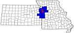 | |
| Largest cities (over 100,000 in 2000) | ||
| Medium-sized cities (10,000 to 100,000 in 2000) | ||
| Smaller Cities (between 5,000 and 9,900 in 2010) | ||
| Counties | ||

Municipalities and communities of Clay County, Missouri, United States | ||
|---|---|---|
| Cities | 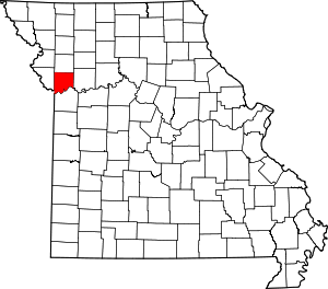 Map of Missouri highlighting Clay County | |
| Villages | ||
| Townships | ||
| Unincorporated communities | ||
| Footnotes | ‡This populated place also has portions in an adjacent county or counties | |