Weatherby Lake, Missouri
Weatherby Lake is a city in Platte County, Missouri and is part of the Kansas City metropolitan area within the United States, which borders Kansas City. The population was 1,723 at the 2010 census.
Weatherby Lake, Missouri | |
|---|---|
 Weatherby Lake from the west | |
 Location of Weatherby Lake, Missouri | |
| Coordinates: 39°14′19″N 94°41′52″W | |
| Country | United States |
| State | Missouri |
| County | Platte |
| Area | |
| • Total | 1.34 sq mi (3.46 km2) |
| • Land | 1.03 sq mi (2.66 km2) |
| • Water | 0.31 sq mi (0.80 km2) |
| Elevation | 912 ft (278 m) |
| Population | |
| • Total | 1,723 |
| • Estimate (2019)[3] | 2,073 |
| • Density | 2,018.50/sq mi (779.63/km2) |
| Time zone | UTC-6 (Central (CST)) |
| • Summer (DST) | UTC-5 (CDT) |
| ZIP codes | 64152-64153 |
| Area code(s) | 816 |
| FIPS code | 29-78046[4] |
| GNIS feature ID | 0728438[5] |

Geography
Weatherby Lake is located at 39°14′19″N 94°41′52″W (39.238602, -94.697879).[6]
According to the United States Census Bureau, the city has a total area of 1.34 square miles (3.47 km2), of which 1.03 square miles (2.67 km2) is land and 0.31 square miles (0.80 km2) is water.[7]
Demographics
| Historical population | |||
|---|---|---|---|
| Census | Pop. | %± | |
| 1960 | 376 | — | |
| 1970 | 832 | 121.3% | |
| 1980 | 1,446 | 73.8% | |
| 1990 | 1,613 | 11.5% | |
| 2000 | 1,873 | 16.1% | |
| 2010 | 1,723 | −8.0% | |
| Est. 2019 | 2,073 | [3] | 20.3% |
| U.S. Decennial Census[8] | |||
2010 census
As of the census[2] of 2010, there were 1,723 people, 699 households, and 564 families living in the city. The population density was 1,672.8 inhabitants per square mile (645.9/km2). There were 732 housing units at an average density of 710.7 per square mile (274.4/km2). The racial makeup of the city was 95.1% White, 0.8% African American, 0.5% Native American, 1.5% Asian, 0.1% Pacific Islander, 0.7% from other races, and 1.4% from two or more races. Hispanic or Latino of any race were 3.2% of the population.
There were 699 households of which 25.9% had children under the age of 18 living with them, 73.0% were married couples living together, 5.4% had a female householder with no husband present, 2.3% had a male householder with no wife present, and 19.3% were non-families. 16.7% of all households were made up of individuals and 6.5% had someone living alone who was 65 years of age or older. The average household size was 2.45 and the average family size was 2.73.
The median age in the city was 52.7 years. 18.7% of residents were under the age of 18; 4.1% were between the ages of 18 and 24; 14.2% were from 25 to 44; 40.8% were from 45 to 64; and 22.2% were 65 years of age or older. The gender makeup of the city was 49.0% male and 51.0% female.
2000 census
As of the census[4] of 2000, there were 1,873 people, 700 households, and 588 families living in the city. The population density was 1,810.5 people per square mile (702.1/km2). There were 722 housing units at an average density of 697.9 per square mile (270.6/km2). The racial makeup of the city was 96.64% White, 1.07% African American, 0.32% Native American, 0.91% Asian, 0.16% from other races, and 0.91% from two or more races. Hispanic or Latino of any race were 1.66% of the population.
There were 700 households out of which 32.7% had children under the age of 18 living with them, 78.9% were married couples living together, 3.1% had a female householder with no husband present, and 15.9% were non-families. 12.7% of all households were made up of individuals and 2.4% had someone living alone who was 65 years of age or older. The average household size was 2.67 and the average family size was 2.88.
In the city the population was spread out with 23.0% under the age of 18, 5.7% from 18 to 24, 20.1% from 25 to 44, 41.4% from 45 to 64, and 9.9% who were 65 years of age or older. The median age was 46 years. For every 100 females, there were 101.4 males. For every 100 females age 18 and over, there were 100.4 males.
The median income for a household in the city was $88,030, and the median income for a family was $94,643. Males had a median income of $61,042 versus $37,386 for females. The per capita income for the city was $37,722. About 0.7% of families and 1.5% of the population were below the poverty line, including 2.7% of those under age 18 and none of those age 65 or over.
References
- "2019 U.S. Gazetteer Files". United States Census Bureau. Retrieved July 26, 2020.
- "U.S. Census website". United States Census Bureau. Retrieved 2012-07-08.
- "Population and Housing Unit Estimates". United States Census Bureau. May 24, 2020. Retrieved May 27, 2020.
- "U.S. Census website". United States Census Bureau. Retrieved 2008-01-31.
- "US Board on Geographic Names". United States Geological Survey. 2007-10-25. Retrieved 2008-01-31.
- "US Gazetteer files: 2010, 2000, and 1990". United States Census Bureau. 2011-02-12. Retrieved 2011-04-23.
- "US Gazetteer files 2010". United States Census Bureau. Retrieved 2012-07-08.
- "Census of Population and Housing". Census.gov. Retrieved June 4, 2015.
Municipalities and communities of Platte County, Missouri, United States | ||
|---|---|---|
| Cities | 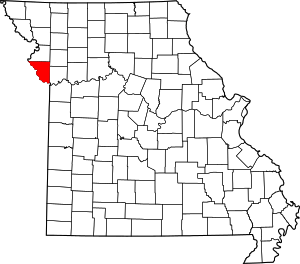 Map of Missouri highlighting Platte County | |
| Villages | ||
| Townships | ||
| Unincorporated communities | ||
| Footnotes | ‡This populated place also has portions in an adjacent county or counties | |
Kansas City metropolitan area's cities and counties | ||
|---|---|---|
| Central city | 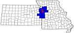 | |
| Largest cities (over 100,000 in 2000) | ||
| Medium-sized cities (10,000 to 100,000 in 2000) | ||
| Smaller Cities (between 5,000 and 9,900 in 2010) | ||
| Counties | ||