Rural Municipality of Touchwood No. 248
The Rural Municipality of Touchwood No. 248 (2016 population: 343) is a rural municipality (RM) in the Canadian province of Saskatchewan within Census Division No. 10 and SARM Division No. 4.
Touchwood No. 248 | |
|---|---|
| Rural Municipality of Touchwood No. 248 | |
 Location of the RM of Touchwood No. 248 in Saskatchewan | |
| Coordinates: 51.258°N 104.278°W[1] | |
| Country | Canada |
| Province | Saskatchewan |
| Census division | 10 |
| SARM division | 4 |
| Formed[2] | December 12, 1910 |
| Government | |
| • Reeve | Ernest Matai |
| • Governing body | RM of Touchwood No. 248 Council |
| • Administrator | Lorelei Paulsen |
| • Office location | Punnichy |
| Area (2016)[4] | |
| • Land | 706.72 km2 (272.87 sq mi) |
| Population (2016)[4] | |
| • Total | 343 |
| • Density | 0.5/km2 (1/sq mi) |
| Time zone | CST |
| • Summer (DST) | CST |
| Area code(s) | 306 and 639 |
History
The RM of Touchwood No. 248 incorporated as a rural municipality on December 12, 1910.[2]
Geography
Communities and localities
The following unincorporated communities are within the RM.
- Localities
- Arbury
- Magyar
- Serath
- South Touchwood
- Touchwood
- Zala
Demographics
In the 2016 Census of Population conducted by Statistics Canada, the RM of Touchwood No. 248 recorded a population of 343 living in 129 of its 147 total private dwellings, a 28.5% change from its 2011 population of 267. With a land area of 706.72 km2 (272.87 sq mi), it had a population density of 0.5/km2 (1.3/sq mi) in 2016.[4]
In the 2011 Census of Population, the RM of Touchwood No. 248 recorded a population of 267, a -7% change from its 2006 population of 287. With a land area of 706.72 km2 (272.87 sq mi), it had a population density of 0.4/km2 (1.0/sq mi) in 2011.[7]
Attractions
- Touchwood Hills Post Provincial Historic Park
Government
The RM of Touchwood No. 248 is governed by an elected municipal council and an appointed administrator that meets on the second Tuesday of every month.[3] The reeve of the RM is Ernest Matai while its administrator is Lorelei Paulsen.[3] The RM's office is located in Punnichy.[3]
Transportation
References
- "Pre-packaged CSV files - CGN, Canada/Province/Territory (cgn_sk_csv_eng.zip)". Government of Canada. July 24, 2019. Retrieved May 23, 2020.
- "Rural Municipality Incorporations (Alphabetical)". Saskatchewan Ministry of Municipal Affairs. Archived from the original on April 21, 2011. Retrieved May 9, 2020.
- "Municipality Details: RM of Touchwood No. 248". Government of Saskatchewan. Retrieved May 21, 2020.
- "Population and dwelling counts, for Canada, provinces and territories, and census subdivisions (municipalities), 2016 and 2011 censuses – 100% data (Saskatchewan)". Statistics Canada. February 8, 2017. Retrieved May 1, 2020.
- "Saskatchewan Census Population" (PDF). Saskatchewan Bureau of Statistics. Archived from the original (PDF) on September 24, 2015. Retrieved May 9, 2020.
- "Saskatchewan Census Population". Saskatchewan Bureau of Statistics. Retrieved May 9, 2020.
- "Population and dwelling counts, for Canada, provinces and territories, and census subdivisions (municipalities), 2011 and 2006 censuses (Saskatchewan)". Statistics Canada. June 3, 2019. Retrieved May 1, 2020.
| Towns | 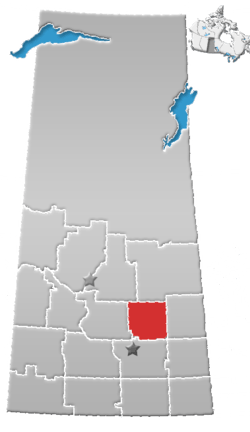 | ||||
|---|---|---|---|---|---|
| Villages | |||||
| Resort villages | |||||
| Rural municipalities | |||||
| First Nations | |||||
| Indian reserves | |||||
| Unincorporated communities |
| ||||