Rural Municipality of Wolverine No. 340
The Rural Municipality of Wolverine No. 340 (2016 population: 480) is a rural municipality (RM) in the Canadian province of Saskatchewan within Census Division No. 11 and SARM Division No. 5. It is located in the central portion of the province east of Saskatoon.
Wolverine No. 340 Plasterfield No. 340 (1909–1910) | |
|---|---|
| Rural Municipality of Wolverine No. 340 | |
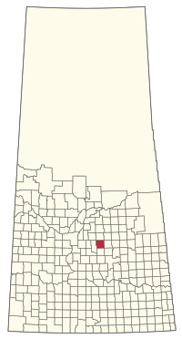 Location of the RM of Wolverine No. 340 in Saskatchewan | |
| Coordinates: 52.013°N 105.210°W[1] | |
| Country | Canada |
| Province | Saskatchewan |
| Census division | 11 |
| SARM division | 5 |
| Formed[2] | December 13, 1909 |
| Name change[3] | March 31, 1910 (from RM of Plasterfield No. 340) |
| Government | |
| • Reeve | Bryan Gibney |
| • Governing body | RM of Wolverine No. 340 Council |
| • Administrator | Sandi Dunne |
| • Office location | Burr |
| Area (2016)[5] | |
| • Land | 834.78 km2 (322.31 sq mi) |
| Population (2016)[5] | |
| • Total | 480 |
| • Density | 0.6/km2 (2/sq mi) |
| Time zone | CST |
| • Summer (DST) | CST |
| Area code(s) | 306 and 639 |
History
The RM of Plasterfield No. 340 was originally incorporated as a rural municipality on December 13, 1909.[2] Its name was changed to the RM of Wolverine No. 340 on March 31, 1910.[3] The RM's name is derived from Wolverine Lake, which lies near the centre of the RM.[6]
Geography
Communities and localities
The following unincorporated communities are within the RM.
- Localities
- Attica
- Bay Tail
- Burr
- Wolverine
Demographics
In the 2016 Census of Population conducted by Statistics Canada, the RM of Wolverine No. 340 recorded a population of 480 living in 177 of its 187 total private dwellings, a 3.4% change from its 2011 population of 464. With a land area of 834.78 km2 (322.31 sq mi), it had a population density of 0.6/km2 (1.5/sq mi) in 2016.[5]
In the 2011 Census of Population, the RM of Wolverine No. 340 recorded a population of 464, a -3.3% change from its 2006 population of 480. With a land area of 834.78 km2 (322.31 sq mi), it had a population density of 0.6/km2 (1.4/sq mi) in 2011.[9]
Government
The RM of Wolverine No. 340 is governed by an elected municipal council and an appointed administrator.[4] The reeve of the RM is Bryan Gibney while its administrator is Sandi Dunne.[4] The RM's office is located in Burr.[4]
Transportation
- Rail[10]
- Minnedosa - Saskatoon - Edmonton C.P.R—serves Kandahar, Dafoe, Jansen, Esk, Lanigan, Guernsey, Wolverine, Plunkett, Viscount
- Roads
- Highway 20—North south section from Burr to Lanigan
- Highway 667—serves Jansen, Saskatchewan and St. Gregor, Saskatchewan North South through RM
References
- "Pre-packaged CSV files - CGN, Canada/Province/Territory (cgn_sk_csv_eng.zip)". Government of Canada. July 24, 2019. Retrieved May 23, 2020.
- "Rural Municipality Incorporations (Alphabetical)". Saskatchewan Ministry of Municipal Affairs. Archived from the original on April 21, 2011. Retrieved May 9, 2020.
- "Renamed Rural Municipalities". Saskatchewan Ministry of Municipal Affairs. Archived from the original on February 25, 2012. Retrieved May 9, 2020.
- "Municipality Details: RM of Wolverine No. 340". Government of Saskatchewan. Retrieved May 21, 2020.
- "Population and dwelling counts, for Canada, provinces and territories, and census subdivisions (municipalities), 2016 and 2011 censuses – 100% data (Saskatchewan)". Statistics Canada. February 8, 2017. Retrieved May 1, 2020.
- Barry, Bill (2005). Geographic Names of Saskatchewan. Regina, Saskatchewan: People Places Publishing Ltd. ISBN 1-897010-19-2.
- "Saskatchewan Census Population" (PDF). Saskatchewan Bureau of Statistics. Archived from the original (PDF) on September 24, 2015. Retrieved May 9, 2020.
- "Saskatchewan Census Population". Saskatchewan Bureau of Statistics. Retrieved May 9, 2020.
- "Population and dwelling counts, for Canada, provinces and territories, and census subdivisions (municipalities), 2011 and 2006 censuses (Saskatchewan)". Statistics Canada. June 3, 2019. Retrieved May 1, 2020.
- Canadian Maps: January 1925 Waghorn's Guide. Post Offices in Man. Sask. Alta. and West Ontario.
