Rural Municipality of Riverside No. 168
The Rural Municipality of Riverside No. 168 (2016 population: 477) is a rural municipality (RM) in the Canadian province of Saskatchewan within Census Division No. 8 and SARM Division No. 3.
Riverside No. 168 | |
|---|---|
| Rural Municipality of Riverside No. 168 | |
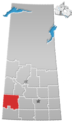
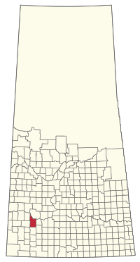 Location of the RM of Riverside No. 168 in Saskatchewan | |
| Coordinates: 50.690°N 108.278°W[1] | |
| Country | Canada |
| Province | Saskatchewan |
| Census division | 8 |
| SARM division | 3 |
| Formed[2] | January 1, 1913 |
| Government | |
| • Reeve | Richard Bye |
| • Governing body | RM of Riverside No. 168 Council |
| • Administrator | Brandi Prentice |
| • Office location | Pennant |
| Area (2016)[4] | |
| • Land | 1,298.39 km2 (501.31 sq mi) |
| Population (2016)[4] | |
| • Total | 477 |
| • Density | 0.4/km2 (1/sq mi) |
| Time zone | CST |
| • Summer (DST) | CST |
| Area code(s) | 306 and 639 |
History
The RM of Riverside No. 168 incorporated as a rural municipality on January 1, 1913.[2]
- Historical properties
There is one historical building located within the RM.
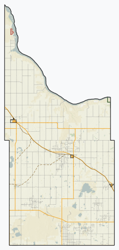
Geography
The north boundary of the RM is one of the arms of Lake Diefenbaker.
Demographics
In the 2016 Census of Population conducted by Statistics Canada, the RM of Riverside No. 168 recorded a population of 477 living in 176 of its 205 total private dwellings, a -2.7% change from its 2011 population of 490. With a land area of 1,298.39 km2 (501.31 sq mi), it had a population density of 0.4/km2 (1.0/sq mi) in 2016.[4]
In the 2011 Census of Population, the RM of Riverside No. 168 recorded a population of 490, a -4.1% change from its 2006 population of 511. With a land area of 1,298.39 km2 (501.31 sq mi), it had a population density of 0.4/km2 (1.0/sq mi) in 2011.[8]
Government
The RM of Riverside No. 168 is governed by an elected municipal council and an appointed administrator that meets on the second Tuesday of every month.[3] The reeve of the RM is Richard Bye while its administrator is Brandi Prentice.[3] The RM's office is located in Pennant.[3]
Transportation
References
- "Pre-packaged CSV files - CGN, Canada/Province/Territory (cgn_sk_csv_eng.zip)". Government of Canada. July 24, 2019. Retrieved May 23, 2020.
- "Rural Municipality Incorporations (Alphabetical)". Saskatchewan Ministry of Municipal Affairs. Archived from the original on April 21, 2011. Retrieved May 9, 2020.
- "Municipality Details: RM of Riverside No. 168". Government of Saskatchewan. Retrieved May 21, 2020.
- "Population and dwelling counts, for Canada, provinces and territories, and census subdivisions (municipalities), 2016 and 2011 censuses – 100% data (Saskatchewan)". Statistics Canada. February 8, 2017. Retrieved May 1, 2020.
- St. John's Norwegian Lutheran Church
- "Saskatchewan Census Population" (PDF). Saskatchewan Bureau of Statistics. Archived from the original (PDF) on September 24, 2015. Retrieved May 9, 2020.
- "Saskatchewan Census Population". Saskatchewan Bureau of Statistics. Retrieved May 9, 2020.
- "Population and dwelling counts, for Canada, provinces and territories, and census subdivisions (municipalities), 2011 and 2006 censuses (Saskatchewan)". Statistics Canada. June 3, 2019. Retrieved May 1, 2020.