Rural Municipality of Storthoaks No. 31
The Rural Municipality of Storthoaks No. 31 (2016 population: 292) is a rural municipality (RM) in the Canadian province of Saskatchewan within Census Division No. 1 and SARM Division No. 1.
Storthoaks No. 31 Storkoaks No. 31 (1911–1912) | |
|---|---|
| Rural Municipality of Storthoaks No. 31 | |
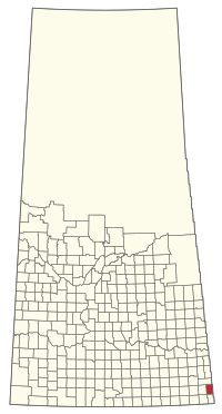 Location of the RM of Storthoaks No. 31 in Saskatchewan | |
| Coordinates: 49.422°N 101.535°W[1] | |
| Country | Canada |
| Province | Saskatchewan |
| Census division | 1 |
| SARM division | 1 |
| Federal riding | Souris—Moose Mountain |
| Provincial riding | Cannington |
| Formed[2] | December 11, 1911 |
| Name change[3] | March 15, 1912 (from RM of Storkoaks No. 31) |
| Government | |
| • Reeve | Brian Chicoine |
| • Governing body | RM of Storthoaks No. 31 Council |
| • Administrator | Elissa Henrion |
| • Office location | Storthoaks |
| Area (2016)[5] | |
| • Land | 584.16 km2 (225.55 sq mi) |
| Population (2016)[5] | |
| • Total | 292 |
| • Density | 0.5/km2 (1/sq mi) |
| Time zone | CST |
| • Summer (DST) | CST |
| Postal code | S0C 2K0 |
| Area code(s) | 306 and 639 |
History
The RM of Storkoaks No. 31 was originally incorporated as a rural municipality on December 11, 1911.[2] Its name was changed to the RM of Storthoaks No. 31 on March 15, 1912.[3]
Geography
Communities and localities
The following urban municipalities are surrounded by the RM.
- Storthoaks
The following unincorporated communities are within the RM.
- Organized hamlets[6]
- Localities
Demographics
In the 2016 Census of Population conducted by Statistics Canada, the RM of Storthoaks No. 31 recorded a population of 292 living in 112 of its 121 total private dwellings, a -3.9% change from its 2011 population of 304. With a land area of 584.16 km2 (225.55 sq mi), it had a population density of 0.5/km2 (1.3/sq mi) in 2016.[5]
In the 2011 Census of Population, the RM of Storthoaks No. 31 recorded a population of 304, a -2.6% change from its 2006 population of 312. With a land area of 582.57 km2 (224.93 sq mi), it had a population density of 0.5/km2 (1.4/sq mi) in 2011.[9]
Government
The RM of Storthoaks No. 31 is governed by an elected municipal council and an appointed administrator that meets on the second Monday of every month.[4] The reeve of the RM is Brian Chicoine while its administrator is Elissa Henrion.[4] The RM's office is located in Storthoaks.[4]
Transportation
- Rail[10]
- Estevan Section C.P.R. -- serves Lauder, Bernice, Bede, Broomhill, Tilston, Fertile, Storthoaks, Nottingham, Alida
- Roads
- Highway 361—serves Storthoaks, Saskatchewan
- Highway 8—North south Highway to the west of Storthoaks, Saskatchewan
- Highway 600—North south section of the Highway to the east of Storthoaks, Saskatchewan
- Highway 361—East West Highway to the east of Storthoaks, Saskatchewan
References
- "Pre-packaged CSV files - CGN, Canada/Province/Territory (cgn_sk_csv_eng.zip)". Government of Canada. July 24, 2019. Retrieved May 23, 2020.
- "Rural Municipality Incorporations (Alphabetical)". Saskatchewan Ministry of Municipal Affairs. Archived from the original on April 21, 2011. Retrieved May 9, 2020.
- "Renamed Rural Municipalities". Saskatchewan Ministry of Municipal Affairs. Archived from the original on February 25, 2012. Retrieved May 9, 2020.
- "Municipality Details: RM of Storthoaks No. 31". Government of Saskatchewan. Retrieved May 21, 2020.
- "Population and dwelling counts, for Canada, provinces and territories, and census subdivisions (municipalities), 2016 and 2011 censuses – 100% data (Saskatchewan)". Statistics Canada. February 8, 2017. Retrieved May 1, 2020.
- "2019-2020 Rural Revenue Sharing Organized Hamlet Grant". Government of Saskatchewan. Retrieved May 4, 2020.
- "Saskatchewan Census Population" (PDF). Saskatchewan Bureau of Statistics. Archived from the original (PDF) on September 24, 2015. Retrieved May 9, 2020.
- "Saskatchewan Census Population". Saskatchewan Bureau of Statistics. Retrieved May 9, 2020.
- "Population and dwelling counts, for Canada, provinces and territories, and census subdivisions (municipalities), 2011 and 2006 censuses (Saskatchewan)". Statistics Canada. June 3, 2019. Retrieved May 1, 2020.
- Canadian Maps: January 1925 Waghorn's Guide. Post Offices in Man. Sask. Alta. and West Ontario.
Places adjacent to Rural Municipality of Storthoaks No. 31 | |
|---|---|
| Cities |  | ||||
|---|---|---|---|---|---|
| Towns | |||||
| Villages | |||||
| Rural municipalities | |||||
| First Nations |
| ||||
| Indian reserves | |||||
| Unincorporated communities |
| ||||