Rural Municipality of Buckland No. 491
The Rural Municipality of Buckland No. 491 (2016 population: 3,375) is a rural municipality (RM) in the Canadian province of Saskatchewan within Census Division No. 15 and SARM Division No. 5. It is located near the City of Prince Albert.
Buckland No. 491 | |
|---|---|
| Rural Municipality of Buckland No. 491 | |
 Location of the RM of Buckland No. 491 in Saskatchewan | |
| Coordinates: 53.303°N 105.850°W[1] | |
| Country | Canada |
| Province | Saskatchewan |
| Census division | 15 |
| SARM division | 5 |
| Formed[2] | December 11, 1911 |
| Government | |
| • Reeve | Don Fyrk |
| • Governing body | RM of Buckland No. 491 Council |
| • Administrator | Cori Sarginson |
| • Office location | Prince Albert |
| Area (2016)[4] | |
| • Land | 791.69 km2 (305.67 sq mi) |
| Population (2016)[4] | |
| • Total | 3,375 |
| • Density | 4.3/km2 (11/sq mi) |
| Time zone | CST |
| • Summer (DST) | CST |
| Area code(s) | 306 and 639 |
| Website | Official website |
History
The RM of Buckland No. 491 incorporated as a rural municipality on December 11, 1911.[2]
Geography
Rural municipalities that neighbour the RM of Buckland No. 491 include the RM of Shellbrook No. 493 to the west, the RM of Paddockwood No. 520 to the north, the RM of Garden River No. 490 to the east, and the RM of Prince Albert No. 461 to the south.
Communities and localities
The following communities are located within the RM.
- Albertville
- Alingly
- Henribourg
- Little Red River IR #106C
- Redwing
- Spruce Home
- Sturgeon Lake IR #101
- Wahpaton 94A Indian reserve
- White Star
Demographics
In the 2016 Census of Population conducted by Statistics Canada, the RM of Buckland No. 491 recorded a population of 3,375 living in 1,237 of its 1,311 total private dwellings, a -7.7% change from its 2011 population of 3,658. With a land area of 791.69 km2 (305.67 sq mi), it had a population density of 4.3/km2 (11.0/sq mi) in 2016.[4]
In the 2011 Census of Population, the RM of Buckland No. 491 recorded a population of 3,658, a 6.7% change from its 2006 population of 3,429. With a land area of 791.69 km2 (305.67 sq mi), it had a population density of 4.6/km2 (12.0/sq mi) in 2011.[7]
Government
The RM of Buckland No. 491 is governed by an elected municipal council and an appointed administrator that meets on the second Monday of every month.[3] The reeve of the RM is Don Fyrk while its administrator is Cori Sarginson.[3] The RM's office is located in Prince Albert.[3]
References
- "Pre-packaged CSV files - CGN, Canada/Province/Territory (cgn_sk_csv_eng.zip)". Government of Canada. July 24, 2019. Retrieved May 23, 2020.
- "Rural Municipality Incorporations (Alphabetical)". Saskatchewan Ministry of Municipal Affairs. Archived from the original on April 21, 2011. Retrieved May 9, 2020.
- "Municipality Details: RM of Buckland No. 491". Government of Saskatchewan. Retrieved May 21, 2020.
- "Population and dwelling counts, for Canada, provinces and territories, and census subdivisions (municipalities), 2016 and 2011 censuses – 100% data (Saskatchewan)". Statistics Canada. February 8, 2017. Retrieved May 1, 2020.
- "Saskatchewan Census Population" (PDF). Saskatchewan Bureau of Statistics. Archived from the original (PDF) on September 24, 2015. Retrieved May 9, 2020.
- "Saskatchewan Census Population". Saskatchewan Bureau of Statistics. Retrieved May 9, 2020.
- "Population and dwelling counts, for Canada, provinces and territories, and census subdivisions (municipalities), 2011 and 2006 censuses (Saskatchewan)". Statistics Canada. June 3, 2019. Retrieved May 1, 2020.
External links
| Cities | 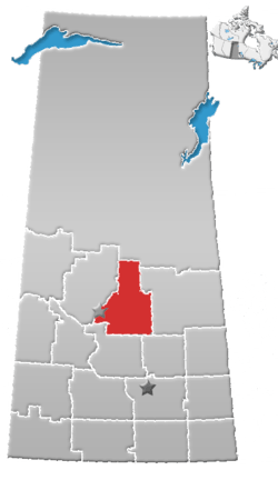 | ||
|---|---|---|---|
| Towns | |||
| Villages |
| ||
| Resort villages | |||
| Rural municipalities |
| ||
| First Nations | |||
| Indian reserves | |||
| Unincorporated communities |
| ||