Rural Municipality of Aberdeen No. 373
The Rural Municipality of Aberdeen No. 373 (2016 population: 1,379) is a rural municipality (RM) in the Canadian province of Saskatchewan within Census Division No. 15 and SARM Division No. 5. It is located on the South Saskatchewan River.
Aberdeen No. 373 | |
|---|---|
| Rural Municipality of Aberdeen No. 373 | |
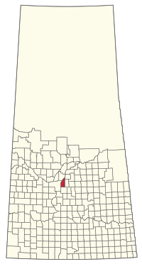 Location of the RM of Aberdeen No. 373 in Saskatchewan | |
| Coordinates: 52.429°N 106.293°W[1] | |
| Country | Canada |
| Province | Saskatchewan |
| Census division | 15 |
| SARM division | 5 |
| Federal riding | Carlton Trail—Eagle Creek |
| Provincial riding | Batoche Saskatoon Stonebridge-Dakota |
| Formed[2] | December 13, 1909 |
| Government | |
| • Reeve | Martin Bettker |
| • Governing body | RM of Aberdeen No. 373 Council |
| • Administrator | Gordon Craig Baird |
| • Office location | Aberdeen |
| Area (2016)[4] | |
| • Land | 673.42 km2 (260.01 sq mi) |
| Population (2016)[4] | |
| • Total | 1,379 |
| • Density | 2/km2 (5/sq mi) |
| Time zone | CST |
| • Summer (DST) | CST |
| Postal code | S0K 0A0 |
| Area code(s) | 306 and 639 |
| Website | Official website |
History
The RM of Aberdeen No. 373 incorporated as a rural municipality on December 13, 1909.[2]
- Heritage properties
There is one historical building located within the rural municipality, the St. Paul's Bergheim Evangelical Lutheran Church constructed in 1919 by early immigrants from Germany. The church is located on a 12-hectare parcel of land on Bergheim Road. The church is still in use.[5]
Geography
Communities and localities
The following urban municipalities are surrounded by the RM.
The following unincorporated communities are within the RM.
- Localities
- Clarkboro
- Edenburg
- Laniwci
- Strawberry Hills
Demographics
In the 2016 Census of Population conducted by Statistics Canada, the RM of Aberdeen No. 373 recorded a population of 1,379 living in 466 of its 558 total private dwellings, a 35.7% change from its 2011 population of 1,016. With a land area of 673.42 km2 (260.01 sq mi), it had a population density of 2.0/km2 (5.3/sq mi) in 2016.[4]
In the 2011 Census of Population, the RM of Aberdeen No. 373 recorded a population of 1,016, a 32.8% change from its 2006 population of 765. With a land area of 673.42 km2 (260.01 sq mi), it had a population density of 1.5/km2 (3.9/sq mi) in 2011.[8]
Economy
Major employers in the RM include the Dreyfus Inland Grain Terminal (near CN line), Horizon Seed Processors pulse crop facility (also near the CN line) and the Hold On Industries manufacturing facility. The area economy is dominated by agriculture.[9]
Government
The RM of Aberdeen No. 373 is governed by an elected municipal council and an appointed administrator that meets on the second Thursday of every month.[3] The reeve of the RM is Martin Bettker while its administrator is Gordon Craig Baird.[3] The RM's office is located in Aberdeen.[3]
Transportation
- Rail[10]
- CNR—Winnipeg-Edmonton Main Line—serves Vonda, Aberdeen, Clarkboro, Warman.
- Roads
As the RM is responsible for snow removal, upkeep and repair in conjunction with the provincial highway department, these are the main Saskatchewan highways served by Aberdeen No. 373.
- Highway 27—serves Vonda to Aberdeen
- Highway 41—serves Alvena to Saskatoon
- Highway 784—Highway 4 to Highway 41 near Aberdeen
- Highway 785—Highway 12 to Highway 41 near Aberdeen
References
- "Pre-packaged CSV files - CGN, Canada/Province/Territory (cgn_sk_csv_eng.zip)". Government of Canada. July 24, 2019. Retrieved May 23, 2020.
- "Rural Municipality Incorporations (Alphabetical)". Saskatchewan Ministry of Municipal Affairs. Archived from the original on April 21, 2011. Retrieved May 9, 2020.
- "Municipality Details: RM of Aberdeen No. 373". Government of Saskatchewan. Retrieved May 21, 2020.
- "Population and dwelling counts, for Canada, provinces and territories, and census subdivisions (municipalities), 2016 and 2011 censuses – 100% data (Saskatchewan)". Statistics Canada. February 8, 2017. Retrieved May 1, 2020.
- St. Paul's Bergheim Evangelical Lutheran Church Heritage Property Details
- "Saskatchewan Census Population" (PDF). Saskatchewan Bureau of Statistics. Archived from the original (PDF) on September 24, 2015. Retrieved May 9, 2020.
- "Saskatchewan Census Population". Saskatchewan Bureau of Statistics. Retrieved May 9, 2020.
- "Population and dwelling counts, for Canada, provinces and territories, and census subdivisions (municipalities), 2011 and 2006 censuses (Saskatchewan)". Statistics Canada. June 3, 2019. Retrieved May 1, 2020.
- Sask Biz
- Canadian Maps: January 1925 Waghorn's Guide. Post Offices in Man. Sask. Alta. and West Ontario.
External links
| Cities | 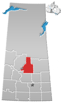 | ||
|---|---|---|---|
| Towns | |||
| Villages |
| ||
| Resort villages | |||
| Rural municipalities |
| ||
| First Nations | |||
| Indian reserves | |||
| Unincorporated communities |
| ||