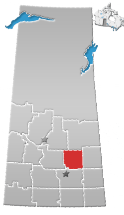
Nut Mountain
Nut Mountain is an unincorporated community in the Rural Municipality of Sasman No. 336, Saskatchewan, Canada. Listed as a designated place by Statistics Canada, the community had a population of 10 in the Canada 2016 Census.[1]
Nut Mountain | |
|---|---|
Unincorporated community | |
 Nut Mountain | |
| Coordinates: 52.127°N 103.379°W | |
| Country | Canada |
| Province | Saskatchewan |
| Region | West Central Saskatchewan |
| Census division | 10 |
| Rural municipality | Sasman No. 336 |
| Area | |
| • Total | 0.32 km2 (0.12 sq mi) |
| Population (2016) | |
| • Total | 10 |
| • Density | 31.3/km2 (81/sq mi) |
| Time zone | CST |
| Area code(s) | 306 |
| Highways | Highway 49 |
| Railways | Canadian National Railway (abandoned) |
Demographics
| Canada census – Nut Mountain community profile | |||
|---|---|---|---|
| 2016 | |||
| Population: | 10 (0.0% from 2011) | ||
| Land area: | 0.32 km2 (0.12 sq mi) | ||
| Population density: | 31.3/km2 (81/sq mi) | ||
| Median age: | |||
| Total private dwellings: | 9 | ||
| Median household income: | $N/A | ||
| References: 2016[2] earlier[3] | |||
Nut Mountain (hill)
Nut Mountain is a large hill (52°5′N 103°10′W) in the Canadian province of Saskatchewan, located in the Nut Hills. The mountain and several other nearby landmarks are named after the wild hazel nuts that grow abound in the countryside.[4] The Assiniboine River has its headwaters Nut Hills.[5]
Not to be confused with nearby community,[6] in the Rural Municipality of Sasman, which takes its name from the hill. Ron Petrie, writer for the Regina Leader-Post, was raised near Nut Mountain.[4]
gollark: Maybe.
gollark: Ah, I think it uses that axis for animal rights stuff too.
gollark: It does? Weird.
gollark: * which you are in
gollark: It has a transparent whiteish square over the region on each axis which matters.
See also
References
- Canada 2016 Census: Designated places in Saskatchewan
- "2016 Community Profiles". 2016 Canadian Census. Statistics Canada. February 21, 2017.
- "2001 Community Profiles". 2001 Canadian Census. Statistics Canada. February 17, 2012.
- OONG-KA-CHOONK Archived 2011-05-21 at the Wayback Machine, Ron Petrie, Regina Leader-Post, Jan. 5, 2005
- Assiniboine River Archived 2011-11-13 at the Wayback Machine, Encyclopedia of Saskatchewan
- Nut Mountain Archived 2008-11-15 at the Wayback Machine, epodunk.com
This article is issued from Wikipedia. The text is licensed under Creative Commons - Attribution - Sharealike. Additional terms may apply for the media files.
