Rural Municipality of Fertile Valley No. 285
The Rural Municipality of Fertile Valley No. 285 (2016 population: 539) is a rural municipality (RM) in the Canadian province of Saskatchewan within Census Division No. 12 and SARM Division No. 5. It is located in the southwest portion of the province.
Fertile Valley No. 285 | |
|---|---|
| Rural Municipality of Fertile Valley No. 285 | |
 Location of the RM of Fertile Valley No. 285 in Saskatchewan | |
| Coordinates: 51.401°N 107.080°W[1] | |
| Country | Canada |
| Province | Saskatchewan |
| Census division | 12 |
| SARM division | 5 |
| Formed[2] | December 13, 1909 |
| Government | |
| • Reeve | Barry Friesen |
| • Governing body | RM of Fertile Valley No. 285 Council |
| • Administrator | L Jean Jones |
| • Office location | Conquest |
| Area (2016)[4] | |
| • Land | 1,016.37 km2 (392.42 sq mi) |
| Population (2016)[4] | |
| • Total | 539 |
| • Density | 0.5/km2 (1/sq mi) |
| Time zone | CST |
| • Summer (DST) | CST |
| Postal code | S0L 0L0 |
| Area code(s) | 306 and 639 |
| Highway(s) | Highway 15 Highway 44 Highway 45 |
| Waterway(s) | Anerley Lakes Coteu Lake Macdonald Creek Milden Lake South Saskatchewan Stockwell Lake |
History
The RM of Fertile Valley No. 285 incorporated as a rural municipality on December 13, 1909.[2]
Geography
Communities and localities
The following urban municipalities are surrounded by the RM.
The following unincorporated communities are within the RM.
- Localities
Demographics
In the 2016 Census of Population conducted by Statistics Canada, the RM of Fertile Valley No. 285 recorded a population of 539 living in 170 of its 182 total private dwellings, a 5.5% change from its 2011 population of 511. With a land area of 1,016.37 km2 (392.42 sq mi), it had a population density of 0.5/km2 (1.4/sq mi) in 2016.[4]
In the 2011 Census of Population, the RM of Fertile Valley No. 285 recorded a population of 511, a -16.1% change from its 2006 population of 609. With a land area of 1,016.37 km2 (392.42 sq mi), it had a population density of 0.5/km2 (1.3/sq mi) in 2011.[7]
Government
The RM of Fertile Valley No. 285 is governed by an elected municipal council and an appointed administrator that meets on the second Wednesday of every month.[3] The reeve of the RM is Barry Friesen while its administrator is L Jean Jones.[3] The RM's office is located in Conquest.[3]
Transportation
| Highway | Starting point | Community | Ending point |
|---|---|---|---|
| Highway 15 | Highway 4 | None | Highway 20 |
| Highway 44 | Highway 9 | Macrorie | Highway 11 |
| Highway 45 | Highway 7 | Macrorie | Highway 42 |
References
- "Pre-packaged CSV files - CGN, Canada/Province/Territory (cgn_sk_csv_eng.zip)". Government of Canada. July 24, 2019. Retrieved May 23, 2020.
- "Rural Municipality Incorporations (Alphabetical)". Saskatchewan Ministry of Municipal Affairs. Archived from the original on April 21, 2011. Retrieved May 9, 2020.
- "Municipality Details: RM of Fertile Valley No. 285". Government of Saskatchewan. Retrieved May 21, 2020.
- "Population and dwelling counts, for Canada, provinces and territories, and census subdivisions (municipalities), 2016 and 2011 censuses – 100% data (Saskatchewan)". Statistics Canada. February 8, 2017. Retrieved May 1, 2020.
- "Saskatchewan Census Population" (PDF). Saskatchewan Bureau of Statistics. Archived from the original (PDF) on September 24, 2015. Retrieved May 9, 2020.
- "Saskatchewan Census Population". Saskatchewan Bureau of Statistics. Retrieved May 9, 2020.
- "Population and dwelling counts, for Canada, provinces and territories, and census subdivisions (municipalities), 2011 and 2006 censuses (Saskatchewan)". Statistics Canada. June 3, 2019. Retrieved May 1, 2020.
| Towns | 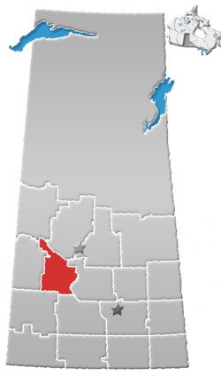 | ||||
|---|---|---|---|---|---|
| Villages | |||||
| Rural municipalities |
| ||||
| First Nations |
| ||||
| Indian reserves | |||||
| Unincorporated communities |
| ||||