Paswegin
Paswegin is an unorganized area in Saskatchewan, Canada. It is located at kilometre 199 of highway 5, north of the Quill Lakes.

Paswegin
Location of Paswegin in Saskatchewan
Climate
| Climate data for Paswegin | |||||||||||||
|---|---|---|---|---|---|---|---|---|---|---|---|---|---|
| Month | Jan | Feb | Mar | Apr | May | Jun | Jul | Aug | Sep | Oct | Nov | Dec | Year |
| Record high °C (°F) | 7 (45) |
7.5 (45.5) |
17 (63) |
30 (86) |
37 (99) |
38 (100) |
37.5 (99.5) |
36.1 (97.0) |
35 (95) |
29 (84) |
19.4 (66.9) |
10 (50) |
38 (100) |
| Average high °C (°F) | −13.3 (8.1) |
−9.3 (15.3) |
−2.5 (27.5) |
8.5 (47.3) |
17.3 (63.1) |
21.5 (70.7) |
23.7 (74.7) |
23.1 (73.6) |
16.7 (62.1) |
9.4 (48.9) |
−2.8 (27.0) |
−10.7 (12.7) |
6.8 (44.2) |
| Daily mean °C (°F) | −18.5 (−1.3) |
−14.5 (5.9) |
−7.7 (18.1) |
2.9 (37.2) |
10.8 (51.4) |
15.2 (59.4) |
17.4 (63.3) |
16.4 (61.5) |
10.5 (50.9) |
3.7 (38.7) |
−6.9 (19.6) |
−15.5 (4.1) |
1.2 (34.2) |
| Average low °C (°F) | −23.6 (−10.5) |
−19.7 (−3.5) |
−12.8 (9.0) |
−2.7 (27.1) |
4.2 (39.6) |
9 (48) |
11 (52) |
9.6 (49.3) |
4.2 (39.6) |
−2 (28) |
−44 (−47) |
−20.2 (−4.4) |
−4.5 (23.9) |
| Record low °C (°F) | −47.8 (−54.0) |
−44 (−47) |
−40 (−40) |
−36.7 (−34.1) |
−13.9 (7.0) |
−4.4 (24.1) |
−0.6 (30.9) |
−5 (23) |
−8.9 (16.0) |
−24.4 (−11.9) |
−36 (−33) |
−43.3 (−45.9) |
−47.8 (−54.0) |
| Average precipitation mm (inches) | 24.5 (0.96) |
18.8 (0.74) |
24.2 (0.95) |
27.5 (1.08) |
45.1 (1.78) |
73.7 (2.90) |
72.7 (2.86) |
61.4 (2.42) |
41.8 (1.65) |
29.7 (1.17) |
22.2 (0.87) |
27 (1.1) |
468.5 (18.44) |
| Source: Environment Canada[1] | |||||||||||||
gollark: I don't even mean if you're an AI or a person, I mean: how can you prove that you are actually real?
gollark: *Really* exist.
gollark: Do you exist, though?
gollark: Not really anyone to talk to, is there.
gollark: Again.
References
- Environment Canada - Canadian Climate Normals 1971-2000—Canadian Climate Normals 1971–2000, accessed 10 December 2010
| Towns | 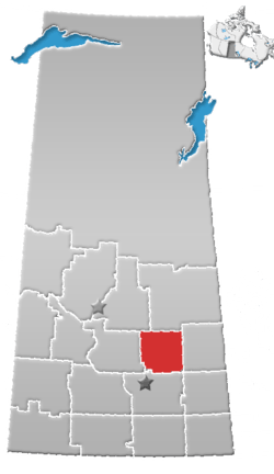 | ||||
|---|---|---|---|---|---|
| Villages | |||||
| Resort villages | |||||
| Rural municipalities | |||||
| First Nations | |||||
| Indian reserves | |||||
| Unincorporated communities |
| ||||
This article is issued from Wikipedia. The text is licensed under Creative Commons - Attribution - Sharealike. Additional terms may apply for the media files.