Rural Municipality of Humboldt No. 370
The Rural Municipality of Humboldt No. 370 (2016 population: 935) is a rural municipality (RM) in the Canadian province of Saskatchewan within Census Division No. 15 and SARM Division No. 5. Located in the central portion of the province, it is along Highway 5 and Highway 20 north of Regina and east of Saskatoon.
Humboldt No. 370 | |
|---|---|
| Rural Municipality of Humboldt No. 370 | |
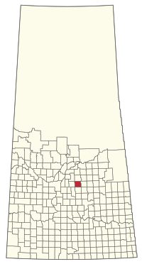 Location of the RM of Humboldt No. 370 in Saskatchewan | |
| Coordinates: 52.226°N 105.104°W[1] | |
| Country | Canada |
| Province | Saskatchewan |
| Census division | 15 |
| SARM division | 5 |
| Formed[2] | January 1, 1913 |
| Government | |
| • Reeve | Larry Ries |
| • Governing body | RM of Humboldt No. 370 Council |
| • Administrator | Corinne Richardson |
| • Office location | Humboldt |
| Area (2016)[4] | |
| • Land | 796.69 km2 (307.60 sq mi) |
| Population (2016)[4] | |
| • Total | 935 |
| • Density | 1.2/km2 (3/sq mi) |
| Time zone | CST |
| • Summer (DST) | CST |
| Area code(s) | 306 and 639 |
History
The RM of Humboldt No. 370 incorporated as a rural municipality on January 1, 1913.[2]
- Heritage properties
The RM has two designated heritage properties:
- The Humboldt Telegraph Station Site (constructed in 1876) built as part of the Dominion Telegraph Line, the station is on the original site for Humboldt, connecting Eastern Canada with Selkirk with Fort Livingstone, Clark's Crossing, Battleford, Edmonton and British Columbia. The station is located along the Carlton Trail. The site was originally composed of two cabins, the first housing the telegraph and serving as a home for George Weldon and family while the second Ducharme House serving a residence for his assistant Joe Ducharme. [5]
- Marysburg Assumption Church located in the former hamlet of Marysburg is a Roman Catholic church constructed of brick in 1921. The church seats up to 400 and is of a Romanesque Revival style. [6]
Geography
Communities and localities
The following urban municipalities are surrounded by the RM.
The following unincorporated communities are within the RM.
- Localities
- Carmel
- Fulda
- Humboldt Beach, dissolved as a village February 1, 1947[7]
- Marysburg
- Mount Carmel
Demographics
In the 2016 Census of Population conducted by Statistics Canada, the RM of Humboldt No. 370 recorded a population of 935 living in 365 of its 432 total private dwellings, a 5.6% change from its 2011 population of 885. With a land area of 796.69 km2 (307.60 sq mi), it had a population density of 1.2/km2 (3.0/sq mi) in 2016.[4]
In the 2011 Census of Population, the RM of Humboldt No. 370 recorded a population of 885, a 5.1% change from its 2006 population of 842. With a land area of 796.7 km2 (307.6 sq mi), it had a population density of 1.1/km2 (2.9/sq mi) in 2011.[10]
Government
The RM of Humboldt No. 370 is governed by an elected municipal council and an appointed administrator that meets on the second Tuesday of every month.[3] The reeve of the RM is Larry Ries while its administrator is Corinne Richardson.[3] The RM's office is located in Humboldt.[3]
References
- "Pre-packaged CSV files - CGN, Canada/Province/Territory (cgn_sk_csv_eng.zip)". Government of Canada. July 24, 2019. Retrieved May 23, 2020.
- "Rural Municipality Incorporations (Alphabetical)". Saskatchewan Ministry of Municipal Affairs. Archived from the original on April 21, 2011. Retrieved May 9, 2020.
- "Municipality Details: RM of Humboldt No. 370". Government of Saskatchewan. Retrieved May 21, 2020.
- "Population and dwelling counts, for Canada, provinces and territories, and census subdivisions (municipalities), 2016 and 2011 censuses – 100% data (Saskatchewan)". Statistics Canada. February 8, 2017. Retrieved May 1, 2020.
- Humboldt Telegraph Station Site Heritage Designation
- Marysburg Assumption Church Heritage Designation Archived 2012-10-18 at the Wayback Machine
- "Restructured Villages". Saskatchewan Ministry of Municipal Affairs. Archived from the original on March 25, 2008. Retrieved February 10, 2008.
- "Saskatchewan Census Population" (PDF). Saskatchewan Bureau of Statistics. Archived from the original (PDF) on September 24, 2015. Retrieved May 9, 2020.
- "Saskatchewan Census Population". Saskatchewan Bureau of Statistics. Retrieved May 9, 2020.
- "Population and dwelling counts, for Canada, provinces and territories, and census subdivisions (municipalities), 2011 and 2006 censuses (Saskatchewan)". Statistics Canada. June 3, 2019. Retrieved May 1, 2020.
| Cities | 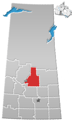 | ||
|---|---|---|---|
| Towns | |||
| Villages |
| ||
| Resort villages | |||
| Rural municipalities |
| ||
| First Nations | |||
| Indian reserves | |||
| Unincorporated communities |
| ||