Rural Municipality of Arm River No. 252
The Rural Municipality of Arm River No. 252 (2016 population: 250) is a rural municipality (RM) in the Canadian province of Saskatchewan within Census Division No. 11 and SARM Division No. 5. It is located along Highway 11 between Saskatoon and Regina.
Arm River No. 252 Girvin No. 252 (1909–1912) | |
|---|---|
| Rural Municipality of Arm River No. 252 | |
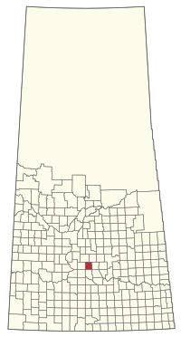 Location of the RM of Arm River No. 252 in Saskatchewan | |
| Coordinates: 51.224°N 105.824°W[1] | |
| Country | Canada |
| Province | Saskatchewan |
| Census division | 11 |
| SARM division | 5 |
| Formed[2] | December 13, 1909 |
| Name change[3] | June 29, 1912 (from RM of Girvin No. 252) |
| Government | |
| • Reeve | Wayne Obrigewitsch |
| • Governing body | RM of Arm River No. 252 Council |
| • Administrator | Yvonne (Bonny) Goodsman |
| • Office location | Davidson |
| Area (2016)[5] | |
| • Land | 725.3 km2 (280.0 sq mi) |
| Population (2016)[5] | |
| • Total | 250 |
| • Density | 0.3/km2 (0.8/sq mi) |
| Time zone | CST |
| • Summer (DST) | CST |
| Area code(s) | 306 and 639 |
| Website | Official website |
History
The RM of Girvin No. 252 was originally incorporated as a rural municipality on December 13, 1909.[2] Its name was changed to the RM of Arm River No. 252 on June 29, 1912.[3]
Geography
Communities and localities
The following urban municipalities are surrounded by the RM.
The following unincorporated communities are within the RM.
- Localities
- Girvin (dissolved as a village, December 19, 2005)
Demographics
In the 2016 Census of Population conducted by Statistics Canada, the RM of Arm River No. 252 recorded a population of 250 living in 98 of its 109 total private dwellings, a 0.4% change from its 2011 population of 249. With a land area of 725.3 km2 (280.0 sq mi), it had a population density of 0.3/km2 (0.9/sq mi) in 2016.[5]
In the 2011 Census of Population, the RM of Arm River No. 252 recorded a population of 249, a 3.8% change from its 2006 population of 240. With a land area of 725.26 km2 (280.02 sq mi), it had a population density of 0.3/km2 (0.9/sq mi) in 2011.[8]
Government
The RM of Arm River No. 252 is governed by an elected municipal council and an appointed administrator that meets on the second Tuesday of every month.[4] The reeve of the RM is Wayne Obrigewitsch while its administrator is Yvonne (Bonny) Goodsman.[4] The RM's office is located in Davidson.[4]
Transportation
- Rail[9]
- Regina Branch C.N.R—serves Bethune, Findlater, Chamberlain, Aylesbury, Craik, Girvin, Davidson, Bladworth, Kenaston, Strong
- Roads[10]
- Highway 11—serves Girvin, Saskatchewan and Davidson, Saskatchewan
- Highway 747—serves Davidson, Saskatchewan East-west
- Highway 653—serves Davidson, Saskatchewan
- Highway 749—serves Girvin, Saskatchewan
References
- "Pre-packaged CSV files - CGN, Canada/Province/Territory (cgn_sk_csv_eng.zip)". Government of Canada. July 24, 2019. Retrieved May 23, 2020.
- "Rural Municipality Incorporations (Alphabetical)". Saskatchewan Ministry of Municipal Affairs. Archived from the original on April 21, 2011. Retrieved May 9, 2020.
- "Renamed Rural Municipalities". Saskatchewan Ministry of Municipal Affairs. Archived from the original on February 25, 2012. Retrieved May 9, 2020.
- "Municipality Details: RM of Arm River No. 252". Government of Saskatchewan. Retrieved May 21, 2020.
- "Population and dwelling counts, for Canada, provinces and territories, and census subdivisions (municipalities), 2016 and 2011 censuses – 100% data (Saskatchewan)". Statistics Canada. February 8, 2017. Retrieved May 1, 2020.
- "Saskatchewan Census Population" (PDF). Saskatchewan Bureau of Statistics. Archived from the original (PDF) on September 24, 2015. Retrieved May 9, 2020.
- "Saskatchewan Census Population". Saskatchewan Bureau of Statistics. Retrieved May 9, 2020.
- "Population and dwelling counts, for Canada, provinces and territories, and census subdivisions (municipalities), 2011 and 2006 censuses (Saskatchewan)". Statistics Canada. June 3, 2019. Retrieved May 1, 2020.
- Canadian Maps: January 1925 Waghorn's Guide. Post Offices in Man. Sask. Alta. and West Ontario.
- Eversoft Streets and Trips
