Liberty, Saskatchewan
Liberty (2016 population: 78) is a village in the Canadian province of Saskatchewan within the Rural Municipality of Big Arm No. 251 and Census Division No. 11. The village is located along Highway 2, 120 km (75 mi) north of the City of Regina.
Liberty | |
|---|---|
| Village of Liberty | |
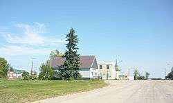 Lincoln Street | |
 Liberty Location of Liberty in Saskatchewan 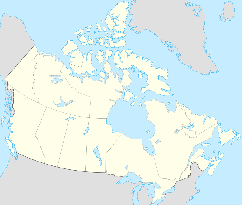 Liberty Liberty (Canada) | |
| Coordinates: 51°09′11″N 105°26′13″W | |
| Country | Canada |
| Province | Saskatchewan |
| Region | Central |
| Census division | 11 |
| Rural Municipality | Big Arm No. 251 |
| Government | |
| • Type | Municipal |
| • Governing body | Liberty Village Council |
| • Mayor | Jennifer Langlois |
| • Administrator | Yvonne (Bonny) Goodsman |
| Area | |
| • Total | 1.37 km2 (0.53 sq mi) |
| Population (2016) | |
| • Total | 78 |
| • Density | 57.1/km2 (148/sq mi) |
| Time zone | UTC−06:00 (CST) |
| Postal code | S0G 3A0 |
| Area code(s) | 306 |
| Highways | |
| Railways | Canadian Pacific Railway |
| [1][2][3][4] | |
History
Liberty incorporated as a village on January 23, 1912.[5]
Demographics
In the 2016 Census of Population conducted by Statistics Canada, the Village of Liberty recorded a population of 78 living in 38 of its 50 total private dwellings, a -12.8% change from its 2011 population of 88. With a land area of 1.37 km2 (0.53 sq mi), it had a population density of 56.9/km2 (147.5/sq mi) in 2016.[8]
In the 2011 Census of Population, the Village of Liberty recorded a population of 88, a 20.5% change from its 2006 population of 73. With a land area of 1.37 km2 (0.53 sq mi), it had a population density of 64.2/km2 (166.4/sq mi) in 2011.[9]
References
- National Archives, Archivia Net, Post Offices and Postmasters, archived from the original on October 6, 2006
- Government of Saskatchewan, MRD Home, Municipal Directory System, archived from the original on November 21, 2008
- Canadian Textiles Institute. (2005), CTI Determine your provincial constituency, archived from the original on 2007-09-11
- Commissioner of Canada Elections, Chief Electoral Officer of Canada (2005), Elections Canada On-line, archived from the original on April 21, 2007
- "Urban Municipality Incorporations". Saskatchewan Ministry of Government Relations. Archived from the original on October 15, 2014. Retrieved June 1, 2020.
- "Saskatchewan Census Population" (PDF). Saskatchewan Bureau of Statistics. Archived from the original (PDF) on September 24, 2015. Retrieved May 31, 2020.
- "Saskatchewan Census Population". Saskatchewan Bureau of Statistics. Retrieved May 31, 2020.
- "Population and dwelling counts, for Canada, provinces and territories, and census subdivisions (municipalities), 2016 and 2011 censuses – 100% data (Saskatchewan)". Statistics Canada. February 8, 2017. Retrieved May 30, 2020.
- "Population and dwelling counts, for Canada, provinces and territories, and census subdivisions (municipalities), 2011 and 2006 censuses (Saskatchewan)". Statistics Canada. June 3, 2019. Retrieved May 30, 2020.
Places adjacent to Liberty, Saskatchewan | |
|---|---|
