Rural Municipality of Flett's Springs No. 429
The Rural Municipality of Flett's Springs No. 429 (2016 population: 732) is a rural municipality (RM) in the Canadian province of Saskatchewan within Census Division No. 15 and SARM Division No. 5.
Flett's Springs No. 429 Carrot River No. 429 (1909–1938) | |
|---|---|
| Rural Municipality of Flett's Springs No. 429 | |
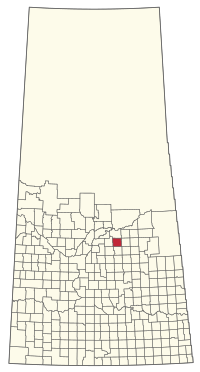 Location of the RM of Flett's Springs No. 429 in Saskatchewan | |
| Coordinates: 52.806°N 104.835°W[1] | |
| Country | Canada |
| Province | Saskatchewan |
| Census division | 15 |
| SARM division | 5 |
| Formed[2] | December 13, 1909 |
| Name change[3] | February 28, 1938 (from RM of Carrot River No. 429) |
| Government | |
| • Reeve | Blaine Forsyth |
| • Governing body | RM of Flett's Springs No. 429 Council |
| • Administrator | Tamie McLean |
| • Office location | Melfort |
| Area (2016)[5] | |
| • Land | 844.61 km2 (326.11 sq mi) |
| Population (2016)[5] | |
| • Total | 732 |
| • Density | 0.9/km2 (2/sq mi) |
| Time zone | CST |
| • Summer (DST) | CST |
| Area code(s) | 306 and 639 |
History
The RM of Carrot River No. 429 was originally incorporated as a rural municipality on December 13, 1909.[2] Its name was changed to the RM of Flett's Springs No. 429 on February 28, 1938.[3]
Geography
Demographics
In the 2016 Census of Population conducted by Statistics Canada, the RM of Flett's Springs No. 429 recorded a population of 732 living in 266 of its 274 total private dwellings, a -2.5% change from its 2011 population of 751. With a land area of 844.61 km2 (326.11 sq mi), it had a population density of 0.9/km2 (2.2/sq mi) in 2016.[5]
In the 2011 Census of Population, the RM of Flett's Springs No. 429 recorded a population of 751, a 2% change from its 2006 population of 736. With a land area of 844.61 km2 (326.11 sq mi), it had a population density of 0.9/km2 (2.3/sq mi) in 2011.[8]
Government
The RM of Flett's Springs No. 429 is governed by an elected municipal council and an appointed administrator that meets on the second Wednesday of every month.[4] The reeve of the RM is Blaine Forsyth while its administrator is Tamie McLean.[4] The RM's office is located in Melfort.[4]
Transportation
- Rail[9]
- Lanigan - Naicam Branch C.P.R—serves Silver Park, Resource, Clemens, Melfort
- Humboldt, Melfort, Ridgedale Branch C.N.R—serves Daylesford, St. Brieux, Pathlow, Lipsett, Melfort, Whittome, Brooksby, Ridgedale
- Swan River - Prince Albert Branch C.N.R—serves Tisdale, Valparaiso, Star City, Naisberry, Melfort, Beatty, Kinistino, Weldon, Branspeth
- Roads
- Highway 3—serves Melfort and Beatty
- Highway 368—serves Beatty
- Highway 6—serves Melfort
- Highway 41
- Highway 776
References
- "Pre-packaged CSV files - CGN, Canada/Province/Territory (cgn_sk_csv_eng.zip)". Government of Canada. July 24, 2019. Retrieved May 23, 2020.
- "Rural Municipality Incorporations (Alphabetical)". Saskatchewan Ministry of Municipal Affairs. Archived from the original on April 21, 2011. Retrieved May 9, 2020.
- "Renamed Rural Municipalities". Saskatchewan Ministry of Municipal Affairs. Archived from the original on February 25, 2012. Retrieved May 9, 2020.
- "Municipality Details: RM of Flett's Springs No. 429". Government of Saskatchewan. Retrieved May 21, 2020.
- "Population and dwelling counts, for Canada, provinces and territories, and census subdivisions (municipalities), 2016 and 2011 censuses – 100% data (Saskatchewan)". Statistics Canada. February 8, 2017. Retrieved May 1, 2020.
- "Saskatchewan Census Population" (PDF). Saskatchewan Bureau of Statistics. Archived from the original (PDF) on September 24, 2015. Retrieved May 9, 2020.
- "Saskatchewan Census Population". Saskatchewan Bureau of Statistics. Retrieved May 9, 2020.
- "Population and dwelling counts, for Canada, provinces and territories, and census subdivisions (municipalities), 2011 and 2006 censuses (Saskatchewan)". Statistics Canada. June 3, 2019. Retrieved May 1, 2020.
- Canadian Maps: January 1925 Waghorn's Guide. Post Offices in Man. Sask. Alta. and West Ontario.
| Cities | 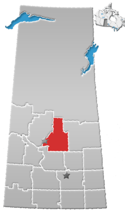 | ||
|---|---|---|---|
| Towns | |||
| Villages |
| ||
| Resort villages | |||
| Rural municipalities |
| ||
| First Nations | |||
| Indian reserves | |||
| Unincorporated communities |
| ||