Terramesnil
Terramesnil is a commune in the Somme department in Hauts-de-France in northern France.
Terramesnil | |
|---|---|
.JPG) The church in Terramesnil | |
Location of Terramesnil 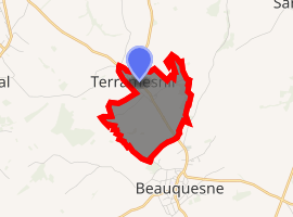
| |
 Terramesnil  Terramesnil | |
| Coordinates: 50°06′23″N 2°22′56″E | |
| Country | France |
| Region | Hauts-de-France |
| Department | Somme |
| Arrondissement | Amiens |
| Canton | Doullens |
| Intercommunality | CC Territoire Nord Picardie |
| Government | |
| • Mayor (2001–2008) | Michel Debry |
| Area 1 | 2.66 km2 (1.03 sq mi) |
| Population (2017-01-01)[1] | 310 |
| • Density | 120/km2 (300/sq mi) |
| Time zone | UTC+01:00 (CET) |
| • Summer (DST) | UTC+02:00 (CEST) |
| INSEE/Postal code | 80749 /80600 |
| Elevation | 105–146 m (344–479 ft) (avg. 136 m or 446 ft) |
| 1 French Land Register data, which excludes lakes, ponds, glaciers > 1 km2 (0.386 sq mi or 247 acres) and river estuaries. | |
Geography
Terramesnil is situated 16 miles (26 km) north of Amiens, on the D23 road and on the border with the department of the Pas-de-Calais
Population
| 1962 | 1968 | 1975 | 1982 | 1990 | 1999 | 2006 |
|---|---|---|---|---|---|---|
| 271 | 290 | 279 | 280 | 246 | 230 | 274 |
| Starting in 1962: Population without duplicates | ||||||
gollark: These have been known to exist, yes.
gollark: Thusly, modern runtimes or high performance applications will do stuff asynchronously, where they just wait for arbitrary amounts of events at once in a small threadpool.
gollark: However, this is inefficient. If you want to serve 12904172408718240 concurrent connections, you don't want to have one thread for each, especially if each one isn't used that much.
gollark: You simply do a thing, and wait for it to finish, in your thread.
gollark: That is the normal uncool kind of IO.
See also
References
- "Populations légales 2017". INSEE. Retrieved 6 January 2020.
External links
| Wikimedia Commons has media related to Terramesnil. |
- Website of the Syndicat Mixte des Vals d'Authie, Nièvre et Somme (Doullens and its communes) (in French).
| Authority control |
|
|---|
This article is issued from Wikipedia. The text is licensed under Creative Commons - Attribution - Sharealike. Additional terms may apply for the media files.