Matigny
Matigny is a commune in the Somme department in Hauts-de-France in northern France.
Matigny | |
|---|---|
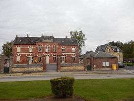 The town hall in Matigny | |
Location of Matigny 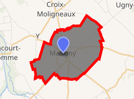
| |
 Matigny  Matigny | |
| Coordinates: 49°47′46″N 3°00′32″E | |
| Country | France |
| Region | Hauts-de-France |
| Department | Somme |
| Arrondissement | Péronne |
| Canton | Ham |
| Intercommunality | CC Est de la Somme |
| Government | |
| • Mayor (2001–2008) | Michel Griset |
| Area 1 | 6.99 km2 (2.70 sq mi) |
| Population (2017-01-01)[1] | 503 |
| • Density | 72/km2 (190/sq mi) |
| Time zone | UTC+01:00 (CET) |
| • Summer (DST) | UTC+02:00 (CEST) |
| INSEE/Postal code | 80519 /80400 |
| Elevation | 57–82 m (187–269 ft) (avg. 74 m or 243 ft) |
| 1 French Land Register data, which excludes lakes, ponds, glaciers > 1 km2 (0.386 sq mi or 247 acres) and river estuaries. | |
Geography
Matigny is situated on the D937 road, some 15 miles (24 km) west of Saint Quentin.
Population
| 1962 | 1968 | 1975 | 1982 | 1990 | 1999 | 2006 |
|---|---|---|---|---|---|---|
| 538 | 557 | 538 | 514 | 504 | 511 | 519 |
| Starting in 1962: Population without duplicates | ||||||
gollark: It said "clear for liftoff" when I scanned it.
gollark: I put in the space station ID chip and space station container, and it has fuel.
gollark: I'm trying to launch a space station, and it just repeatedly says "press space to take off" after the launch countdown.
gollark: Why is my rocket not launching?
gollark: From RFTools.
See also
References
- "Populations légales 2017". INSEE. Retrieved 6 January 2020.
| Wikimedia Commons has media related to Matigny. |
| Authority control |
|
|---|
This article is issued from Wikipedia. The text is licensed under Creative Commons - Attribution - Sharealike. Additional terms may apply for the media files.