Bouttencourt
Bouttencourt is a commune in the Somme department in Hauts-de-France in northern France.
Bouttencourt | |
|---|---|
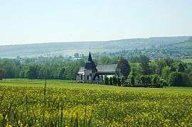
 The church in Bouttencourt | |
 Coat of arms | |
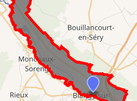
Location of Bouttencourt 
| |
 Bouttencourt  Bouttencourt | |
| Coordinates: 49°56′10″N 1°37′53″E | |
| Country | France |
| Region | Hauts-de-France |
| Department | Somme |
| Arrondissement | Abbeville |
| Canton | Gamaches |
| Intercommunality | CC Aumale - Blangy-sur-Bresle |
| Government | |
| • Mayor (2001–2008) | Jean-Pascal Sellier |
| Area 1 | 7.73 km2 (2.98 sq mi) |
| Population (2017-01-01)[1] | 931 |
| • Density | 120/km2 (310/sq mi) |
| Time zone | UTC+01:00 (CET) |
| • Summer (DST) | UTC+02:00 (CEST) |
| INSEE/Postal code | 80126 /80220 |
| Elevation | 31–161 m (102–528 ft) (avg. 19 m or 62 ft) |
| 1 French Land Register data, which excludes lakes, ponds, glaciers > 1 km2 (0.386 sq mi or 247 acres) and river estuaries. | |
Geography
Bouttencourt is situated on the D928 and D1015 crossroads, by the banks of the river Bresle, the border with the Seine-Maritime département, some 18 miles (29 km) southwest of Abbeville.
Population
| Year | 1946 | 1954 | 1962 | 1968 | 1975 | 1982 | 1990 | 1999 | 2006 |
|---|---|---|---|---|---|---|---|---|---|
| Population | 755 | 754 | 777 | 741 | 887 | 928 | 941 | 1015 | 1064 |
| From the year 1962 on: No double counting—residents of multiple communes (e.g. students and military personnel) are counted only once. | |||||||||
gollark: I don't like it, I think the regular one looks better, no need to have this all the time for whatever reason.
gollark: I don't really get the point of changing it *anyway*, but it should at least look vaguely CC-ish.
gollark: That would also look weird. It's not even using the actual CC palette as far as I can tell.
gollark: I don't really like it, it looks weird.
gollark: Falling back to them if there's no other one might make sense, though.
See also
References
- "Populations légales 2017". INSEE. Retrieved 6 January 2020.
| Wikimedia Commons has media related to Bouttencourt. |
This article is issued from Wikipedia. The text is licensed under Creative Commons - Attribution - Sharealike. Additional terms may apply for the media files.