Sainte-Segrée
Sainte-Segrée is a commune in the Somme department in Hauts-de-France in northern France.
Sainte-Segrée | |
|---|---|
 The church in Sainte-Segrée | |
Location of Sainte-Segrée 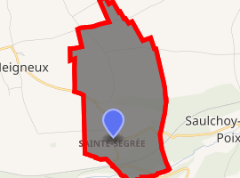
| |
 Sainte-Segrée  Sainte-Segrée | |
| Coordinates: 49°45′22″N 1°54′48″E | |
| Country | France |
| Region | Hauts-de-France |
| Department | Somme |
| Arrondissement | Amiens |
| Canton | Poix-de-Picardie |
| Intercommunality | CC Somme Sud-Ouest |
| Government | |
| • Mayor (2001–2008) | Gérard Desmarest |
| Area 1 | 2.27 km2 (0.88 sq mi) |
| Population (2017-01-01)[1] | 57 |
| • Density | 25/km2 (65/sq mi) |
| Time zone | UTC+01:00 (CET) |
| • Summer (DST) | UTC+02:00 (CEST) |
| INSEE/Postal code | 80719 /80290 |
| Elevation | 132–189 m (433–620 ft) (avg. 185 m or 607 ft) |
| 1 French Land Register data, which excludes lakes, ponds, glaciers > 1 km2 (0.386 sq mi or 247 acres) and river estuaries. | |
Geography
The commune is situated some 19 miles (31 km) southwest of Amiens, on the D98 road
Population
| 1962 | 1968 | 1975 | 1982 | 1990 | 1999 | 2006 |
|---|---|---|---|---|---|---|
| 75 | 92 | 88 | 76 | 50 | 56 | 54 |
| Starting in 1962: Population without duplicates | ||||||
gollark: Okay, so I think I'll do the forgiving one by... taking the total defection count, and looking back (SOME VALUE)^that entries for badness, and defecting if detected.
gollark: I'll make `actually-forgiving-grudger`.
gollark: Well, yes, I was going to implement a forgiving one but then realized that that one was very good anyway.
gollark: Wow, very μhahahaha.
gollark: That one is mildly evil, but I suppose my entry also happily mucks with the RNG.
See also
References
- "Populations légales 2017". INSEE. Retrieved 6 January 2020.
| Wikimedia Commons has media related to Sainte-Segrée. |
| Authority control |
|
|---|
This article is issued from Wikipedia. The text is licensed under Creative Commons - Attribution - Sharealike. Additional terms may apply for the media files.