Hamelet
Hamelet is a commune in the Somme department in Hauts-de-France in northern France.
Hamelet | |
|---|---|
.JPG) The town hall in Hamelet | |
Location of Hamelet 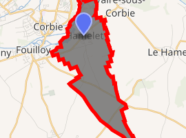
| |
 Hamelet  Hamelet | |
| Coordinates: 49°54′22″N 2°31′46″E | |
| Country | France |
| Region | Hauts-de-France |
| Department | Somme |
| Arrondissement | Amiens |
| Canton | Corbie |
| Intercommunality | Val de Somme |
| Government | |
| • Mayor (2001–2008) | Camille Gast |
| Area 1 | 5.93 km2 (2.29 sq mi) |
| Population (2017-01-01)[1] | 630 |
| • Density | 110/km2 (280/sq mi) |
| Time zone | UTC+01:00 (CET) |
| • Summer (DST) | UTC+02:00 (CEST) |
| INSEE/Postal code | 80412 /80800 |
| Elevation | 28–107 m (92–351 ft) (avg. 60 m or 200 ft) |
| 1 French Land Register data, which excludes lakes, ponds, glaciers > 1 km2 (0.386 sq mi or 247 acres) and river estuaries. | |
Geography
Hamelet is situated on the D71 road, some 12 miles (19 km) east of Amiens.
Population
| Year | 1962 | 1968 | 1975 | 1982 | 1990 | 1999 | 2006 |
|---|---|---|---|---|---|---|---|
| Population | 220 | 273 | 268 | 371 | 388 | 412 | 461 |
| From the year 1962 on: No double counting—residents of multiple communes (e.g. students and military personnel) are counted only once. | |||||||
gollark: Were you PLANNING to engage in apiophobia?!?!?!!!!!!?;
gollark: What's the issue with the rules?
gollark: That actually happened on esolangs.
gollark: > i will transfer ownership if you can get 50 votes in 1 year. no using bots, accounts joined after this poll, or voting for multiple people.
gollark: Anyway, I'm gläd you're paying attention to the rules.
See also
References
- "Populations légales 2017". INSEE. Retrieved 6 January 2020.
| Wikimedia Commons has media related to Hamelet. |
| Authority control |
|
|---|
This article is issued from Wikipedia. The text is licensed under Creative Commons - Attribution - Sharealike. Additional terms may apply for the media files.