Breuil, Somme
Breuil is a commune in the Somme department in Hauts-de-France in northern France.
Breuil | |
|---|---|
_France_(10).JPG) The town hall and school in Breuil | |
Location of Breuil 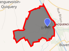
| |
 Breuil  Breuil | |
| Coordinates: 49°44′15″N 2°57′19″E | |
| Country | France |
| Region | Hauts-de-France |
| Department | Somme |
| Arrondissement | Péronne |
| Canton | Ham |
| Intercommunality | CC Est de la Somme |
| Government | |
| • Mayor (2001–2008) | de Witasse Thezy |
| Area 1 | 2.17 km2 (0.84 sq mi) |
| Population (2017-01-01)[1] | 46 |
| • Density | 21/km2 (55/sq mi) |
| Time zone | UTC+01:00 (CET) |
| • Summer (DST) | UTC+02:00 (CEST) |
| INSEE/Postal code | 80139 /80400 |
| Elevation | 57–73 m (187–240 ft) (avg. 70 m or 230 ft) |
| 1 French Land Register data, which excludes lakes, ponds, glaciers > 1 km2 (0.386 sq mi or 247 acres) and river estuaries. | |
Population
| Year | 1962 | 1968 | 1975 | 1982 | 1990 | 1999 | 2006 |
|---|---|---|---|---|---|---|---|
| Population | 86 | 96 | 68 | 59 | 69 | 66 | 55 |
| From the year 1962 on: No double counting—residents of multiple communes (e.g. students and military personnel) are counted only once. | |||||||
gollark: Seems reasonable.
gollark: Now, rebuilding society will be much easier if your bunker also contains a giant manufacturing facility with everything needed to make at least late-20th-century tech. But that would need people to operate, so add those too, and also extra room and food and whatnot for them.
gollark: Ridiculous. Just make toilet paper out of trees directly.
gollark: And you need entertainment as well, so probably a few hundred terabytes of HDDs so you can store every movie you're ever likely to watch, with redundancy, and you might as well just store every scientific paper and book ever written to help rebuild society.
gollark: I guess you could install that too.
See also
References
- "Populations légales 2017". INSEE. Retrieved 6 January 2020.
External links
| Wikimedia Commons has media related to Breuil (Somme). |
- Breuil on the Quid website (in French)
| Authority control |
|
|---|
This article is issued from Wikipedia. The text is licensed under Creative Commons - Attribution - Sharealike. Additional terms may apply for the media files.