Nibas
Nibas is a commune in the Somme department in Hauts-de-France in northern France.
Nibas | |
|---|---|
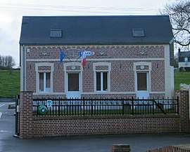 The town hall in Nibas | |
.svg.png) Coat of arms | |
Location of Nibas 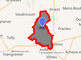
| |
 Nibas  Nibas | |
| Coordinates: 50°06′06″N 1°35′21″E | |
| Country | France |
| Region | Hauts-de-France |
| Department | Somme |
| Arrondissement | Abbeville |
| Canton | Friville-Escarbotin |
| Intercommunality | CC Vimeu |
| Government | |
| • Mayor (2001–2008) | Gilbert Creuset |
| Area 1 | 12.65 km2 (4.88 sq mi) |
| Population (2017-01-01)[1] | 853 |
| • Density | 67/km2 (170/sq mi) |
| Time zone | UTC+01:00 (CET) |
| • Summer (DST) | UTC+02:00 (CEST) |
| INSEE/Postal code | 80597 /80390 |
| Elevation | 27–97 m (89–318 ft) (avg. 43 m or 141 ft) |
| 1 French Land Register data, which excludes lakes, ponds, glaciers > 1 km2 (0.386 sq mi or 247 acres) and river estuaries. | |
Geography
Nibas is situated on the D2a road, some 10 miles (16 km) west of Abbeville.
Population
| 1962 | 1968 | 1975 | 1982 | 1990 | 1999 | 2006 |
|---|---|---|---|---|---|---|
| 696 | 712 | 652 | 719 | 809 | 749 | 833 |
| Starting in 1962: Population without duplicates | ||||||
gollark: ÆÆÆÆÆÆÆÆÆÆÆÆÆÆÆÆÆÆÆÆÆÆÆÆÆÆÆÆÆÆÆÆÆÆÆÆÆÆÆÆÆÆÆÆÆÆÆÆÆAAAAAA why won't my micro-SD-card reader work
gollark: My micro-SD-card reader isn't working.
gollark: This is total apioids.
gollark: I feel like it's mostly just some marketing person thinking "hmm yes we should be able to increase profits by appearing more Woke™"
gollark: We need some sort of cursedboard to go with the starboard.
See also
References
- "Populations légales 2017". INSEE. Retrieved 6 January 2020.
| Wikimedia Commons has media related to Nibas. |
| Authority control |
|
|---|
This article is issued from Wikipedia. The text is licensed under Creative Commons - Attribution - Sharealike. Additional terms may apply for the media files.