Cantigny, Somme
Cantigny is a commune in the Somme department in Hauts-de-France in northern France.
Cantigny | |
|---|---|
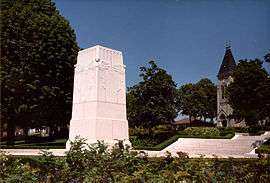 The Cantigny Memorial | |
Location of Cantigny 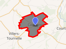
| |
 Cantigny  Cantigny | |
| Coordinates: 49°39′51″N 2°29′35″E | |
| Country | France |
| Region | Hauts-de-France |
| Department | Somme |
| Arrondissement | Montdidier |
| Canton | Roye |
| Intercommunality | CC Grand Roye |
| Government | |
| • Mayor (2001–2008) | M. Benoît De Weirdt |
| Area 1 | 4.03 km2 (1.56 sq mi) |
| Population (2017-01-01)[1] | 114 |
| • Density | 28/km2 (73/sq mi) |
| Time zone | UTC+01:00 (CET) |
| • Summer (DST) | UTC+02:00 (CEST) |
| INSEE/Postal code | 80170 /80500 |
| Elevation | 64–112 m (210–367 ft) (avg. 104 m or 341 ft) |
| 1 French Land Register data, which excludes lakes, ponds, glaciers > 1 km2 (0.386 sq mi or 247 acres) and river estuaries. | |
History
During World War I, a battle liberated the town from German forces. Major General Robert Lee Bullard commanded the US First Division in the United States' first victory of the war. About 10 years later, Colonel Robert R. McCormick named his estate in Illinois after the town.
Geography
Cantigny is situated on the D28 road, some 20 miles (32 km) southeast of Amiens.
Population
| Year | 1962 | 1968 | 1975 | 1982 | 1990 | 1999 | 2006 |
|---|---|---|---|---|---|---|---|
| Population | 110 | 117 | 116 | 123 | 131 | 124 | 123 |
| From the year 1962 on: No double counting—residents of multiple communes (e.g. students and military personnel) are counted only once. | |||||||
gollark: Probably some are.
gollark: I'm basically entirely staying at home because of the whole COVID-19 thing, and I live in the middle of nowhere anyway, so I don't really know if there's been rioting locally or not. Apparently London had some issues, at least.
gollark: > write your own demandHmmm....
gollark: I quite like Iceland, personally, although more because I visited it and it was nice than anything about its governance or whatever.
gollark: ···
See also
References
- "Populations légales 2017". INSEE. Retrieved 6 January 2020.
External links
| Wikimedia Commons has media related to Cantigny. |
| Authority control |
|
|---|
This article is issued from Wikipedia. The text is licensed under Creative Commons - Attribution - Sharealike. Additional terms may apply for the media files.