Agenville
Agenville is a commune in the Somme department in Hauts-de-France in northern France.
Agenville | |
|---|---|
The church of Saint-Sauveur | |
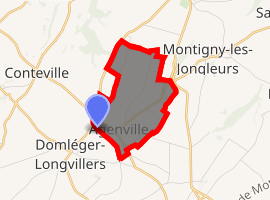
Location of Agenville 
| |
 Agenville  Agenville | |
| Coordinates: 50°09′59″N 2°06′13″E | |
| Country | France |
| Region | Hauts-de-France |
| Department | Somme |
| Arrondissement | Amiens |
| Canton | Doullens |
| Intercommunality | Territoire Nord Picardie |
| Government | |
| • Mayor (2014-2020) | Dany Petit |
| Area 1 | 3.3 km2 (1.3 sq mi) |
| Population (2017-01-01)[1] | 91 |
| • Density | 28/km2 (71/sq mi) |
| Time zone | UTC+01:00 (CET) |
| • Summer (DST) | UTC+02:00 (CEST) |
| INSEE/Postal code | 80005 /80370 |
| Elevation | 88–136 m (289–446 ft) (avg. 140 m or 460 ft) |
| 1 French Land Register data, which excludes lakes, ponds, glaciers > 1 km2 (0.386 sq mi or 247 acres) and river estuaries. | |
Geography
The commune is a village of mixed farming situated 25 km (16 mi) northeast of Abbeville on the D56 road.
Surrounded by the commons Domléger-Longvillers, Conteville and Prouville, Agenville is located 20 km north-east of Abbeville's largest city nearby.[2]
History
Destroyed by the English at the time of the battle of Crecy in 1346 and rebuilt on a new site. Rebuilt after the bombardments of 1944, when 95% of the village was destroyed, as the V1 rocket site was nearby. Agenville was once a centre of a pilgrimage.
Population
| Year | Pop. | ±% |
|---|---|---|
| 2006 | 105 | — |
| 2007 | 107 | +1.9% |
| 2008 | 111 | +3.7% |
| 2009 | 118 | +6.3% |
| 2010 | 114 | −3.4% |
| 2011 | 111 | −2.6% |
| 2012 | 107 | −3.6% |
| 2013 | 104 | −2.8% |
| 2014 | 103 | −1.0% |
| 2015 | 99 | −3.9% |
| 2016 | 95 | −4.0% |
gollark: And watching over their shoulder as they read anything ever.
gollark: I think this is approximately as unreasonable as insisting on listening in to all a child's conversations.
gollark: Mostly "people are bad on the internet, some bad things happened which might have been prevented with constant monitoring, law says you can do it, so do so".
gollark: Also, naive JS devs doing `x == null` *might* cause apiocity.
gollark: Staying up late is not an *ethical* issue.
See also
References
- "Populations légales 2017". INSEE. Retrieved 6 January 2020.
- "Annuaire-Mairie"
This article is issued from Wikipedia. The text is licensed under Creative Commons - Attribution - Sharealike. Additional terms may apply for the media files.