Arry, Somme
Arry is a commune in the Somme department in Hauts-de-France in northern France.
Arry | |
|---|---|
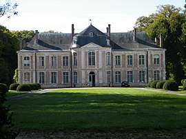 The castle in Arry. | |
Location of Arry 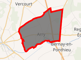
| |
 Arry  Arry | |
| Coordinates: 50°16′44″N 1°43′17″E | |
| Country | France |
| Region | Hauts-de-France |
| Department | Somme |
| Arrondissement | Abbeville |
| Canton | Rue |
| Intercommunality | CC Ponthieu-Marquenterre |
| Government | |
| • Mayor (2016-2020) | Thibault Bourgois |
| Area 1 | 7.34 km2 (2.83 sq mi) |
| Population (2017-01-01)[1] | 212 |
| • Density | 29/km2 (75/sq mi) |
| Time zone | UTC+01:00 (CET) |
| • Summer (DST) | UTC+02:00 (CEST) |
| INSEE/Postal code | 80030 /80120 |
| Elevation | 2–39 m (6.6–128.0 ft) (avg. 16 m or 52 ft) |
| 1 French Land Register data, which excludes lakes, ponds, glaciers > 1 km2 (0.386 sq mi or 247 acres) and river estuaries. | |
Geography
The commune is situated about 1 kilometre from the A16 autoroute, on the D938 road to Rue.
Population
| Year | 1962 | 1968 | 1975 | 1982 | 1990 | 1999 | 2006 | 2015 |
|---|---|---|---|---|---|---|---|---|
| Population | 155 | 182 | 191 | 176 | 158 | 164 | 165 | 205 |
| From the year 1962 on: No double counting—residents of multiple communes (e.g. students and military personnel) are counted only once. | ||||||||
Monument aux morts
The monument aux morts in this commune features a sculpture by Louis-Henri Leclabart. A montage of photographs of this monument aux morts, which stands in front of the church, is shown below.
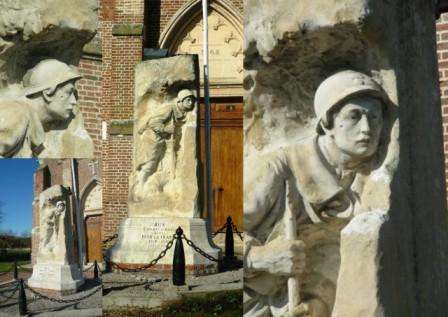
The Arry monument aux morts.
gollark: Correction: my copy of Wikipedia (compressed ZIM file, including FTS index, including images too, dated 2020-08) is 92GB.
gollark: * accidentally adding a zero
gollark: *Wikipedia* is about 80GB, so I assume you're missing a zero.
gollark: It would take me about 12 hours to download 30GB of content over my network link.
gollark: No, I mean the previous communism thing was random anecdotes.
References
- "Populations légales 2017". INSEE. Retrieved 6 January 2020.
| Wikimedia Commons has media related to Arry (Somme). |
| Authority control |
|
|---|
This article is issued from Wikipedia. The text is licensed under Creative Commons - Attribution - Sharealike. Additional terms may apply for the media files.